Alsace — Wine Region Guide
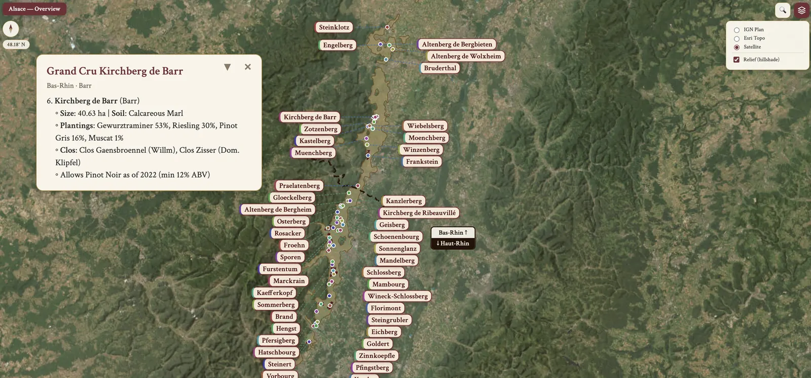
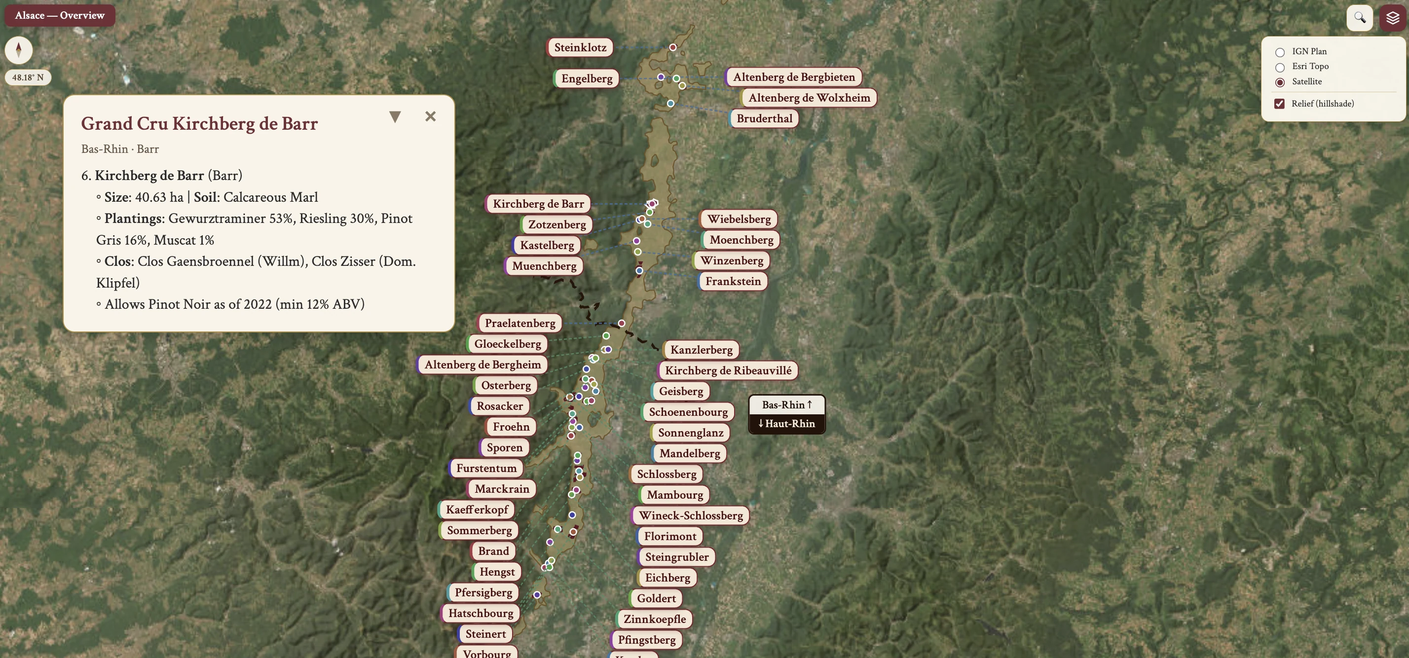
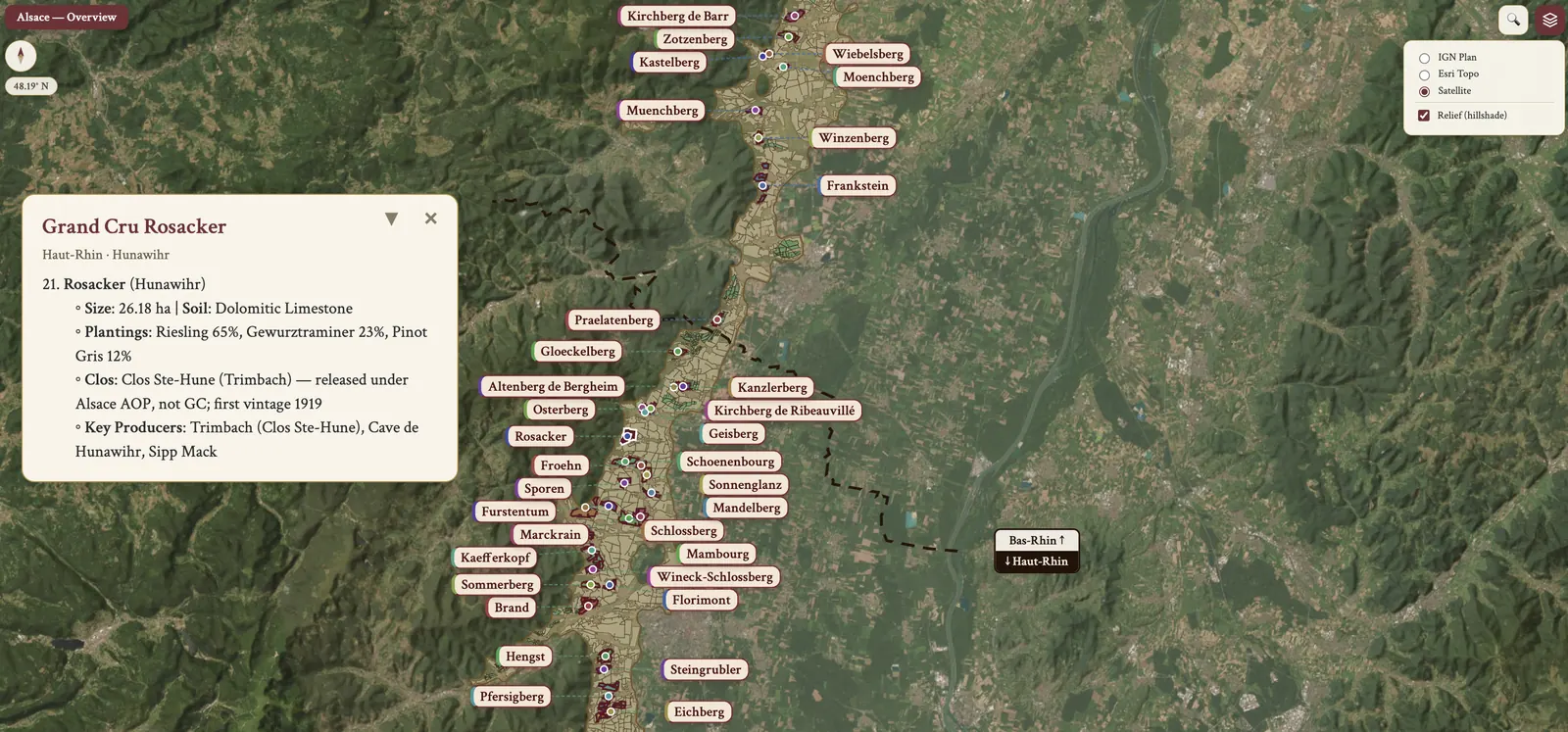
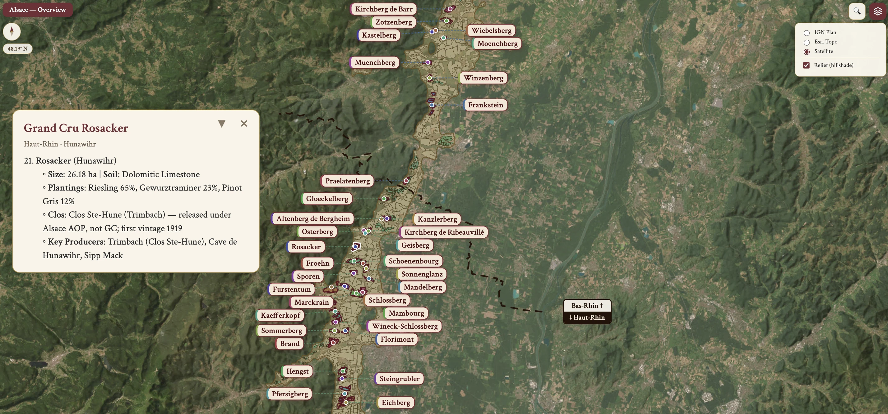
The Alsace maps from Your Own Wine Encyclopedia — every name tag opens a study card. Below, the chapter's own geography, climate and geology notes.
From the encyclopedia
History — from Westphalia to the postwar divide
The Peace (Treaty) of Westphalia of 1648 concluded the Thirty Years' War of 1618–1648, and the Habsburg lands in Alsace — roughly 4/5 of Upper Alsace — were ceded to France. In 1871 came the Franco-Prussian War: Germany claimed Alsace and Lorraine, and during this period vineyards were planted with high-yielding, low-quality hybrid vines. Post-WWI, Alsace returned to France in 1918. In the early 1940s the WWII Nazi German occupation of Alsace was short-lived.
1945 is the definitive divergence. German wines remained sweet; Alsace fermented to dryness for a more powerful, food-friendly wine. Today's vineyards date from 1945 onward, and the modern Alsace wine industry is built on vineyards replanted after 1945, creating consistency in quality and style across generations. Post-WWII, Alsace and Lorraine, along with Champagne, form the Grand Est region, and Alsace shares borders with France and Germany.
History — the appellation era
The 1945–1962 years laid the groundwork for the Alsace AOP, officially established in 1962. The first Grand Cru, Schlossberg, came in 1975, and Crémant d'Alsace AOP was established in 1976. 24 Grand Crus were added in 1983, and the Vendanges Tardives (VT) and Sélection de Grains Nobles (SGN) designations were created in 1984. 25 more Grand Crus followed in 1992, for a total of 50. Lorraine was promoted to AOC/AOP in 2003, and the 51st Grand Cru, Kaefferkopf, was added in 2007.
From 2008 the Alsace AOP mandates that Riesling must be dry. In 2011 each of the 51 Grand Crus received its own appellation and cahier des charges. Sweetness labeling became mandatory with the 2021 vintage. In 2022 Hengst and Kirchberg de Barr were approved for Grand Cru Pinot Noir, and in 2024 Vorbourg Grand Cru gained Pinot Noir. Alsace Rieslings and noble-variety wines command respect internationally, particularly for dry expressions and aging potential.
Geography & Topography
Alsace's geography, climate and geology are set out here and in the two sections that follow; the geography comes first. Alsace sits in north-eastern France, in the foothills of the Vosges Mountains, at a latitude of ~48°N — roughly the 47th–49th parallel. It is located on the western part of the Rhine Graben, a geological trough flanked by the Vosges and the hills of Baden, Germany. Isostatic uplift influenced Rhine Graben formation, and also affects the Pfalz in Germany.
The region is divided into 2 départements. Haut-Rhin contains over 2/3 of the Grand Cru vineyards; Bas-Rhin contains 14 Grand Crus. The major cities, north to south, are Strasbourg, Colmar and Mulhouse. Colmar is the capital of Haut-Rhin and the driest city in France, and with Ribeauvillé it is one of Haut-Rhin's two principal towns.
Climate
The climate is cool continental. The growing season is cool and long, with extended daytime length from the northerly latitude. The Vosges Mountains rain shadow effect holds annual rainfall to only 600mm, against 700mm in the Côte d'Or. The Foehn wind is a dry, warm wind that raises temperature and reduces fungal disease pressure. High sunshine hours are the result of that northerly latitude combined with the rain shadow effect.
Rainfall distribution is spread throughout the year, wettest in summer (August) and driest during harvest (September-October). Its timing can be problematic at flowering and fruit set. Marked diurnal temperature variation, especially on higher elevation sites, retains acidity.
Vineyard Sites & Aspects
Vineyard sites are diverse, with a range of altitude up to 450m elevation; the best vineyards average 200-250m. The best slope aspects are south, southeast and southwest — and warm east-facing sites — which maximize sunlight.
The plain between the foothills and the Rhine has deeper, fertile soil, higher yield and lesser quality. Hillside vineyards have lower fertility, better drainage and better fruit quality. The steepest mountain slopes are often terraced for Grand Crus.
Soil Diversity
The soils are a mosaic of terroirs, varying widely across the region. There are 13 major soil types. The mountain soils are Granite-Gneiss, Shale (the rarest), Volcanic and Sandstone. The Sub-Vosges soils are Calcareous, Marl-Calcareous, Marl-Sandstone, Marl-Limestone-Sandstone, Calcareous-Sandstone and Clayed-Marl. The plain soils are Colluvial, Alluvial and Loess-Loam.
Additional soil types include granite, limestone, schist, clay, gravel, chalk, loess and pink sandstone — Grès de Vosges. The elevation-soil relationship runs as follows: the steeper mountain slopes carry schist, granite and volcanic soils; the lower slopes limestone; the plain richer alluvial clay and gravel.
Muschelkalk is shell limestone, German for "mussel chalk" — a marine sedimentary rock from the Triassic period, found for example at Clos Ste Hune in Rosacker.
Grape Varieties — Overview
Wine color distribution runs White 90%, Red 10%. The 7 primary varieties are Riesling, Muscat, Gewurztraminer, Pinot Gris, Sylvaner, Pinot Blanc and Pinot Noir. The secondary varieties are Pinot Blanc, Sylvaner, Chasselas, Klevener (Savagnin Rosé), Auxerrois Blanc, Chardonnay — only Crémant — and Pinot Noir. Riesling is the most planted variety, while Pinot Blanc/Auxerrois combined give the largest production volume.
Grape Varieties — Riesling
Riesling is one of the 4 primary noble varieties, and its production dominance is plain: it is the most planted variety in Alsace. It has late budbreak and late ripening — the last of the noble varieties to ripen — and the frost advantage of that late budbreak is that it helps the vine avoid spring frost. It needs a good site, with full sun and good drainage, and it is cold hardy. Very good quality is achievable even at relatively high yields, and disease resistance is good against powdery mildew, downy mildew and botrytis. Clone 49 is the most planted Riesling clone in Alsace.
Winemaking is typically unoaked. The wine style is dry, medium to full body, medium alcohol, high acidity, and the aromatics are citrus, stone fruit and stony, steely mineral notes. That high acidity also underpins sweet-wine (VT/SGN) potential. Pronounced acidity and minerality give an aging potential among the longest-lived dry whites in the world. Alsace versions are drier, more powerful and higher in alcohol than German Riesling. The quality level is good to outstanding, at mid to premium price, some super-premium.
Grape Varieties — Gewurztraminer
Gewurztraminer has early budbreak and early ripening. It is a vigorous vine, so its vigor requires careful pruning and canopy management, and it is only moderately productive — productivity is held down by coulure and poor fruit set. Sugar accumulation is rapid, giving higher ABV or residual sweetness. The grape appearance is a light pink skin, which gives a deeper wine colour. Its disease and pest susceptibility covers coulure, chlorosis, grapevine moth, powdery mildew, botrytis and stem desiccation. Its clonal origin is a pink-berried clone of traditional Traminer, along with Savagnin Rosé.
In the winery, harvest timing means picking late for fully ripe skins, to maximize aromatics and avoid unripe tannins. The wine style is medium–high alcohol, medium–full body, low–medium acidity, dry to sweet. Aromatics are pronounced — lychee, apricot, rose, spice — and the colour is a medium lemon tint. The quality level is good to outstanding, at mid to premium price.
Grape Varieties — Pinot Gris
Pinot Gris has early budbreak and early ripening, with moderate yields. Its disease susceptibility covers spring frost, botrytis and downy mildew. Harvest timing is the critical decision: sugar rises rapidly while acidity drops. The picking strategy is earlier picking for a drier style, which is currently in fashion. Its former naming was Tokay d'Alsace, or Tokay Pinot Gris.
The wine style is medium–high alcohol, full body, medium acidity, with a medium intensity flavour of peach and lemon. The best expression is a rich, oily texture with aging capacity, developing honey and smoky notes with age; the fullest expression shows the fullest, richest, spicy-smoky qualities on a frame of solid — though not high — acidity. The quality level is good to outstanding, at mid to premium price.
Grape Varieties — Muscat
Muscat Blanc à Petits Grains has early budbreak and mid ripening. Its grape size is smaller than Muscat of Alexandria, and on climate tolerance it is tolerant to dry weather conditions. Its disease susceptibility covers powdery mildew, mite and botrytis, and its aromatic expression carries great intensity of aromas.
Muscat Ottonel is early ripening, which avoids autumn rain problems, and it ripens faster than Muscat Blanc à Petits Grains; the planting in Alsace is tiny. Muscat Rosé à Petits Grains is also allowed in Alsace.
Muscat has common characters with Gewurztraminer: both are highly aromatic, with lower acidity. The key difference is that Gewurztraminer has higher alcohol, a more off-dry style and a perfumed quality, while Muscat has fragrant floral and grapy aromas.
Grape Varieties — Pinot Blanc, Auxerrois & Sylvaner
Among the secondary varieties, Pinot Blanc and Auxerrois have early budbreak and early ripening, and their disease susceptibility covers spring frost and fungal disease. Their production volume is the largest in Alsace, Pinot Blanc and Auxerrois combined. Auxerrois origins are a cross of Gouais Blanc × Pinot. In the winery, early picking is used for sparkling — Crémant d'Alsace. Klevner is the synonym for Pinot Blanc, and the labeling rule follows: "Pinot Blanc" or "Klevner" means 100% PB OR 100% Auxerrois OR a blend of both. The flavour is low in intensity — apple, peach — with medium acidity and medium alcohol, Auxerrois lower in acidity. The quality level is acceptable to good, at inexpensive to mid price range.
Sylvaner has early budding and early ripening, which carries spring-frost risk. The regional trend is decline in Alsace, since Pinot Gris and Pinot Blanc are easier to grow. Its synonyms are Johannisberg, Silvaner and Grüner Silvaner. On Grand Cru allowance, Grand Cru Zotzenberg permits Sylvaner. Its character is lower acidity and less aromatic than Riesling, and most wines come from older vines, which makes for good value and very good quality.
Grape Varieties — Chasselas, Klevener de Heiligenstein & Chardonnay
Chasselas carries the synonym Gutedel.
Klevener de Heiligenstein is Savagnin Rosé. Its clone type is a pink-berried Traminer clone, along with Gewurztraminer. Its geographic origin is the commune of Heiligenstein in Bas-Rhin, and the permitted bottling communes are Heiligenstein, Bourgheim, Gertweller, Goxwiller and Obernai. Its aromatic intensity is lower: less intensely aromatic than Gewurztraminer, but higher in acidity. Its production status is that production was permitted until 2021.
Chardonnay carries a restriction: it is only permitted for Crémant d'Alsace, not for still wines.
Grape Varieties — Pinot Noir
Pinot Noir has early budbreak and early ripening, which leaves it spring-frost prone, and it is vulnerable to various diseases and pests. In regional context it is the only black grape allowed for Alsatian AOC wine. Its quality trajectory is rising, due to global warming and knowledge transfers from Burgundy and Germany, and the production styles are rosé, red or sparkling.
On Grand Cru for Pinot Noir: in 2022 Hengst and Kirchberg de Barr were designated for PN, and in 2024 Vorbourg was designated for PN. The key producers of quality PN are Domaine Albert Mann — Clos de la Faille in Wintzenheim, and Les Saintes Claires, the first RP 100 Pinot Noir from Alsace, from the 2022 vintage — and Domaine Muré, with Clos Saint Landelin in Vorbourg GC.
Yield restrictions for GC PN are max 40 hl/ha, against 50 hl/ha for white in the same villages. Minimum alcohol by GC runs min 12.5% ABV for GC Hengst PN and min 12% ABV for GC Kirchberg de Barr PN.
Grape Varieties — Varietal Labeling Rules
The varietal labeling rules start from one primary rule: 100% of the stated variety is required. "Pinot Blanc" or "Klevner" means 100% Pinot Blanc OR Auxerrois OR a blend of both. "Pinot (Klevner)" permits any proportion of PN, PB, PG and Auxerrois. "Pinot d'Alsace" covers Auxerrois, PB, PN (vinified white) and PG, with no minimum or maximum proportion. A wine simply labeled "Pinot" may contain any proportion of PN, PB, PG and Auxerrois. Where no variety is listed, the wine may be a blend.
The approved varieties for Vin d'Alsace AOP varietal bottling are Auxerrois, Riesling, Pinot Gris (formerly Tokay PG), Gewurztraminer, Muscat, Muscat Ottonel, Pinot Blanc, Pinot (Klevner), Chasselas (Gutedel) and Sylvaner.
For rosé, Clairet and Schillerwein the only grape is Pinot Noir. For red wine the only grape is Pinot Noir.
Viticulture — Training Systems & Planting Density
The permitted training methods are single or double Guyot, required by the AOC. The fruit zone is trained higher, at 1-1.2m, which avoids frost, especially on the valley floor; the canopy is trained higher still, up to 1.9m, which maximizes sunlight. Interrow spacing is wider, to avoid canopy shading.
Average planting density is 4,400-4,800 vines per hectare. The minimum density is 4,500/ha, or 4,000/ha if planted before October 2011. There is slope-based variation: steep slopes take more dense plantings, the valley floor less dense plantings, and the steepest Grand Crus require terracing.
Viticulture — Organic Certification, Yields & Climate Change
The organic certification rate is 35% of vineyards certified or in conversion to organic. The operational advantage is small scale, which allows greater attention to detail, and a dry, warm season gives disease reduction — it reduces disease pressure and chemical use.
Yield management runs through the PLC, the Plafond Limité de Classement: an annual authorization, expressed as a %, to exceed the base yield, granted by INAO and capped by the rendement butoir. The rendement de base is white 80 / rosé 75 / red 60 hl/ha; the rendement butoir, the ceiling, is white 96 / rosé 90 / red 66 hl/ha.
The climate change impact is a warming trend. Rising global temperatures are enabling better Pinot Noir ripeness and quality, earlier harvests on an accelerating trend, and expanded knowledge transfer from warmer regions, Burgundy and Germany.
Hazards
The weather-related hazards are frost — spring frost and winter frost — hail and summer drought. The disease and pest hazards are powdery mildew, downy mildew, grapevine moth and esca, a wood disease.
Climate sets the context. A warm, sunny climate with low rainfall means reduced disease pressure. The notable disease years: 2021 and 2024 brought high downy mildew pressure, and in 2014 Drosophila suzukii, the vinegar fly, was a significant issue, especially on Pinot Noir and Gewurztraminer.
Harvesting
Harvesting runs long. The duration is a long harvest period, early September to late October: the range of styles (sparkling to sweet), the varieties and the site diversity require an extended picking schedule.
Harvest methods follow the site. On steep slopes hand harvest is mandatory, and in the Grand Crus hand harvest is mandatory. On gentle slopes and the plain machine harvest is permitted, which reduces cost for inexpensive and mid-price wines. Legally hand-harvest only are Pinot Gris and Pinot Noir labelled by a lieu-dit, and all VT and SGN wines.
The notable harvest records: 2018 was the largest harvest, the warmest vintage and the earliest harvest before 2025; 2025 is the earliest harvest on record, with Crémant grapes starting August 19.
Winemaking — Philosophy, Skin Contact & Fermentation Temperature
The philosophy and production focus are narrow: single varietal wine is the most common approach, and the primary goal is to preserve primary fruit character.
Pre-fermentation work turns on skin contact. Skin contact, or contact with pressed grapes, means longer time on the skins, which extracts flavor and adds texture; the impact is that it enhances complexity while maintaining varietal purity. "Comme un Rouge" and Sil rosé are skin contact white wines — extended maceration on white grape skins, vinified like a red.
Fermentation temperature follows style. Cool fermentation is used for Muscat and Riesling. Mid-temperature fermentation is used for Gewurztraminer: its high sugar and alcohol content and pronounced aromatics call for a higher temp for effective fermentation, and avoid banana and ester aromas.
Winemaking — Vessels, MLF, Lees & Oak
Fermentation vessels are inert: temperature-controlled stainless steel is preferred. The alternative vessels are large old oak, used for neutral character with no oak flavor contribution, and large neutral casks are preferred for both fermentation and aging.
Malolactic fermentation (MLF) is typically avoided for white wines — that is the general practice. The reason is that MLF reduces acidity and can mask primary fruit character.
Aging and lees contact use the same large neutral containers, with fine lees for freshness. There is no lees stirring, and without lees stirring the wine retains primary fruit character.
Oak usage follows one philosophy: very little new oak is utilized. The reasons are that it reduces production cost, retains primary fruit character, and avoids an oak spice overlay on delicate flavors.
Winemaking — Barrel Sizes & Historic Vessels
On barrel sizes, the Aume is 114 liters, the German standard, and the Foudre is 1,000 liters. For comparison, the Feuillette of the Côte d'Or is 114L and the Feuillette of Chablis is 132L.
The notable historic vessels both belong to Hugel. The Ste Catherine Cask, dating to 1715, is the oldest barrel still in use; the 1472 barrel is the oldest barrel-stored wine in the world, stored at the Cave Historique des Hospices de Strasbourg, which holds both historic vessels.
Finishing & Packaging
Finishing and packaging turn on the bottle format, which is mandatory: the 'Flûte' bottle — Vin du Rhin, or Flûte d'Alsace — is mandatory for all AOC Alsace wines. Bag-in-box is not allowed. The branding effect is that it gives clear brand identity to Alsace wines.
The packaging controversy is market confusion: the distinctive flûte bottle can cause confusion with German wines.
For rosé and light red designations, the alternative names are Clairet or Schillerwein.
On the map
- Bas-Rhin (North)
- Marlenheim–Molsheim
- Barr–Andlau–Dambach
- Haut-Rhin (South)
- Ribeauvillé–Riquewihr
- Kaysersberg–Ammerschwihr
- Colmar (Turckheim–Eguisheim)
- Rouffach–Guebwiller
- Thann (Rangen)