Bordeaux — Wine Region Guide
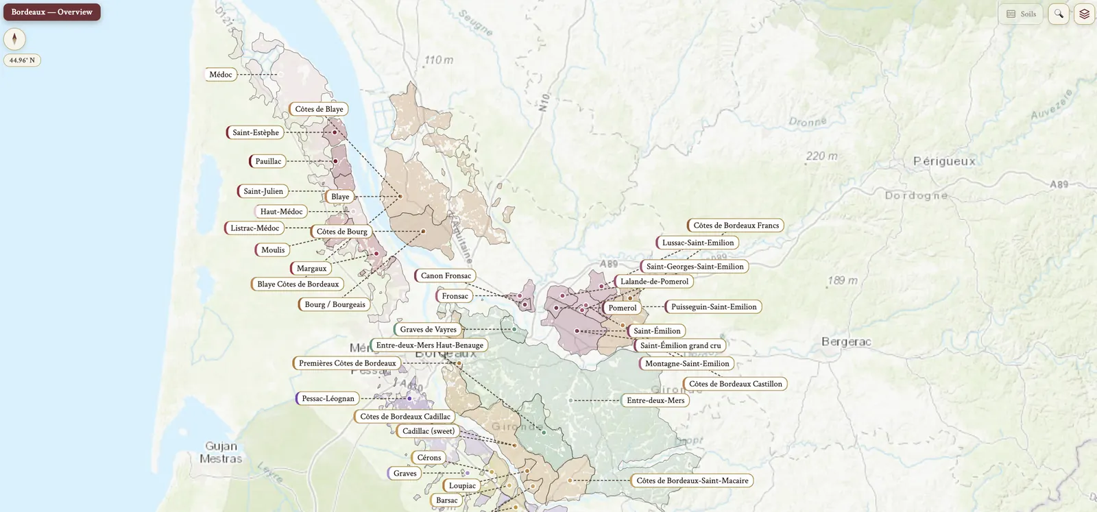
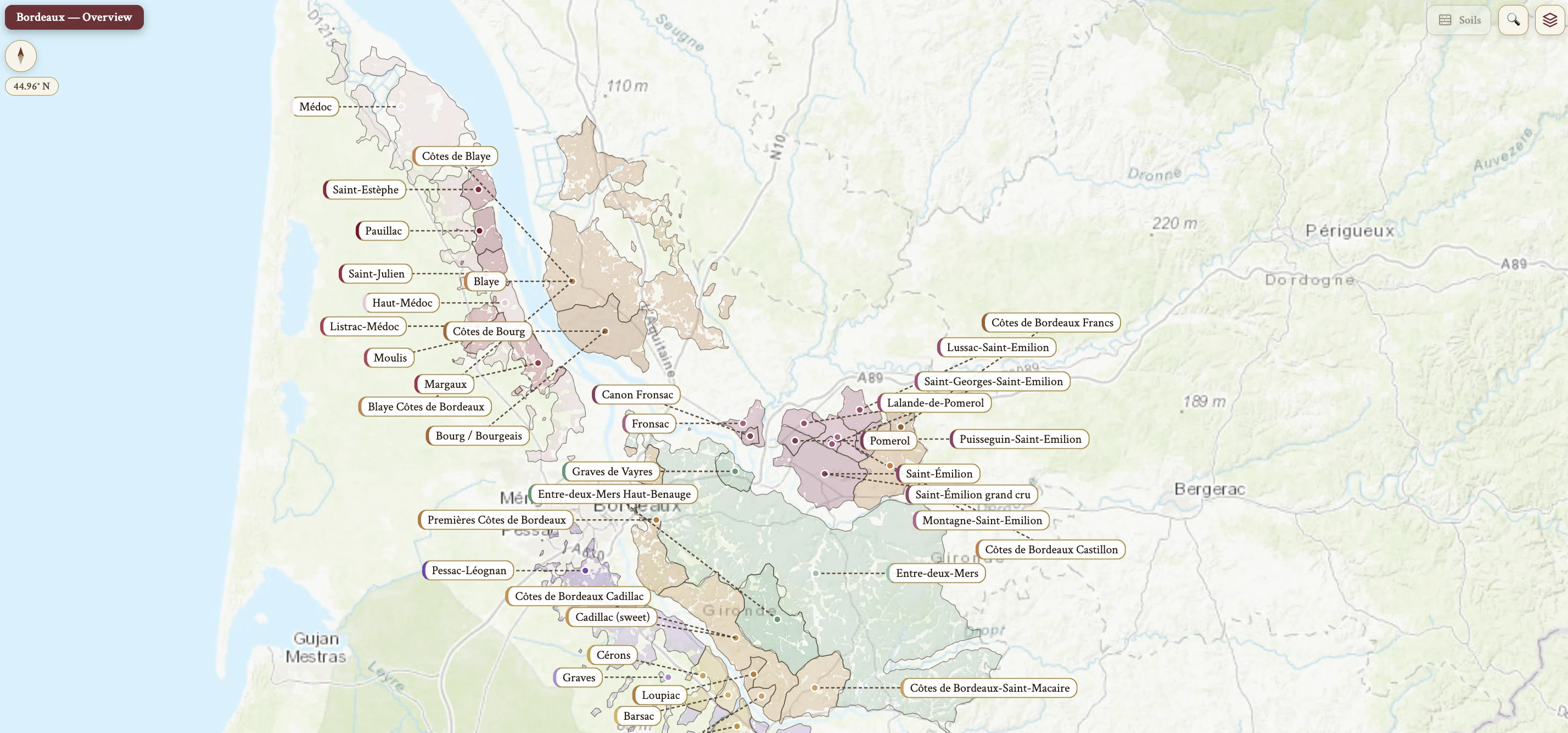
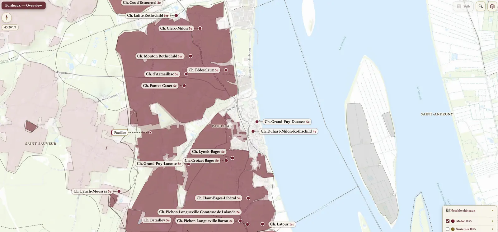
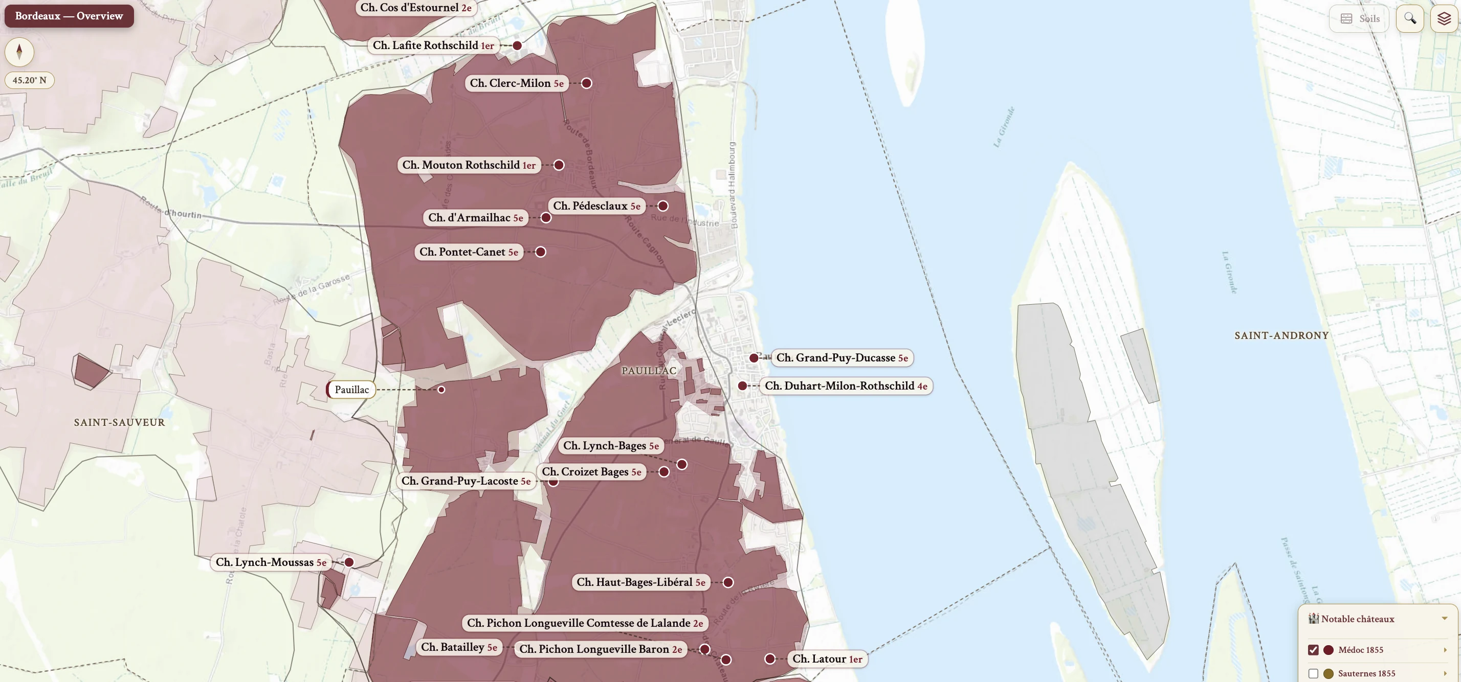
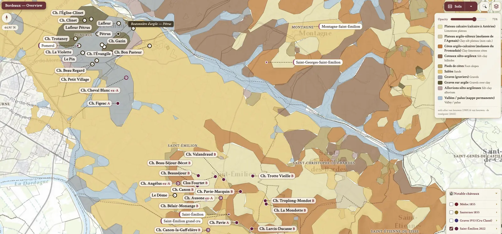
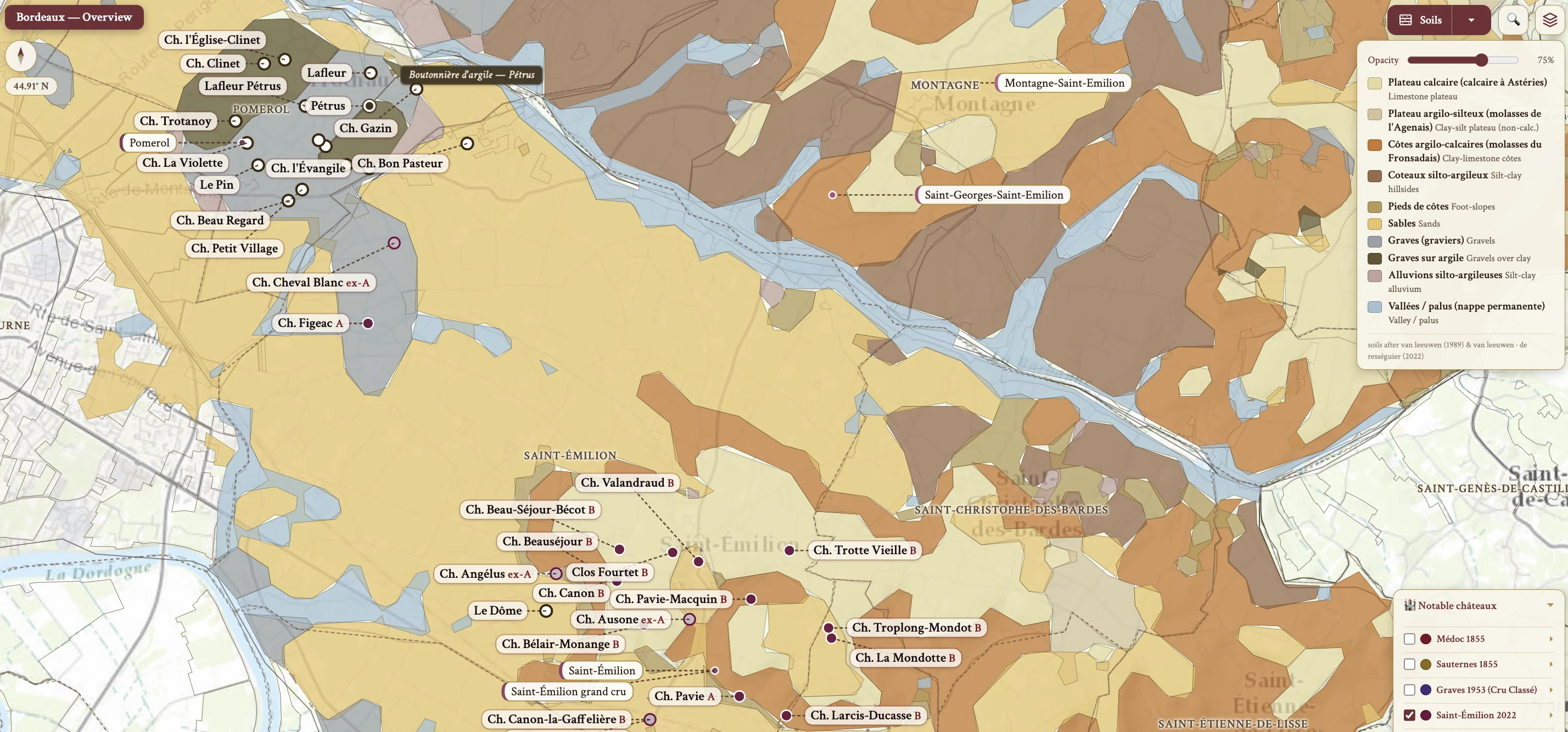
The Bordeaux maps from Your Own Wine Encyclopedia — every name tag opens a study card. Below, the chapter's own geography, climate and geology notes.
From the encyclopedia
History
The first vineyards were planted in the Graves sub-region in the Roman period, and the first identifiable vineyard estate was Château Pape Clément in 1305. The English connection began when Eleanor of Aquitaine married Henry Plantagenet in 1152, who became King Henry II of England in 1154; Aquitaine was then controlled by England from 1154 to 1453, ending at the Battle of Castillon. After the Hundred Years' War of 1337–1453 the Dutch became the main market.
That Dutch presence reshaped the ground itself. They drained the marshy Médoc in the mid-17th century, raising the gravel beds that became the basis for fine wines; before this the best wines came from the well-drained Graves, Haut-Brion among them. The jalles — drainage channels in the Médoc — still prevent it from reverting to swampland.
The vine diseases arrived in sequence: powdery mildew in 1852, phylloxera in 1865 and downy mildew in 1880. The answer to two of them was found here — bouillie bordelaise, the Bordeaux mixture of lime, copper sulfate and water, was invented at Château Ducru-Beaucaillou in 1885. The 1855 Classification had been commissioned by Napoleon III for the Universal Exposition in Paris, and the modern 225L barrique size was adopted in 1866.
Mouton-Rothschild was the estate-bottling pioneer, the first to begin in 1924; estate bottling has been compulsory for classified estates in the Médoc since 1972. The same estate was the highest scoring Bordeaux at the 1970 Judgement of Paris, in the 1976 tasting. Two freezes bracket the modern era: the 1956 deep freeze killed 1/4 of the vine stock, and Malbec lost 1/3 of its acreage, replaced mostly with Merlot; the terrible April frost of 1991 destroyed 80% of production. Crémant de Bordeaux gained its own AOP in 1990, and St-Émilion was declared a UNESCO World Heritage site in 1999.
Geography & Climate
Bordeaux sits in southwest France, close to the Atlantic Ocean, traversed by the Garonne and the Dordogne, which merge to form the Gironde estuary. Three things moderate it. The Gironde estuary protects the vineyards from frost. The Landes forest — Les Landes — is a man-made forest partially shielding the Left Bank, and the northern Médoc, less protected, is more maritime and therefore cooler.
The climate is classified as moderate maritime, with rainfall of about 950 mm/yr. Temperature is regulated from two directions at once — the warm Gulf Stream and the cool Atlantic Ocean. On the easterly Right Bank the maritime influence is less prominent and the climate turns more continental. Vintage variation is marked, and it affects both volume and quality.
The best years, and what rain costs
The best years follow one shape. Warmth throughout the growing season gives even ripening, plentiful rainfall gives growth, and a dry, warm autumn allows complete ripening — which is what produces the excellent balance of tannins, sugar and acidity behind Bordeaux's ageing potential.
Rain costs something different depending on when it falls. At flowering it means poor fruit set, with coulure and millerandage. Throughout the growing season it means disease. At or after véraison it means unripe fruit and fungal disease. At harvest it means dilute flavours.
Topography & Soil — the Left Bank
The Left Bank — the Médoc and Graves — lies west of the Garonne and the Gironde. Its soil is gravel and stony soil, with clay and sand, carried down from the Pyrenees and the Massif Central. The land is low: gravel mounds, the croupes, at low altitude, the highest in Margaux at 32m. The Dutch unearthed those gravel mounds during the drainage work of the 1600s.
Gravel does three things here. Good drainage means the ground dries out quickly and the vine continues to ripen — though in extreme dry, hot years such as 2003 that becomes water stress. It retains heat, capturing daytime warmth and releasing it gradually, which slows ripening. And gravel and sand are warm soils in the proper sense: they radiate heat.
Within that, the detail decides the grape. St-Estèphe has pockets of clay, which give robust, characterful wines. Away from the estuary there is more clay, which favours Merlot; close to the estuary there is more gravel, which favours Cabernet Sauvignon. The Graves soil has its own name — boulbènes, a mixture of sand, gravel and light clay.
Topography & Soil — the Right Bank and Entre-Deux-Mers
The Right Bank lies east of the Dordogne and the Gironde. Clay dominates, with some gravel and limestone. Where the Left Bank's gravel is warm, clay and limestone are cold soils — they retain moisture. The St-Émilion plateau is a limestone plateau.
That ground selects Merlot, which dominates here: early ripening, suited to clay, and ripening almost fully every vintage. Clay's water-holding capacity also produces the large berry size typical of Merlot.
Between the two tidal rivers, the Garonne and the Dordogne, lies Entre-Deux-Mers — the land between two seas. It is the 2nd largest in terms of hectares.
Grape Varieties — Merlot
Merlot buds early and ripens mid-season — the earliest red to ripen in Bordeaux. Early budding leaves it vulnerable to spring frost, and the harvest has to come before autumn rain. In the Bordeaux ripening order it is 1st, harvested mid-to-late September, 10-14 days before Cabernet Sauvignon.
It is prone to coulure, drought and botrytis bunch rot, so growers reduce yields and sort to maintain quality. It is also the adaptable one: it can ripen fully in cooler years and ripens on cooler soils, and it prefers clay-based soil, which delays its natural vigor. The high water-holding capacity of clay gives the large berry size typical of Merlot.
The wine is medium to pronounced in intensity, with strawberry and red plum in cooler conditions, cooked blackberry and black plum when hot. Tannins are medium, alcohol medium to high. In a blend Merlot contributes fleshy, juicy texture and softens the austerity of Cabernet Sauvignon.
After the 1956 frost it replaced Malbec extensively. The synonym recorded here is Pressac — the Right Bank name for Malbec — but Merlot is the most planted.
Grape Varieties — Cabernet Sauvignon & Cabernet Franc
Cabernet Sauvignon buds late and ripens late, harvested early-to-mid October, after Merlot and Cabernet Franc. Its skin is thick, which gives deeper color and high tannins. It is prone to fungal disease — powdery mildew, eutypa, esca — and late ripening leaves it vulnerable to autumn rain, so it needs warmer, well-drained soil. That means gravel: well-draining, deep roots, and the slight water stress that gives concentration. In a cooler vintage it struggles to ripen and needs blending.
The primary aromas are violet, blackcurrant, black cherry, and menthol or herbaceous notes. Alcohol is medium, acidity and tannins high, and the wine is highly pigmented and tannic. Its structural role is to give structure, power and longevity; the typical Left Bank ratio is 2/3 Cabernet Sauvignon, 1/3 Merlot. It prefers gravel soil.
Cabernet Franc brings herbal spice and red fruit aromatics. It is more tannic than Merlot but less muscular than Cabernet Sauvignon, and it contributes red fruit, high acidity and medium tannins. It is harvested after Merlot and before Cabernet Sauvignon. It prefers limestone-based soil, which promotes acidity and freshness. The typical Right Bank blend is 3/4 Merlot, 1/4 Cabernet Franc, and its regional name on the Right Bank, in Pomerol, is Bouchet.
Grape Varieties — Malbec, Petit Verdot & Carménère
Malbec — Cahors, and Pressac on the Right Bank — first appeared in Bordeaux in the 18th century, in the 1730s. After the hard frosts of 1956 it was mainly replaced with Merlot, and it is seldom planted today owing to that 1956 freeze. Its highest concentration is Bourg AOP, at 10% of plantings. Its blending role is similar to Merlot's, and it ripens between Merlot and the Cabernets.
Petit Verdot buds early and ripens later than Cabernet Sauvignon — very last to ripen in Bordeaux. Early budding exposes it to spring frost, and in cool years it fails to ripen. When it does ripen fully, which happens only in riper vintages, it is rich, age-worthy and spicy; in a cool year it shows a raw, underripe note. It is increasingly valued as the climate warms. Thick skins give concentrated, tannic wines rich in color, and the profile is powerful, deep in color, high in tannins, with a spice note. On the Left Bank it is occasionally added for color, depth and exotic perfume.
Carménère has Gros Cabernet × Cabernet Franc parentage. Historically one of the hardest to ripen, with a long cycle, it declined in Bordeaux. It is late-ripening but matures before Petit Verdot — Plantgrape data puts it at +2 wks vs Chasselas, which is the Harvest Ripening Order set out below — and it is often described as the hardest to reach full phenolic maturity, with a lingering pyrazine and green character. It is NOT authorized in Pomerol AOP. Château Clerc Milon holds the largest plantings of Carménère in Bordeaux, planted 1947.
Grape Varieties — the whites
Sémillon ripens mid-season and can carry high yields. Its thin skin makes it susceptible to botrytis, which brings honey, dried fruit and a waxy texture. The fruit is low in intensity — apple, lemon — and turns grassy if underripe. Body is medium, alcohol medium, acidity medium to medium(+). With age it develops toast and honey, where Sauvignon Blanc can hold but its flavors do not evolve.
In blends Sémillon softens Sauvignon Blanc's intense flavours and high acidity, has a strong affinity with new oak, and adds roundness. Being very susceptible to botrytis, it is the noble rot grape: the top Sauternes carry a high proportion of Sémillon.
Sauvignon Blanc gives grassy, gooseberry notes and high acidity, adding pungency and citrus flavors. Worldwide popularity has meant increasing single-varietal wine.
Muscadelle needs a well-exposed site and is very prone to botrytis, so it is used for sweet wine. It is flowery and grapey, but NOT related to Muscat; its intense floral character can quickly overtake balance, so it is added sparingly.
Bordeaux AOP Blanc also admits accessory white varieties: max 30% combined of Ugni Blanc, Merlot Blanc — Merlot × Folle Blanche — and Colombard, and max 10% combined of Alvarinho and Liliorila.
Grape Varieties — the 2019 authorizations & the ripening order
Bordeaux authorized new varieties in 2019 in response to climate change. The whites are Alvarinho, Petit Manseng and Liliorila; the reds Marselan, Touriga Nacional, Castets and Arinarnoa. They are limited to 5% of an estate's total surface and to max 10% of the blend, and they were chosen for their ability to handle water stress and late ripening.
The harvest ripening order, earliest to latest, runs: 1st Merlot, mid-to-late September, usually among the earliest; 2nd Cabernet Franc; 3rd Malbec, or Côt; 4th Cabernet Sauvignon, early-to-mid October; 5th Carménère, context-dependent and often harvested late in Chile; 6th Petit Verdot, very last, generally the latest and very late-ripening.
Plantgrape (INRAE-IFV) data measures something else. The metric type is phenological maturity period vs Chasselas, measured at Domaine de Vassal in southern France — NOT actual Bordeaux harvest timing. By this metric Carménère ranks earliest: Carménère +2 wks, Merlot +2½ wks, Côt / Malbec +2½ wks, Cabernet Franc +2½–3 wks, Cabernet Sauvignon +3–3½ wks, Petit Verdot +3½–4 wks, the latest.
Although Carménère appears relatively early by Plantgrape maturity data, in Chile it is often harvested after Cabernet Sauvignon. Growers wait not simply for sugar ripeness but for pyrazine reduction and fuller phenolic and tannin maturity; Chile's dry autumns allow this extra hang time.
Viticulture — planting density & training
The traditional standard density is 10,000 vines/ha for top quality. It is suitable for relatively infertile soil and moderate vigor; it adds to cost — planting material, trellising, specialist tractors — and it makes the best use of expensive land.
Density varies by quality tier. Less prestigious AOP plant less densely: basic Bordeaux AOC runs 3,000–4,000 vines/ha. The Médoc premier appellations require a minimum of 7,000 vines/ha, and many top properties are at 1×1m spacing. The Right Bank is lower — St-Émilion and Pomerol mandate 5,500 vines/ha, with rows 1.3–1.5m apart.
Training systems are head-trained, replacement cane pruned with wires: double Guyot on the Left Bank, single Guyot on the Right Bank. Cordon-trained, spur-pruned vines are rare, the exception being Sauternes, where they give smaller berries and so more botrytis; the taille à côts, a low spur-trained system found in Sauternes, produces smaller berries.
Canopy height differs across the river. The Médoc has the smallest canopy, with bunches 1m off the ground for radiant heat, while the Right Bank is higher, being more frost-prone.
Viticulture — canopy work, yields & treatments
De-leafing is the Bordeaux method for controlling mildew without sulfur treatments. Leaf removal during summer balances several things at once: aeration reduces rot and high UV aids ripening, but too much causes sunburn.
Bunch thinning lowers yield and flavor concentration, may imbalance the vine, and is less popular now — pruning short in winter has taken its place. Soft pruning makes only small cuts, leaving extra wood, which improves sap flow and reduces fungal trunk disease such as eutypa and esca.
Yields have decreased over the past two decades, to an average of 50hl/ha. The fashion for very low yield, super-concentrated wine, especially on the Right Bank, is now in decline for its lack of sense of place. Christian Moueix was an early proponent of green harvesting, from 1973, in St-Émilion and Pomerol.
The chemical arsenal is Bordeaux mixture, fungal spray and insecticides. Organic certification stood at 18% in 2021. Among the 1855 classified estates, the organic and biodynamic producers in the Médoc are Latour, Brane-Cantenac, Durfort-Vivens, La Lagune, Palmer, Haut-Bages Libéral and Pontet-Canet, and in Sauternes, Climens and Guiraud.
Hazards
Frost is the first of the hazards, especially spring frost, with coulure and millerandage at flowering; the 2009 spring frost was untimely. Untimely rain matters at flowering, at fruit set and at harvest.
The major fungal diseases are botrytis bunch rot and both mildews, alongside fungal trunk disease — eutypa and esca. Flavescence dorée, the most common grapevine yellows in the EU, is met with insecticides. Climate change brings extreme heat and drought.
Harvesting
Hand harvesting is the preference for high quality wine, and it depends heavily on the workforce. A grower may harvest at a not perfect moment, or hire for longer and harvest at optimal ripeness, which adds cost. Its advantages are high fruit quality, sorting at picking, and the option to pick individual plots.
Machine harvest is for high volume, inexpensive wine. It picks at the perfect time without dealing with a team schedule and collects quicker, which matters against predictive rain or storm; quality is difficult to control.
Winemaking — red
Inexpensive wine is not routinely sorted. Expensive, high quality fruit is sorted at harvest and again at the winery, by hand on a moving belt or with an optical sorting machine. Plot by plot picking and winemaking raises quality — optimum ripeness, separate small lots, blending options — at the cost of more, smaller vessels.
Extraction is a choice of temperature and time. Light extraction is mid temp, 17-25°C, with 5-7 days on skin, for early drink: primary fruit preserved, less tannins. Full extraction is mid to warm temp, 26-32°C, with 14-30 days on skin, for more tannins, color and flavor — complexity, structure, age.
Pressing uses pneumatic, modern vertical or hydraulic presses, a gentle extraction that avoids harsh tannins. Press wine carries more structure, in tannins and color, with less acidity and less delicacy; the proportion depends on what the free-run wine needs.
Malolactic fermentation runs in tank or barrel, the barrel giving better oak integration, and is often inoculated to finish before En Primeur.
Aging and oak treatment split by price. Inexpensive wine sits in stainless or concrete for 4-6mo with oak chip. High quality wine goes into French barriques for 18-24mo, a mix of new and 1-2yr old, racked every 3mo, with toasting at M to M(+); a range of cooperages adds complexity, and premium red sees new oak up to 2 years. Micro-oxygenation — cliquage — replaces racking and softens tannins.
Blending comes before En Primeur most commonly, as a near-final blend with deselection for the 2nd and 3rd wines, or a few months before bottling for minor adjustments.
Winemaking — rosé & white
Rosé is made from Merlot and Cabernet Sauvignon. The traditional clairet is deeper in color, from a short maceration of 24-36 hrs, or by the bleeding-off method — a by-product of red that leaves a deeper colored red behind. The lighter rosé is the newer style, by direct pressing.
For white, direct pressing gives more freshness; short skin contact of up to 24hrs before pressing gives more aromas, phenols and complexity, and the grapes must be healthy. Fermentation in a cool stainless tank is for early drinking, keeping primary fruit and freshness; barrel fermentation at mid temp gives oak integration, complexity, texture and body. Malolactic fermentation is usually blocked, to retain freshness and acidity.
Lees contact and aging follow: fine lees 6-12mo, at the mid-priced level, add body, texture and complexity, with bâtonnage optional. Élevage is in stainless for a few months to keep the fruit, or in barriques with a varying proportion of new oak; the best white sees new oak up to 16 months.
The modern style leaders are Denis Dubourdieu, at Clos Floridène, and André Lurton, at Couhins-Lurton: more Sauvignon Blanc, skin contact and a reduction of new oak, for freshness and fruitiness, with cooler fermentation, bâtonnage and hygiene. The best whites achieve a creamy, waxy texture with aromas of honey and beeswax.
On the map
- Médoc (Left Bank)
- Saint-Estèphe
- Pauillac
- Saint-Julien
- Margaux
- Graves & Pessac-Léognan
- Pessac-Léognan
- Sauternes & Barsac
- Libournais (Right Bank)
- Saint-Émilion
- Pomerol
- Entre-Deux-Mers
- Blaye & Bourg