California — Wine Region Guide
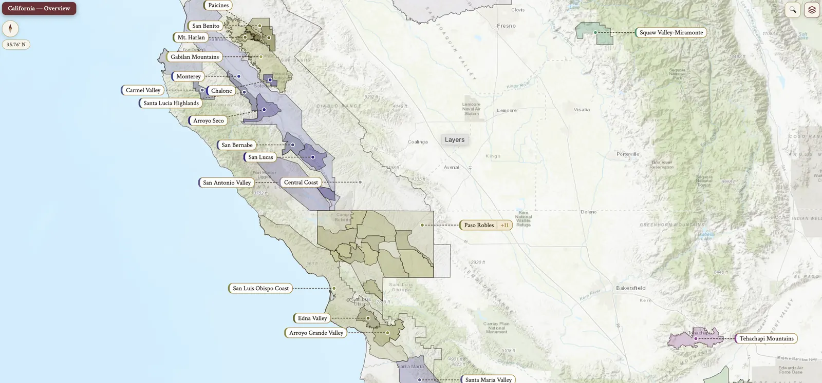
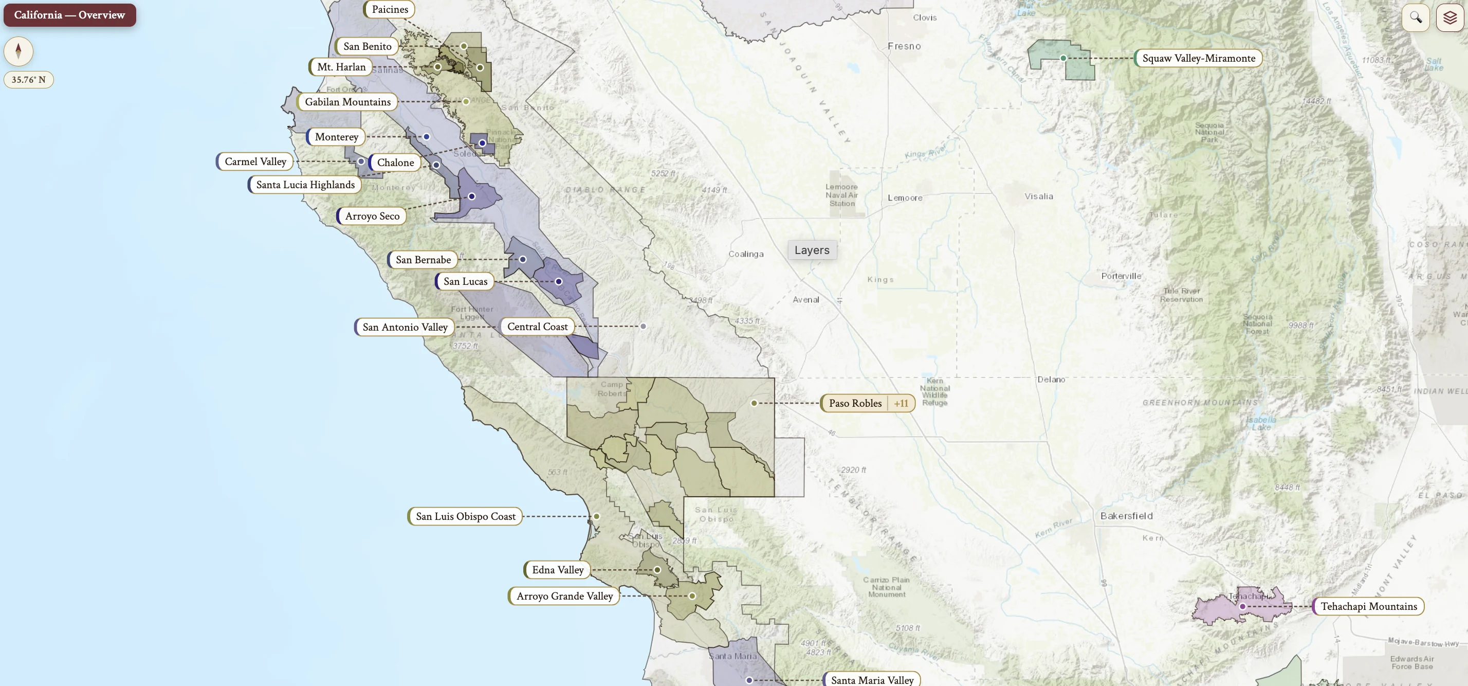
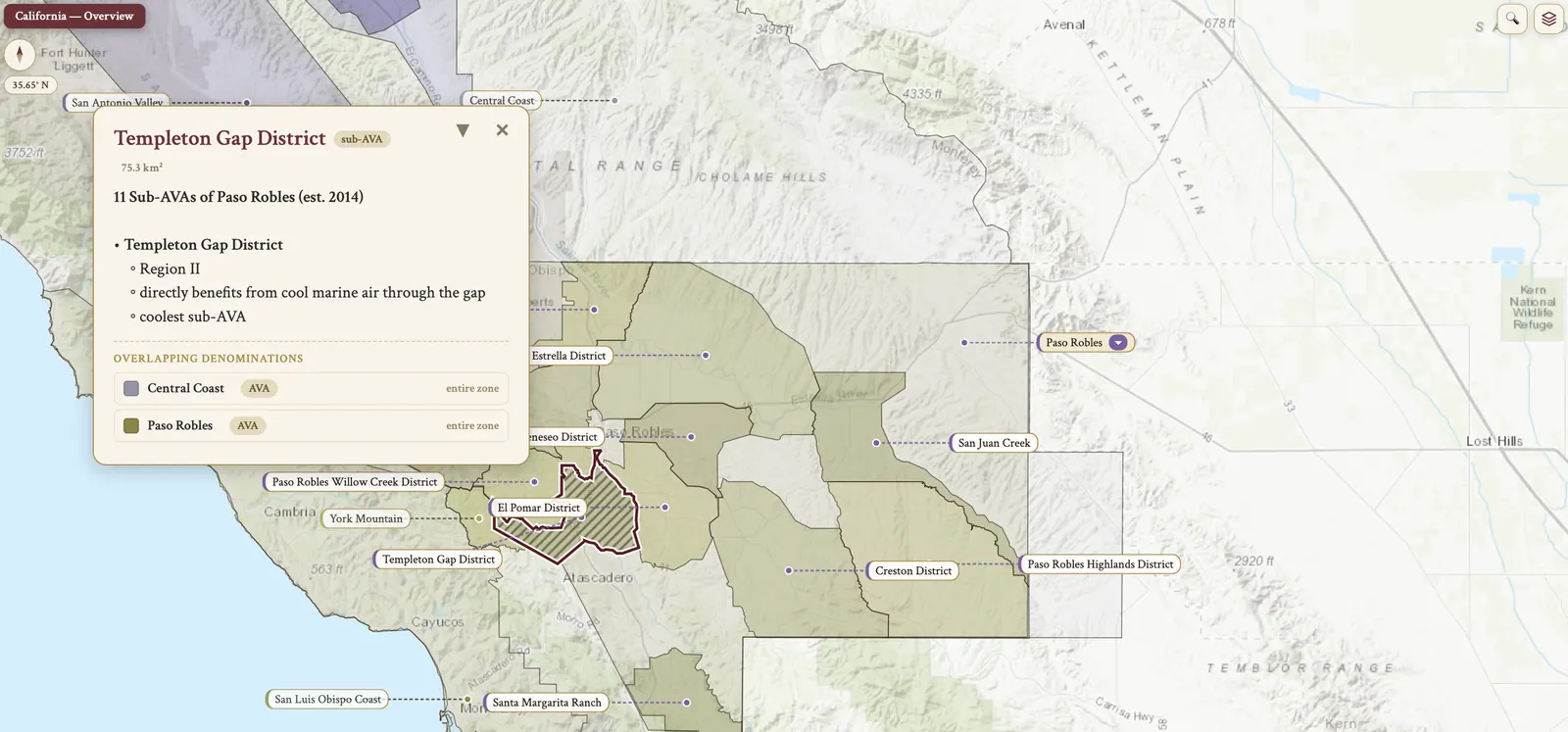
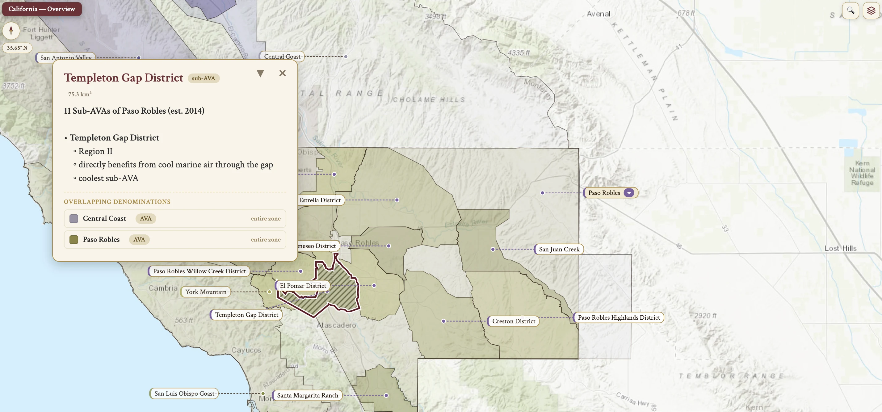
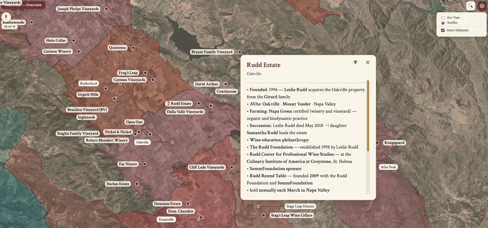
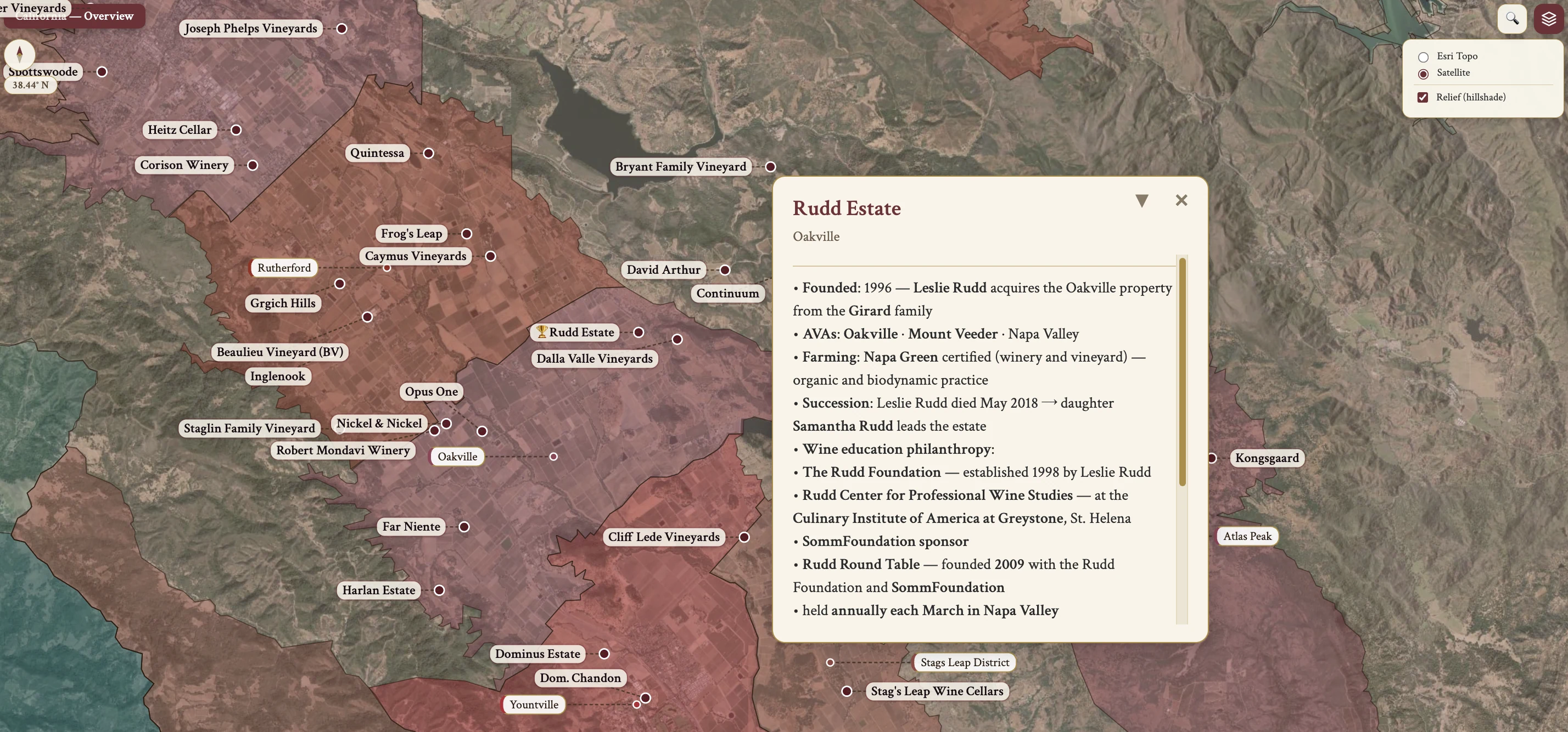
The California maps from Your Own Wine Encyclopedia — every name tag opens a study card. Below, the chapter's own geography, climate and geology notes.
From the encyclopedia
USA — National Overview
In national terms the USA is the 4th largest wine producer globally. The major states are California (85%), Washington (5%), New York (3%) and Oregon (2%).
The vineyard area is 400,000 hectares across 30+ states, wine is produced in all 50 states, and there are 10,000+ wineries.
History of US winemaking — the colonial and growth eras
The history of US winemaking opens with the colonial era, the 15th–early 19th c. European colonization over the 15th-19th centuries brought settlers seeking resources, trade, and expansion. Indigenous peoples faced land loss, conflict, disease, and enslavement. Millions of Africans were enslaved, including in vineyards.
Europeans tried making wine since the late 1500s, but native vines were unsuitable. European vinifera vines were introduced around 1620 and faced diseases and pests. Hybrid vines like Alexander led to early commercial success in the 1800s. In the Mexican territories, V. vinifera grapes thrived in New Mexico, Texas and California.
The growth era ran 1848–1900. The California Gold Rush, post-1848, spurred vineyard expansion, and the California Wine Association of 1894 stabilized the market.
Prohibition and repeal
Prohibition and repeal span 1919–1933. The 18th Amendment, ratified Jan 16, 1919, enacted nationwide Prohibition. Prohibition itself, 1920–1933, devastated the US wine industry: the winery count plummeted, many vineyards were uprooted or converted to other crops, and cooperage, equipment, distribution channels and markets all atrophied.
The 21st Amendment, ratified Dec 5, 1933, repealed the 18th Amendment — the only US constitutional amendment to repeal another. Its Section 2 delegates alcohol regulation to the states, the constitutional basis for the three-tier system and for state-by-state variation in direct-to-consumer (DTC) shipping.
Decline, revival and the modern era
Post-Prohibition decline and revival ran 1933–1960s. Wine fell out of fashion due to economic recession and a preference for spirits and beer. In the 1940s-1950s large companies like Roma Wines and Gallo promoted wine, and the 1960s revival brought new wineries, better practices and increased interest.
The modern era runs from 1970 to the present. California wineries went from 240 in 1970 to nearly 4,000 by 2014. Ohio, New York and Virginia renewed viticulture, Mid-western and northern states explored cold-climate varieties, and Washington's Yakima Valley and Oregon's Willamette Valley gained recognition. Ongoing challenges are climate conditions and restrictive alcohol laws, and there have been significant advancements in the past 50 years.
California — Overview
California is the largest producer in the US, making 85% of US wine, and on its own it is the 4th largest producer globally. Its 250,000 hectares of vineyards are located along the Pacific coast, the Central Valley, and the Sierra Nevada foothills.
Its AVAs are grouped into North Coast, Central Coast, Inland valleys — including the Central Valley — Sierra Foothills and South Coast.
History — from the missions to varietal labeling
Spanish missionaries introduced grapes for altar and sweet fortified wine; the Mission grape, Listán Prieto, was brought to California by Franciscan monks in 1783. The 1849 Gold Rush increased plantings. In the late 19th century key wine regions were established and the wine research center at UC Davis was founded. In the 1890s overplanting led to a drop in prices.
Prohibition, 1920-1933, devastated the industry, and over the 1930s-1960s the industry was rebuilt. In the Mid-20th century consumer preference was for medium-sweet wines, named after European regions.
The shift to varietal labeling — red table wine, grape variety, and specific origin — was promoted by Robert Mondavi, and it came with rapid growth of Chardonnay and Cabernet Sauvignon plantings.
History — Tchelistcheff, Paris and the modern era
André Tchelistcheff's innovations were temperature-controlled fermentation, improved hygiene, and disease and frost prevention. At the Judgement in Paris, 1976, California wines — Stag's Leap Wine Cellars Cabernet Sauvignon and Chateau Montelena Chardonnay — won top scores, boosting the industry.
The phylloxera attack in the 1980s came through AXR-1 rootstock, which gave higher yield but was not resistant to phylloxera, leading to large-scale replanting and a focus on quality. The 1990s brought the popularity of deeply colored, highly concentrated, high alcohol red wines and very ripe whites with new oak. In recent years diversity and quality in wine production have increased, the big wine trend is mostly over, and the focus is on matching grape variety to climate and soil.
The Rhône Rangers are California winemakers making Rhône-style blends; they helped popularize Syrah, Grenache and Mourvèdre, Bonny Doon and Tablas Creek among them. The Meritage Alliance holds a trademarked term for premium Bordeaux-style blends, in which no single grape may exceed 90%; it may be red or white. Wine Advocate was established in 1978 by Robert Parker, Wine Spectator in 1979. Growth of professionally trained winemakers came alongside local wine research at UC Davis, and experimentation with a wide range of grape varieties, techniques and styles.
Grape Varieties — Cabernet Sauvignon
The top grape varieties by hectares (2021) rank CS, CH, PN, Zin, Merlot, Colombard, PG, SB, Syrah, in that order.
For Cabernet Sauvignon the site governs much of the style: vineyards with a moderating influence give fresher black fruit flavors, herbal notes, less body and lower alcohol. Green-harvesting reduces yield to improve grape quality. Long hang times: the results are very concentrated, ripe styles, often full-bodied with high alcohol.
Most wines are matured in oak, except some inexpensive ones. High percentages of new French oak are common, maturation time is often shorter than in the past, and there is a better balance of fruit and oak than in previous decades.
Blending with Bordeaux grapes — small proportions of other Bordeaux varieties — accounts for many of the most prestigious and expensive wines in California. Blending with different sites pairs a cool region, for freshness and acidity, with a warm region, for ripeness and body, to give good balance. Blending wines with different treatment covers harvest time, oak treatment, free run or pressed, and maceration.
Grape Varieties — Chardonnay and Pinot Noir
Chardonnay site selection is increasingly nearer the coast or with coastal influence, and at high altitudes. Premium wines are M(+) to full-bodied, with pronounced flavors of peach and pineapple and secondary flavors from MLC and new oak. Recent trends run fresher and leaner: less-ripe fruit characteristics of citrus fruits, less overt new oak, and lees contact managed to give struck match aromas from volatile sulfur compounds. Inexpensive Chardonnays are a soft, easy-drinking style, with M acidity, sometimes slight RS, often unoaked or made with oak alternatives.
Pinot Noir plantings have increased rapidly in the last 20-30 years, and the premium wines come from relatively cool sites, with coastal influence or higher altitude. Style varies between M(+) acidity, M body and alcohol with fresh flavors of red cherry and raspberry, or greater body and alcohol with M to M(+) acidity and riper flavors, black fruits or slightly jammy. Trends are toward earlier picking, and toward whole bunch fermentation or stem inclusion for enhanced aroma complexity and tannic structure. For maturation there is some new oak, generally French.
Grape Varieties — Zinfandel
Zinfandel is the signature variety of California and is not widely grown elsewhere, except in Puglia. It is prone to uneven ripening, which can lead to a combination of M(+) acidity with some fresh flavor alongside jammy characters. Old-vine Zinfandel includes plants over 100 years old, and there is considerable planting of it in California.
Premium Zinfandel has M(+) acidity, M to full body and ripe M(+) tannins, with flavors of raspberry, blueberry and blackberry; American oak is used for maturation, its overt vanilla flavors pairing well with Zinfandel's juicy fruit profile. Inexpensive Zinfandel is a soft, ripe, often jammy style, with oak alternatives for spice flavors.
White Zinfandel is a Rosé made with a short maceration on skins to a medium pink color. It is fermented in stainless steel at cool temperatures, and fermentation is often stopped early to leave RS. The wine is medium dry and low in alcohol, ~10.5–11% abv, with M acidity and body and flavors of strawberry and fruit candy. It is usually sold under big brand labels and is often inexpensive to mid-priced.
The notable Zinfandel vineyards are Pagani Ranch in Sonoma Valley, Sonoma County; Dusi, or Dante Dusi Ranch, in Paso Robles on the Central Coast; and Teldeschi in Dry Creek Valley, Sonoma County.
Grape Varieties — Merlot, Colombard and Syrah
Merlot was popular in the 1990s and early 2000s and declined with changing consumer trends; plantings have declined. Inexpensive to mid-priced wines show M acidity and M tannins and a fruity, plummy character. Premium wines are made in more moderate climates, such as Stag's Leap District and Oak Knoll District in Napa Valley; they have higher acidity and tannins, greater freshness and complexity, and are sometimes blended with other Bordeaux varieties.
Colombard is a neutral white grape, also used for IGP wines in South West France. It is generally grown in the Central Valley. Its inexpensive wines are often blended and rarely seen on labels, usually labeled as "fruity white" or "dry white".
Syrah has been increasing in popularity in recent years, and its optimal growing conditions are areas with some cooling influence, where it performs best. The wine is M to M(+) in body with M(+) acidity and tannins, and flavors of fresh plum, blackberry and spice. Some producers specialize in the Rhône varieties — Grenache and Cinsaut among the reds, Viognier, Marsanne and Roussanne among the whites — Tablas Creek in Paso Robles among them.
Grape Varieties — Pinot Gris, Sauvignon Blanc and the others
Pinot Gris plantings have increased over the last couple of decades. The wine is a dry but fruity style, with flavors of peach, pear and melon.
Sauvignon Blanc is generally fruity, typically fermented in stainless steel and released early. Barrel fermented styles are fermented and matured in oak for greater body and texture, with toasty flavors. It is occasionally labeled as Fumé Blanc, which does not necessarily indicate oak fermentation or maturation.
The range of other grape varieties includes Italian, German, Spanish, Portuguese and additional French varieties. Petite Sirah, which is Durif, has its origin in France and is more planted in California than anywhere else. It is late-ripening and best in warm areas, deeply colored and full-bodied, with M(+) to H tannins and acidity and flavors of black fruit and spice. It adds color, body, tannins and acidity to other red wines.
Climate
The overall climate is Mediterranean-like, with a relatively dry growing season; dry autumns can extend the growing season, which is beneficial for cooler regions. The Pacific Ocean is the major influence, its cold water currents reducing coastal temperatures.
Fog is produced by cold offshore water. It travels through gaps in the Coast Ranges, is usually morning fog and burns off by midday, and it lowers temperatures and slows ripening. The diurnal range comes from cold air moving coastward from inland areas at night, replacing warm air. Interior valleys carry a continental influence, experiencing extreme heat and cold without coastal moderation.
Topography & Soil
The Coast Ranges run north to south along the coast, creating barriers and gaps for marine influence. Valley orientation affects exposure to fog and wind — east-west oriented valleys funnel marine air. With altitude, higher-elevation vineyards may sit above the fog layer, receiving more sunshine and warmth.
Tectonic activity, volcanic history and alluvial processes create diverse soils. The common types are volcanic soils, sedimentary soils of sandstone and limestone, and alluvial soils of gravel, sand and clay. Free-draining soils are common in the quality regions, where they limit vigor and yields.
Viticulture & Hazards
Drip irrigation is widely used owing to the dry growing seasons. Training is typically cordon or replacement spur with VSP trellising. Sustainability covers various programs including Napa Green Winery, Sonoma County Winegrowers and Lodi Rules. The Central Valley has historically been mechanized, with large-scale, high-yield vineyards.
Among the hazards, spring frosts are combated with sprinklers and wind machines. Wildfires are threatening vines and winery buildings, and causing smoke taint. Drought and sunburn are met with drip irrigation and with mist, which is experimental, as at Beaulieu Vineyard.
On the map
- North Coast — Overview
- Napa Valley
- Napa Valley Floor (Yountville–Calistoga)
- Mayacamas Range (west)
- Vaca Range (east)
- Southern Napa (Carneros–Coombsville)
- Sonoma County (all AVAs)
- Sonoma Valley
- Northern Sonoma (Alexander–Dry Creek)
- Russian River Valley
- Sonoma Coast
- Petaluma Gap
- Mendocino County
- Anderson Valley
- Covelo & Dos Rios
- Lake County (Clear Lake)
- Solano County (Suisun)
- Central Coast — Overview
- San Francisco Bay
- Livermore Valley
- Santa Cruz Mountains
- Monterey County (Salinas Valley)
- Santa Lucia Highlands
- San Benito County (Mt. Harlan)
- San Luis Obispo County (all AVAs)
- Paso Robles (11 sub-AVAs)
- Edna Valley & Arroyo Grande
- Santa Barbara County
- Sta. Rita Hills
- Central Valley (Lodi–Madera)
- Lodi (7 sub-AVAs)
- Clarksburg & Delta
- Yolo & Solano (Capay–Suisun)
- Sierra Foothills — Overview
- El Dorado & Amador
- Central Valley South (Madera–Tracy)
- South Coast — Overview
- Temecula & San Diego County
- Malibu & Los Angeles County
- Far North (Shasta–Siskiyou)