Green Spain — Wine Region Guide
The Green Spain maps from Your Own Wine Encyclopedia — every name tag opens a study card. Below, the chapter's own geography, climate and geology notes.
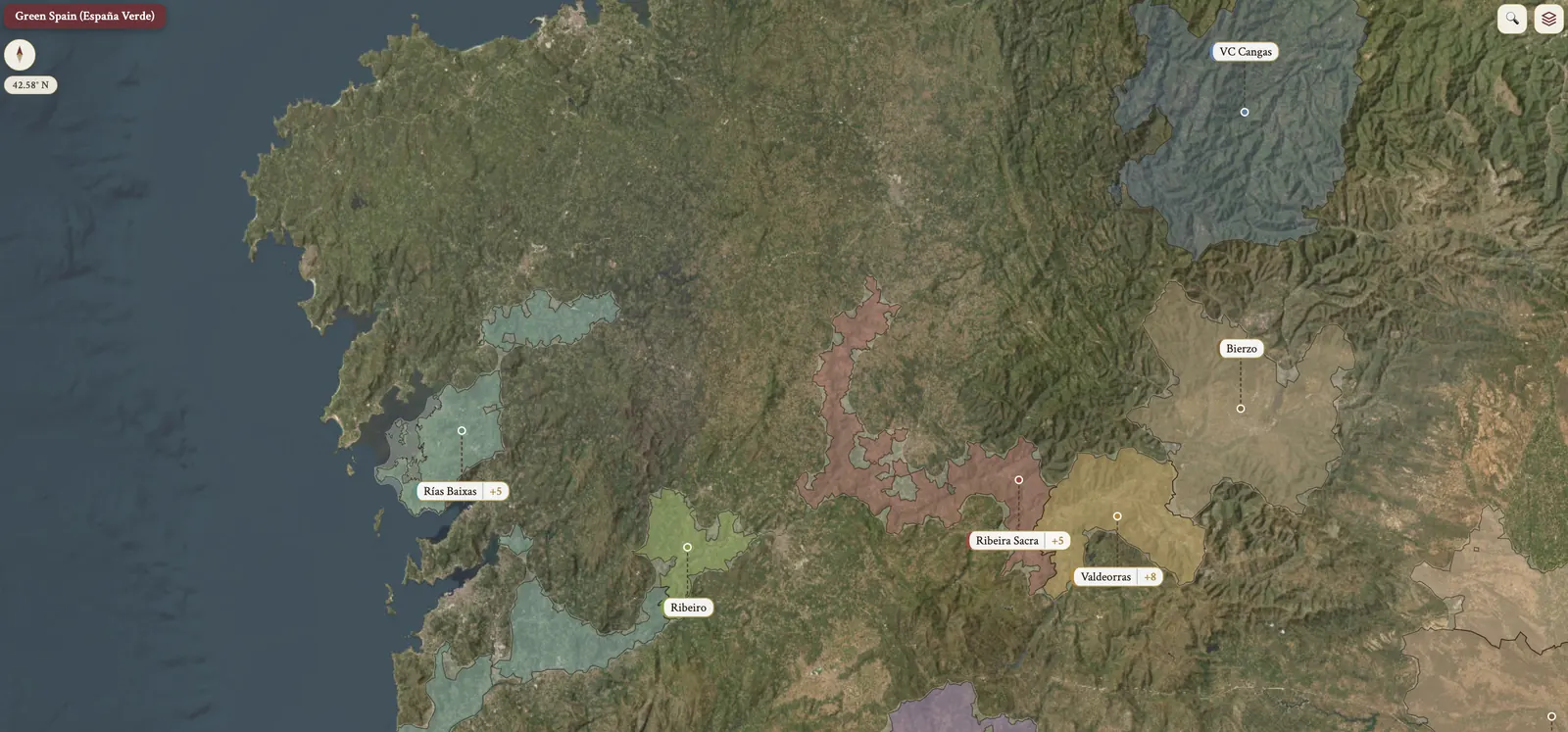
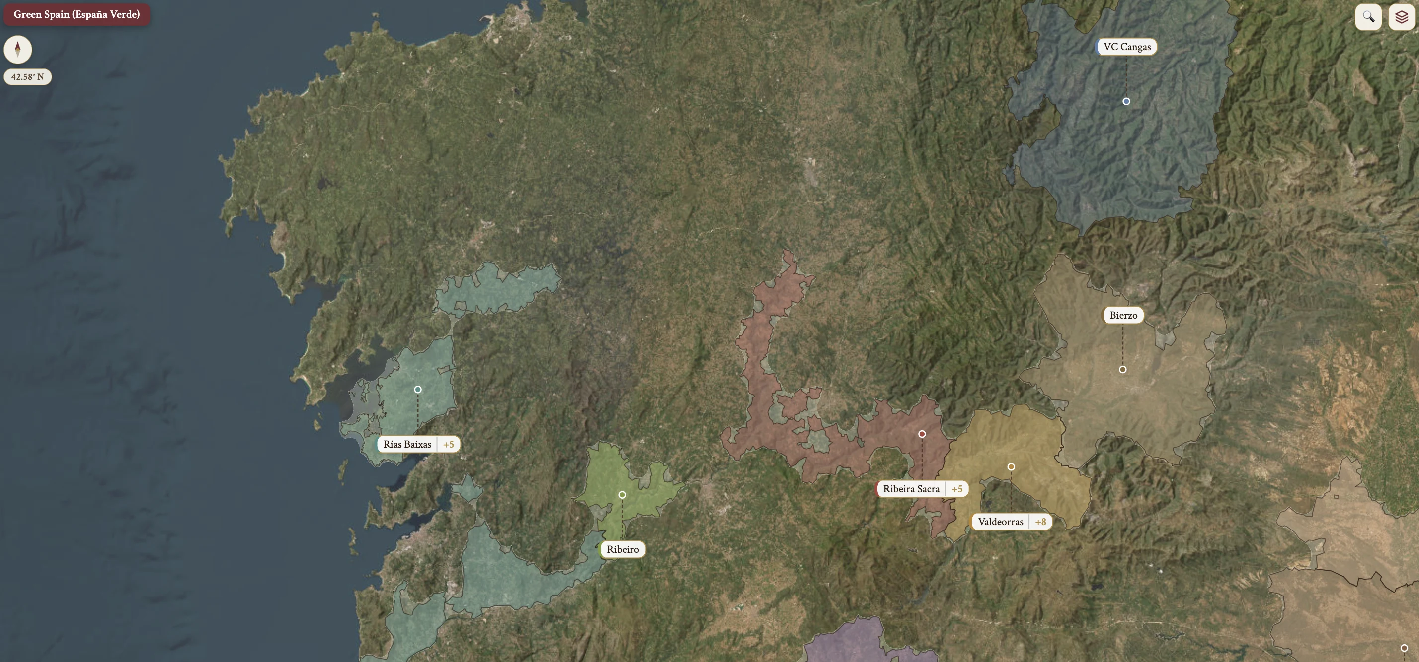
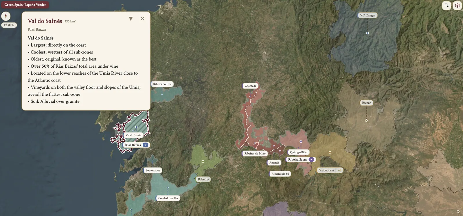
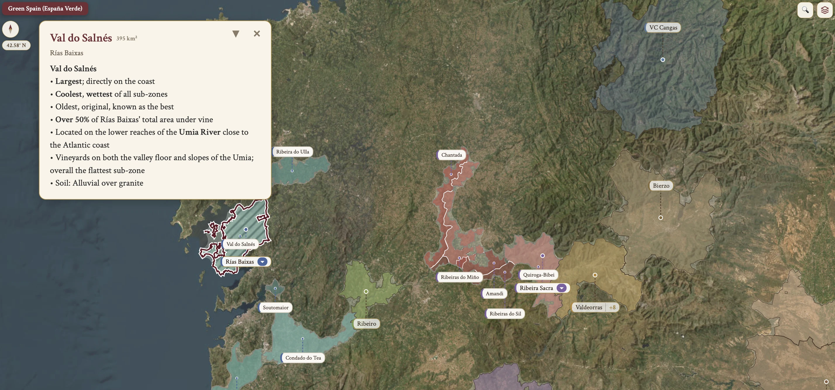
From the encyclopedia
Green Spain (España Verde)
Green Spain — España Verde — takes in Galicia, Asturias, Cantabria and País Vasco, the Basque Country. Galicia holds the northwestern corner of the Iberian Peninsula, bordered by the Atlantic Ocean to the north and west, by Portugal to the south, and by Castilla y León and Asturias to the east. It is divided into four provinces: A Coruña, Lugo, Pontevedra and Ourense. Galicia's capital is Santiago de Compostela, famous for the Christian pilgrimage, and its largest city is Vigo, with ~292,000 inhabitants.
Location & Topography
The coastal areas are cliffs and rías — submerged river valleys open to the sea, formed by the partial flooding of unglaciated river valleys as sea levels rose, which gives a branch-like, indented coastline with islands. The interior is a hilly and mountainous landscape. The two most important rivers are the Río Miño and the Río Sil, known as the country of the thousand rivers.
The Macizo Galaico, or Galician Massif, has three primary mountain ranges: Serra do Eixe, Serra da Enciña da Lastra and Serra do Courel. Avg heights run ~500 m, with some exceeding 2,000 m.
Vine training follows the site. Steep hillsides are planted en espaldera, on terraces; flatter sites are planted on parrals, pergolas.
Climate
The climate is maritime, and temperate compared with other areas at similar latitude. Winters are mild, avg ~14°C, and snow is rare. Summers are moderate: the southwest coast averages ~25°C, the northwest coast ~23°C, and inland can exceed 30°C. Rainfall is heavy, especially in winter.
North and south are not the same. Southern Galicia is subject to summer drought, but with mild temperatures. Northern Galicia has milder summers and more uniform year-round rainfall.
Soils
On the coast the ground is predominantly granite-based — sandy, shallow and slightly acidic. In the inland terraced river valleys granite is coupled with clay, and in the river valleys further inland it is shallow slate, shale and granitic sand. Granite is ideally suited to the damp climate: it is porous, with excellent drainage.
Grape Varieties
The region produces more white wine than red. It is home to many indigenous grapes, and international varieties are virtually non-existent. Albariño is the star of Rías Baixas, at ~90% of plantings there, and is preferred in multiple DOs. Godello is often a better choice in the inland DOs — Valdeorras, Ribeiro and Monterrei. Mencía is the dominant red grape for the inland regions, and is indigenous to neighboring Castilla y León.
Viticulture & Winemaking
Stylistically both whites and reds tend to be youthful and fresh, but producers are increasingly experimenting with long-term aging. Vineyards lie on slopes and steep terraces along the river valleys, and harvesting is labor-intensive and expensive. Spain's EU admittance brought significant investment, which brought updated equipment and modern techniques, and with them quality improvements.
Whites are fermented in stainless steel, which gives fresh, crisp, acidic wines; barrel fermentation experiments with Albariño, Godello, Treixadura and Loureira give fuller-bodied, powerful wines, dry with a tannic grip. Reds are generally made in stainless steel, and the cool climate gives fresh, fruit-forward, mineral, light- to medium-bodied wines, Mencía especially; barrel aging is increasingly common.
Galician oak, Quercus pyrenaica, is being trialed alongside American and French oak, and early indications suggest characteristics of both. Ribeira Sacra translates to Sacred Riverbank in English.
Asturias & Cantabria
Asturias and Cantabria both share a maritime climate — cool, damp, Atlantic-influenced. The Cordillera Cantábrica forms the southern border with Castilla y León, and the Picos de Europa is the highest range within the Cordillera Cantábrica, its highest peak Torrecerredo at 2,648 m. Vineyards sit at considerable elevation, ~500 m avg, on steep terraces, and mechanization is practically non-existent. Vineyards on the lee side of the Cordillera Cantábrica benefit from the foehn effect — warm, dry downslope winds that extend the growing season.
Winemaking is in stainless steel and barriques, with experiments in Galician oak, Quercus pyrenaica, and chestnut casks. As of 2016 there were only 10 wineries in Asturias and 15 in Cantabria.
Asturias
The capital of Asturias is Oviedo and the largest city is Gijón, with ~273,000 inhabitants. It is bordered by Galicia to the west, Cantabria to the east, Castilla y León to the south and the Cantabrian Sea to the north. The climate gives mild, rainy winters at ~13°C, cool summers at ~23°C, and rainfall of ~1,000 mm/yr. Limestone mountains give way to slate, with excellent drainage for the ~70 ha of vines, and the vineyards are in the mountainous southwest corner only.
Production is predominantly red wine, ~2/3 of the total, and the reds are typically blends — light, aromatic, fruity, floral, mineral, low in alcohol. The red grapes are Mencía, Albarín Tinto and Carrasquín; the white is Albarín Blanco. A catastrophic hailstorm in 1959 destroyed vines for 3 years and growers left for the coal industry; the Wine of Cangas campaign in the 1990s revived viticulture.
Cantabria
The capital and largest city of Cantabria is Santander, with ~183,000 inhabitants. It is bordered by Asturias to the west, País Vasco to the east, Castilla y León to the south and the Cantabrian Sea to the north. This is the cloudiest part of Spain: coastal avg ~14°C, inland avg ~9°C, rainfall ~1,200 mm/yr, and snow frequent inland, the Cordillera snow-capped Oct–May.
Limestone makes the mountains, shale and sandstone the valleys, and the ground is extremely fertile, which makes it better suited to apple trees — Cantabria is famous for sidra, apple cider. The northern coast is almost exclusively white wine, from Albariño, Godello, Treixadura and Hondarribi Zuri; inland the wines are red-dominant blends of local and international varieties.
País Vasco (Euskadi)
País Vasco, the Basque Country, also known as Euskadi, is the easternmost Green Spain autonomía. It has 3 provinces — Álava (Araba), Vizcaya (Bizkaia) and Guipúzcoa (Gipuzkoa); Navarra is the 4th Spanish Basque province but remains independent. There is no official capital, and Vitoria-Gasteiz, in Álava, serves as government HQ. The largest city is Bilbao, with ~345,000 inhabitants. It borders the Bay of Biscay to the north, France and Navarra to the east, Cantabria and Castilla y León to the west, and La Rioja to the south, with the southern border running along the Ebro River.
Three distinct areas divide it. The Atlantic Basin is coastal and carries the majority of txakoli vineyards. The Montes Vascos are mountain ranges up to 1,551 m, separated by the Álava Plain. The Ebro River Basin is south Álava — Rioja Alavesa.
País Vasco — Climate & Soils
The coastal provinces of País Vasco, Vizcaya and Guipúzcoa, have a cool, damp, maritime climate, with winter at ~9°C and summer at ~20°C. Rainfall is ~1,200 mm in Bilbao and ~1,500 mm in San Sebastián. Álava is more continental, with warmer summers peaking at ~26°C and a drier growing season.
Guipúzcoa has sandy topsoil over alluvial clay subsoil; Vizcaya has clay-loam over limestone subsoil; Álava, in the DO area, is predominantly limestone, rich in organic matter.
Txakoli (Chacolí)
Txakoli, or Chacolí, takes its name from the Basque etxakoa, made at home. It nearly disappeared in the mid-20th century and was revived by a growers' association. It is ~95% white wine, and 90% of the vineyards are planted to Hondarribi Zuri — Zuri is white in Basque. The sole red grape is Hondarribi Beltza, Beltza black. Both grapes are named after the town of Hondarribia, in Guipúzcoa.
The parral system dominates, for humidity management, though some growers are switching to espaldera, and the harvest is by hand. The fruit is destemmed, given skin maceration and a 2–3 week fermentation, then bottled or given brief lees aging — traditionally in large wooden foudres, now mostly in stainless steel. Experiments run to extended lees aging, concrete vessels, barrel fermentation in oak or acacia, carbonic maceration, and blends with international varieties.
The wine is crisp, H acidity, pale yellow, with citrus and white flowers, low alcohol and sometimes a slight spritz. In service it is traditionally poured from a height to aerate.
On the map
- Galicia
- Rías Baixas DO
- Val do Salnés
- O Rosal
- Condado do Tea
- Ribeira do Ulla
- Soutomaior
- Ribeiro DO
- Ribeira Sacra DO
- Amandi
- Chantada
- Ribeiras do Miño
- Ribeiras do Sil
- Quiroga-Bibei
- Valdeorras DO
- Monterrei DO
- Valle de Monterrei
- Ladera de Monterrei
- VC Cangas (Asturias)
- País Vasco — Txakoli
- Getariako Txakolina
- Bizkaiko Txakolina
- Arabako Txakolina