Loire Valley — Wine Region Guide
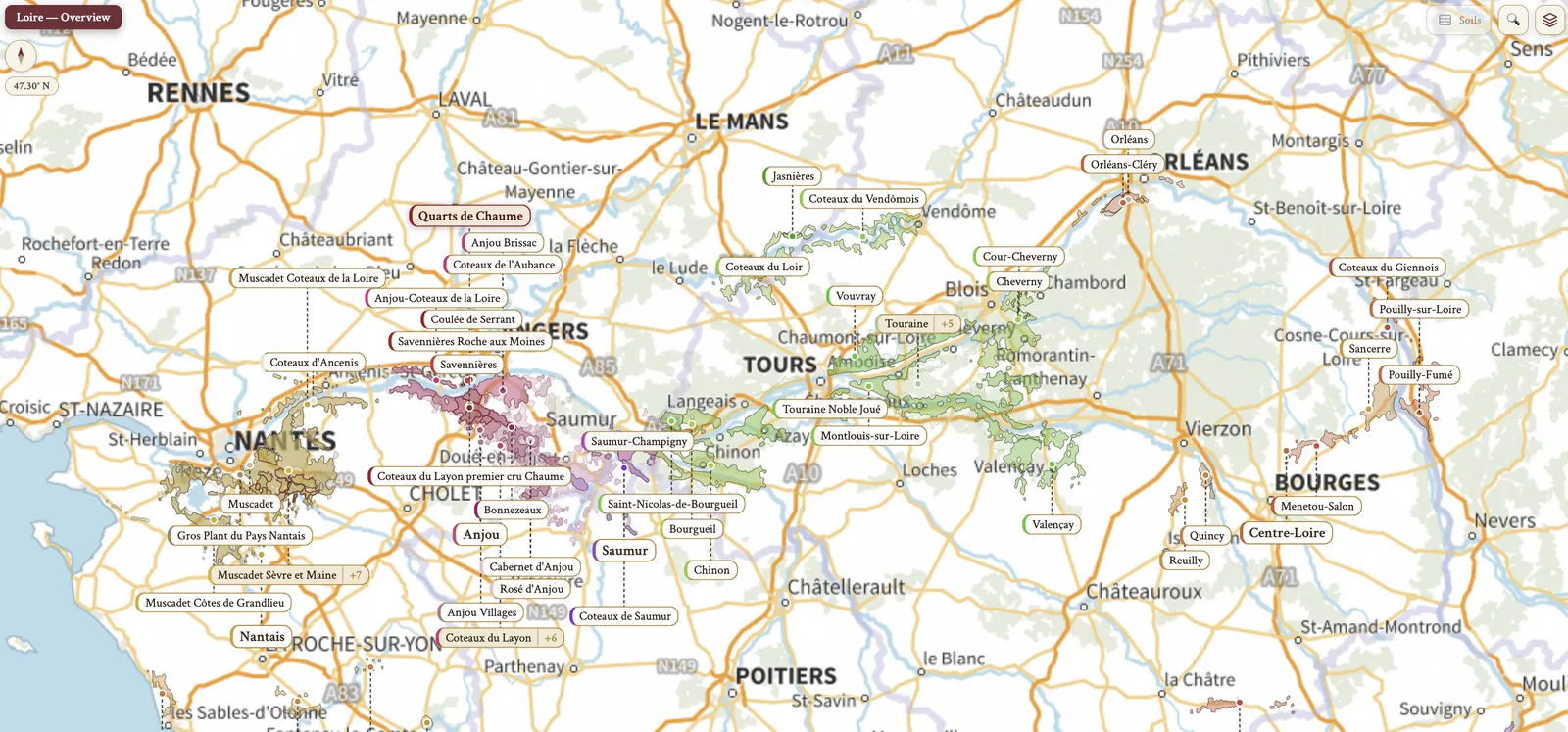
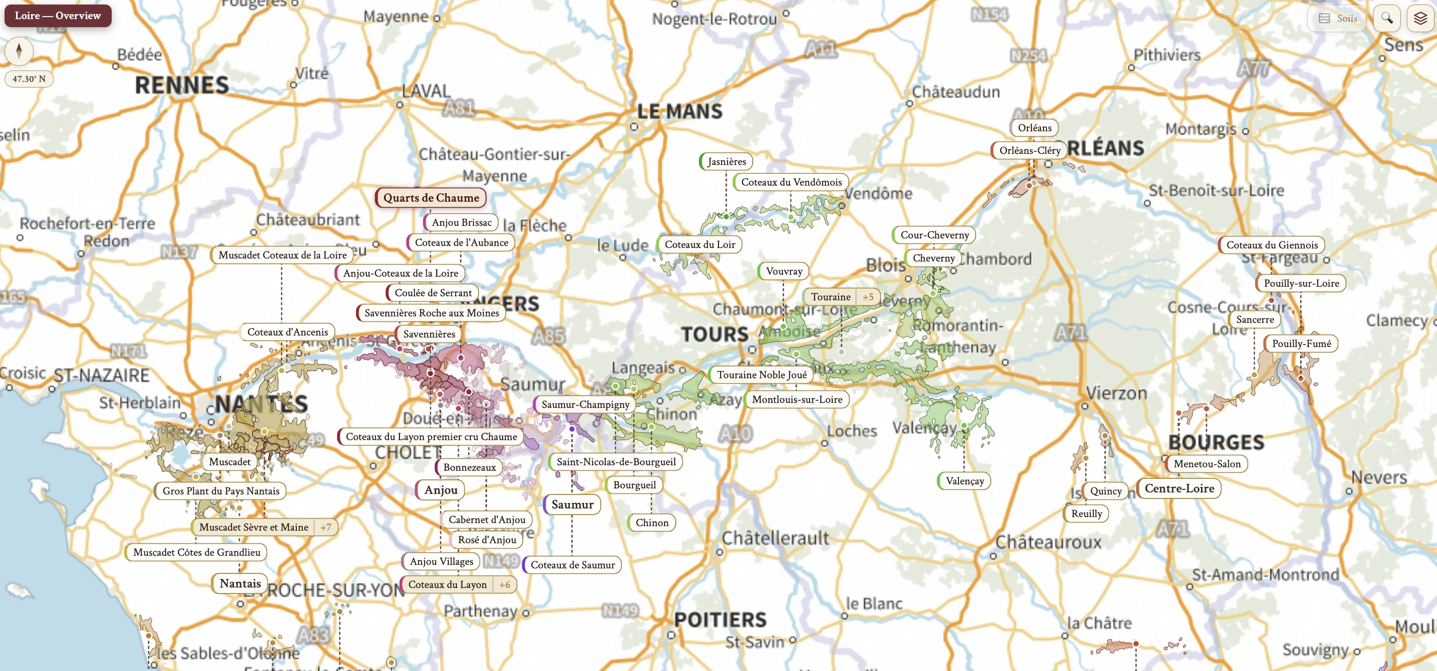
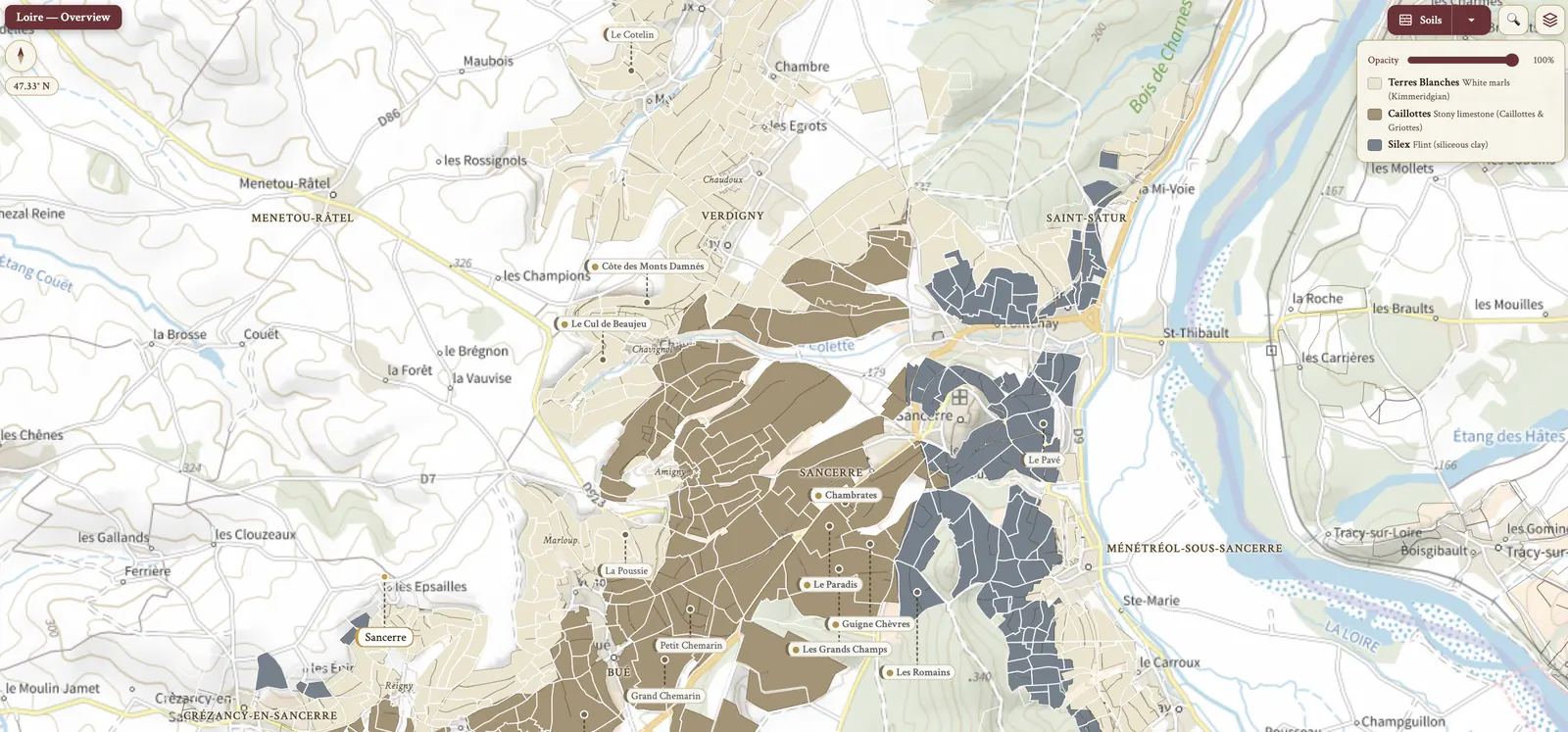
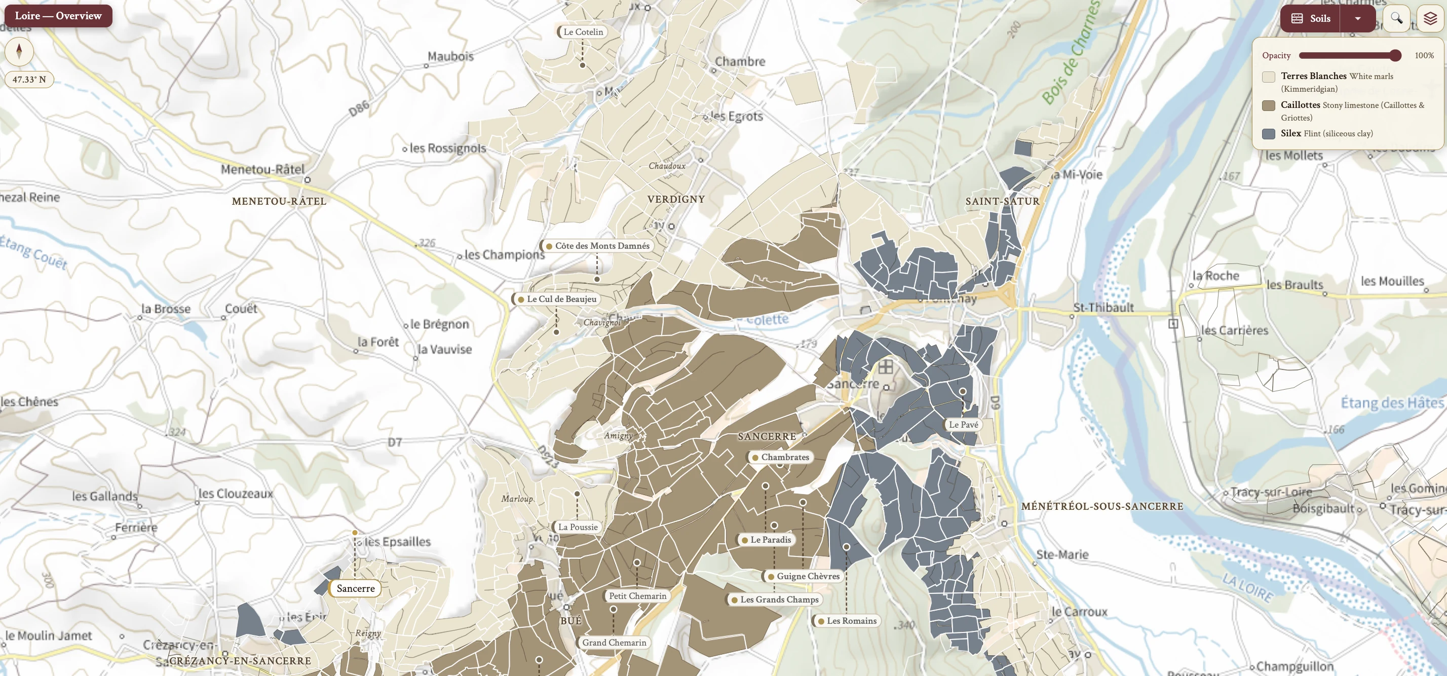
The Loire Valley maps from Your Own Wine Encyclopedia — every name tag opens a study card. Below, the chapter's own geography, climate and geology notes.
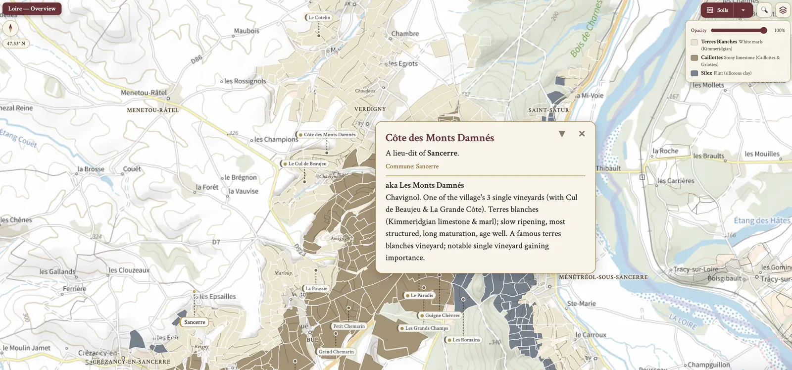
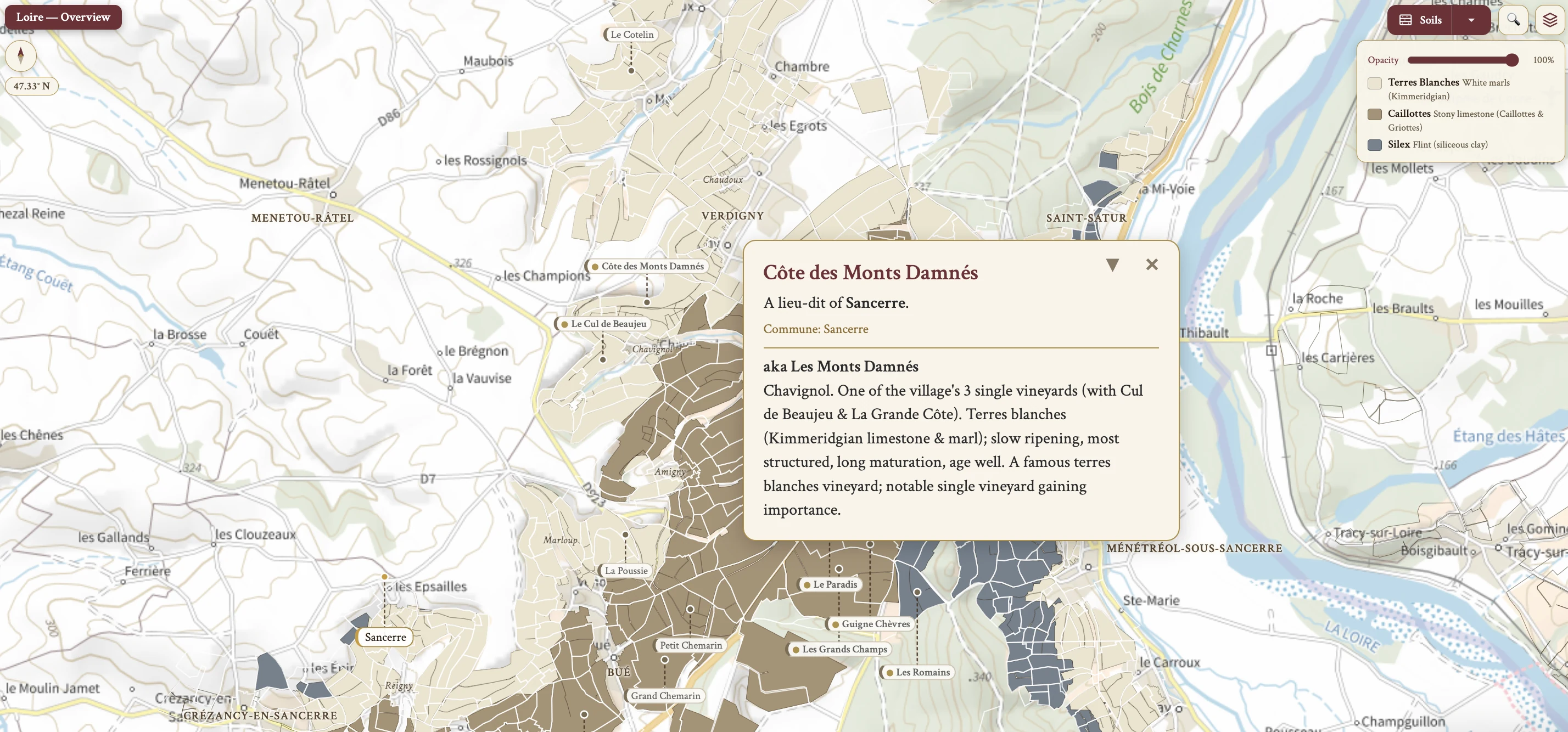
From the encyclopedia
Overview
The Loire Valley, from Sully-sur-Loire to Chalonnes, was designated a UNESCO World Heritage Site in 2000. It is France's largest white wine region, and it holds ~51 AOCs. The Romans are credited with bringing viticulture to the Loire, and the regional catch-all is Val de Loire IGP.
Organic, Biodynamic & Natural Wine
The Loire has a number of well-known proponents of organic and biodynamic vine growing. Nicolas Joly is the founder of the Renaissances des Appellations, the Return to Terroir group, now a worldwide group of biodynamic producers, with more producers in the Loire than any other region.
Total production of certified organic wine is below the French average due to the cool and damp climate. The Loire is also a centre of natural winemaking, and such wine is often produced as Vin de France. A significant number of good producers in Anjou prefer to forsake the appellation system and opt for Vin de France.
Geography
The Loire Valley sits north of Bordeaux, south of Normandy, east of the Atlantic and west/southwest of Bourgogne. The warm Gulf Stream flows to the west of France, influencing the climate.
The Loire is the longest river in France, at ~1,000 km. It springs at the base of Mont Gerbier de Jonc, in the Massif Central, Cévennes Mountains, and empties into the Bay of Biscay. Its source lies more precisely in the Ardèche département, in the commune of Sainte-Eulalie, at ~1,408 m elevation.
The key tributaries of the Loire are the Allier, Vienne, Layon, Cher, Indre, Loir and Sèvre Nantaise. They create favorable mesoclimates and exert a warming influence on the vineyards that flank them.
Climate & Geology
The climate shifts by sub-region. Pays Nantais, the Lower Loire, is maritime. Anjou, Saumur and Touraine — the Middle Loire — are maritime with continental influences. Centre-Loire and the Upper Loire are continental.
The geology belongs to three larger structures. Pays Nantais and Anjou are part of the Massif Armoricain, Touraine and Centre-Loire are part of the Paris Basin, and the Upper Loire is part of the Massif Central. The soil types run to sedimentary soils, soils from the decomposition of igneous and metamorphic rock, and wind-blown sands: vineyards flank the Loire and its tributaries on a wide variety of soils.
Grape Varieties — Chenin Blanc
Among the white varieties, Chenin Blanc — Pineau de la Loire in Anjou — is the 2nd most planted in Anjou-Saumur. Its range of styles covers dry, off-dry, sweet and sparkling.
In the vineyard it buds early, which leaves it prone to spring frost, and ripens late, which exposes it to autumn rain. It ripens unevenly, and with botrytis it is picked over several passes; multiple passes limit mechanical harvest and add cost. It is vigorous and can carry high yields if allowed, and it is prone to powdery mildew, botrytis bunch rot and trunk diseases.
The profile is noticeably H acidity, often balanced with some RS for an off-dry style. In the dry to off-dry style the intensity is M — green apple, lemon, steely, smoky — with M alcohol and H acidity. Quality is good to very good QL at inexpensive to mid-price, with some outstanding and premium, Domaine Huet among them.
Grape Varieties — Sauvignon Blanc
In the Central Vineyards, 80% of plantings are SB. Sauvignon Blanc buds late and ripens early, which suits it to cool climates and lets it avoid the early autumn rains. It grows vigorously, so it is best on poor soils, and its canopy is carefully managed to avoid shading — otherwise the flavours are under-ripe and overly green.
It is prone to powdery mildew, botrytis bunch rot and trunk diseases such as Esca, and prone to Eutypa dieback if cordon-trained. It gives good QL fruit with relatively high yield.
The aromas are P in intensity — grass, bell pepper, asparagus, gooseberry, grapefruit and wet stone in cooler areas, with riper passion fruit in warmer areas. The wine is M in body, M in alcohol and H in acidity.
Grape Varieties — Melon de Bourgogne
Melon de Bourgogne, which is Muscadet, is the most-planted white grape of the Loire. Its parentage is Gouais Blanc × Pinot Blanc, and it is the only allowed variety in the Muscadet AOCs.
It buds early and ripens early, which carries spring frost risk but avoids autumn rain. It is a hardy variety, well suited to cool regions, and gives high yields. It has good resistance to powdery mildew, but its tight bunches leave it susceptible to downy mildew and botrytis, so timely, repeated spraying is needed, and that adds cost.
It arrived in the Pays Nantais in the 17th century as distillation fodder for the Dutch. It gained prominence after the 1709 frost — "Le Grand Hiver" — and the ensuing moratorium on red grapes that transformed the Nantais into a white wine region.
Grape Varieties — Other White Varieties
Other white varieties appear across the Loire in narrower roles. Folle Blanche, or Gros Plant, is used in Gros Plant du Pays Nantais. Chardonnay is a secondary variety, and its synonym in Orléans is Auvernat Blanc. Orbois — Arbois, or Menu Pineau — is an accessory variety, allowed up to 5% in Vouvray.
Romorantin is the local variety of Cour-Cheverny. Chasselas is used in Pouilly-sur-Loire AOP. Pinot Gris, called Malvoisie in the Loire, is used in Reuilly rosé and Coteaux d'Ancenis.
Grape Varieties — Cabernet Franc
Cabernet Franc, or Breton, is the 1st most planted in Anjou-Saumur and the most planted and most significant red grape of the Loire, at ~56% of red plantings. The Loire's 3 most-planted reds are Cabernet Franc, then Gamay, then Pinot Noir.
It buds early, which carries spring frost risk, and is mid-ripening, so it is often picked before the autumn rains. It is prone to coulure, which reduces yields. It is herbaceous and needs better canopy management — dense canopies avoided, leaf removal — which raises labour and cost. It is winter hardy and so suitable for cool areas.
The aromas are M to P in intensity: red fruit of redcurrant and raspberry, floral violet, and leafy notes. The body is L to M, with M tannins and H acidity. Its uses run to a single-variety red, a rosé blend, and a red blend with Malbec, or Cot, in eastern Touraine. From Anjou-Saumur the regional style is generally light, bright and elegantly floral; from Touraine it is most ageworthy.
Grape Varieties — Other Red Varieties
Among the other red varieties, Pinot Noir takes 15% of plantings in the Central Vineyards. It is M ruby, with L to M intensity raspberry and strawberry, H acidity and M alcohol, at mid-price to premium. Gamay Noir is principally grown in Touraine and the Central Vineyards, and is made by carbonic maceration.
Cabernet Sauvignon is late budding and late ripening, and in Anjou it is found only in the warmest sites; it is blended with CF and also used in rosé. Malbec, or Cot, is used in Touraine blends.
Grolleau Noir, or Groslot, is early budding and mid-ripening, and prone to botrytis. It is a blending variety in rosé — Rosé d'Anjou and Rosé de Loire — and the dominant variety in Anjou for rosé production. Pineau d'Aunis is used in Coteaux du Loir and Coteaux du Vendômois.
Synonym Summary
The synonyms worth holding together are these. Gros Plant is Folle Blanche. Cabernet Franc is Breton. Malbec is Cot. Groslot is Grolleau. Pineau de la Loire is Chenin Blanc. Malvoisie is Pinot Gris. Gris Meunier is Pinot Meunier.
On the map
- Pays Nantais
- Anjou–Saumur
- Touraine
- Central Vineyards
- Upper Loire
- Chinon
- Sancerre
- Muscadet — Crus Communaux
- Sancerre — Soils