New Zealand — Wine Region Guide
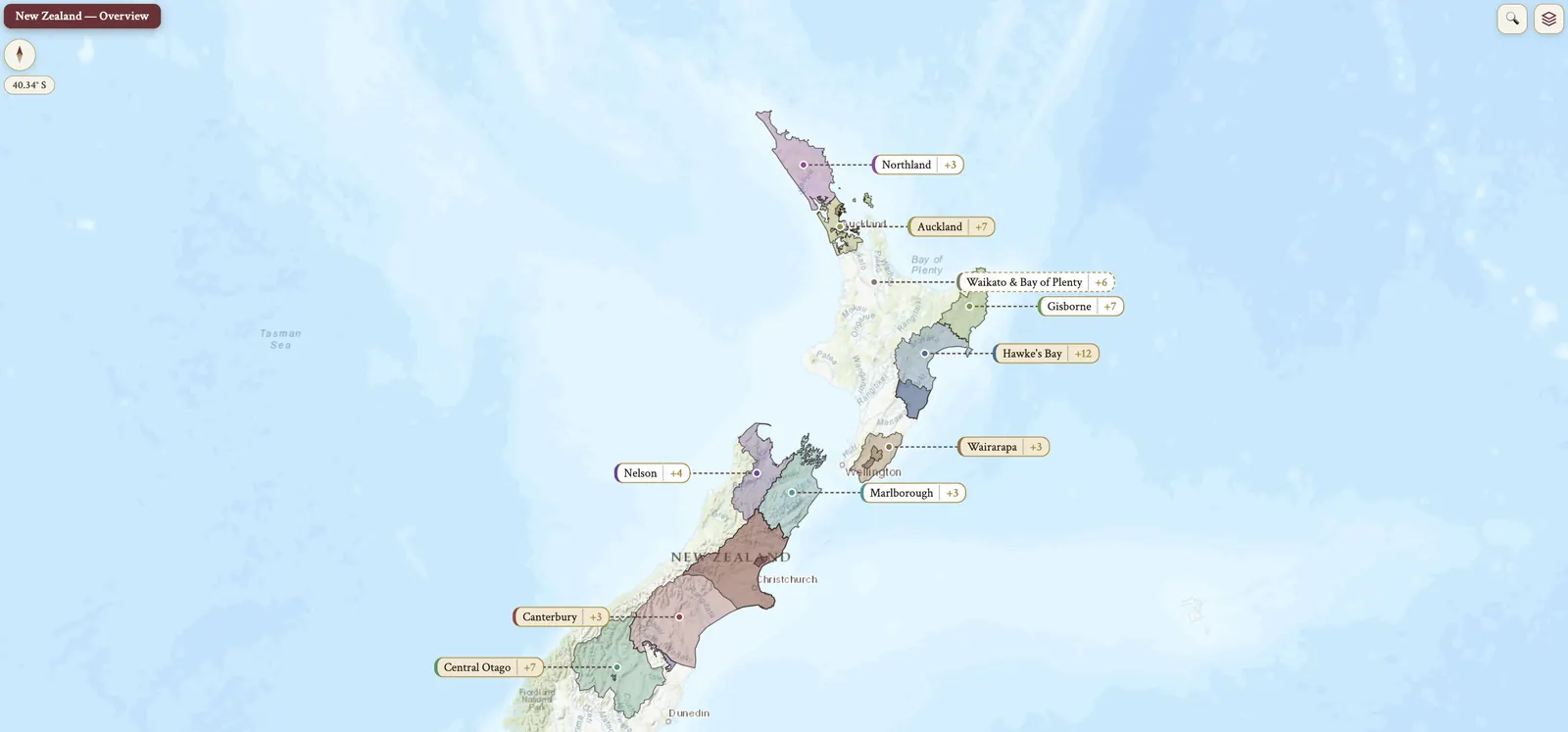
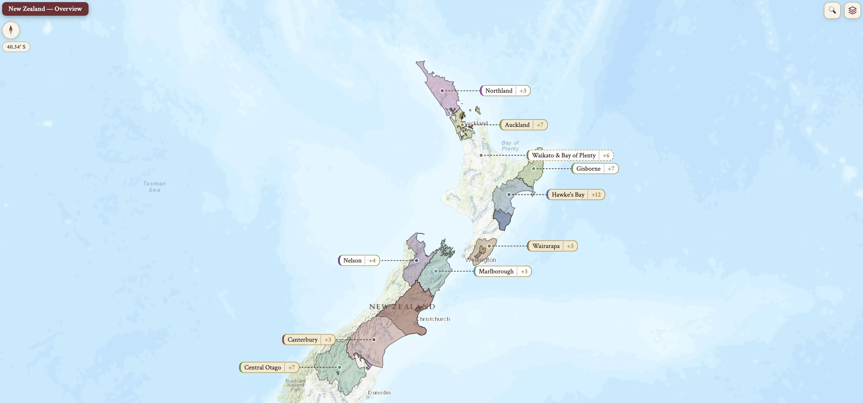
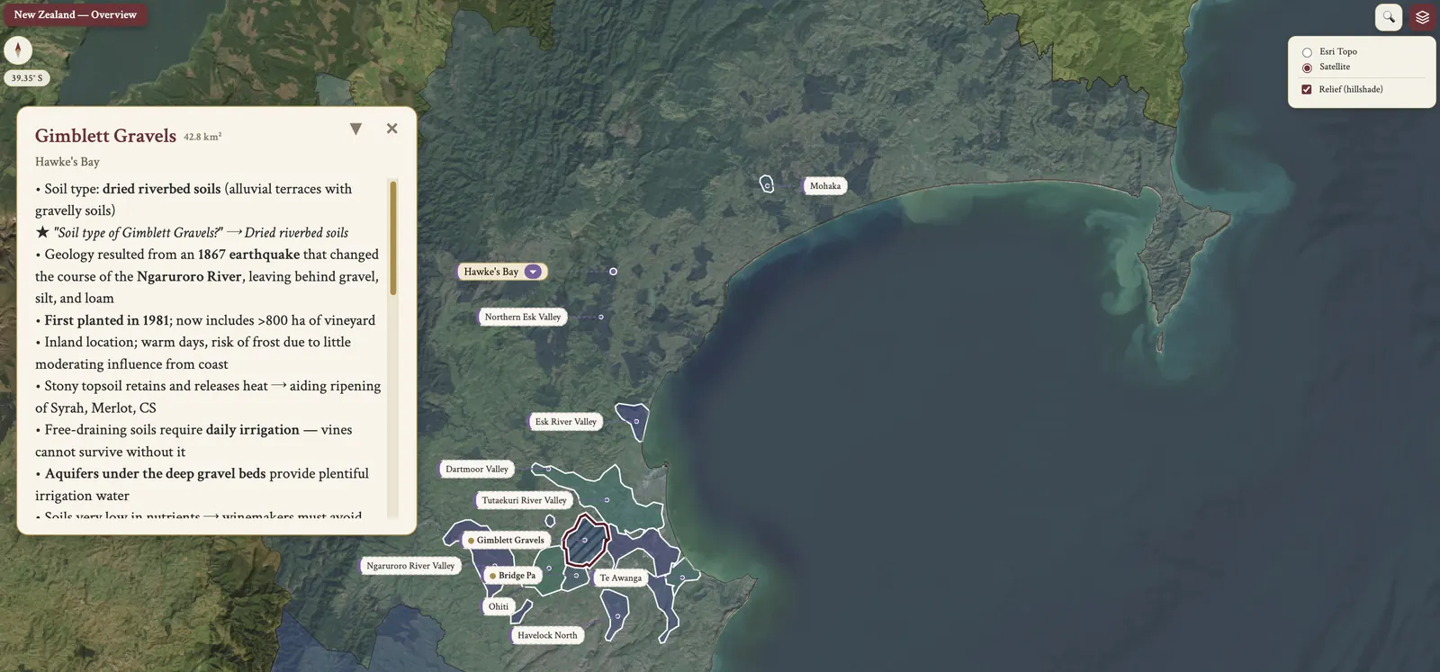
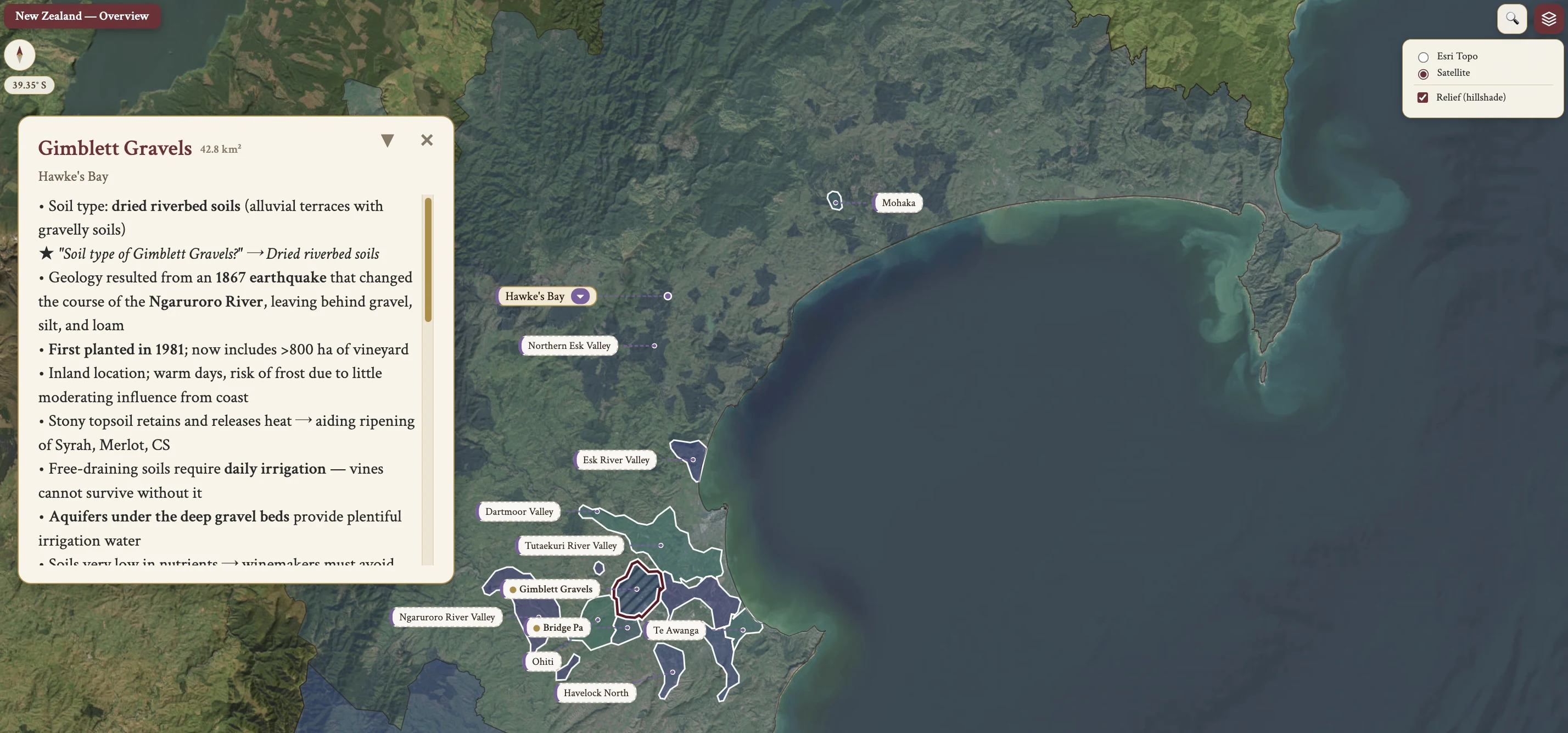
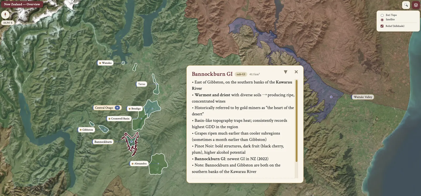
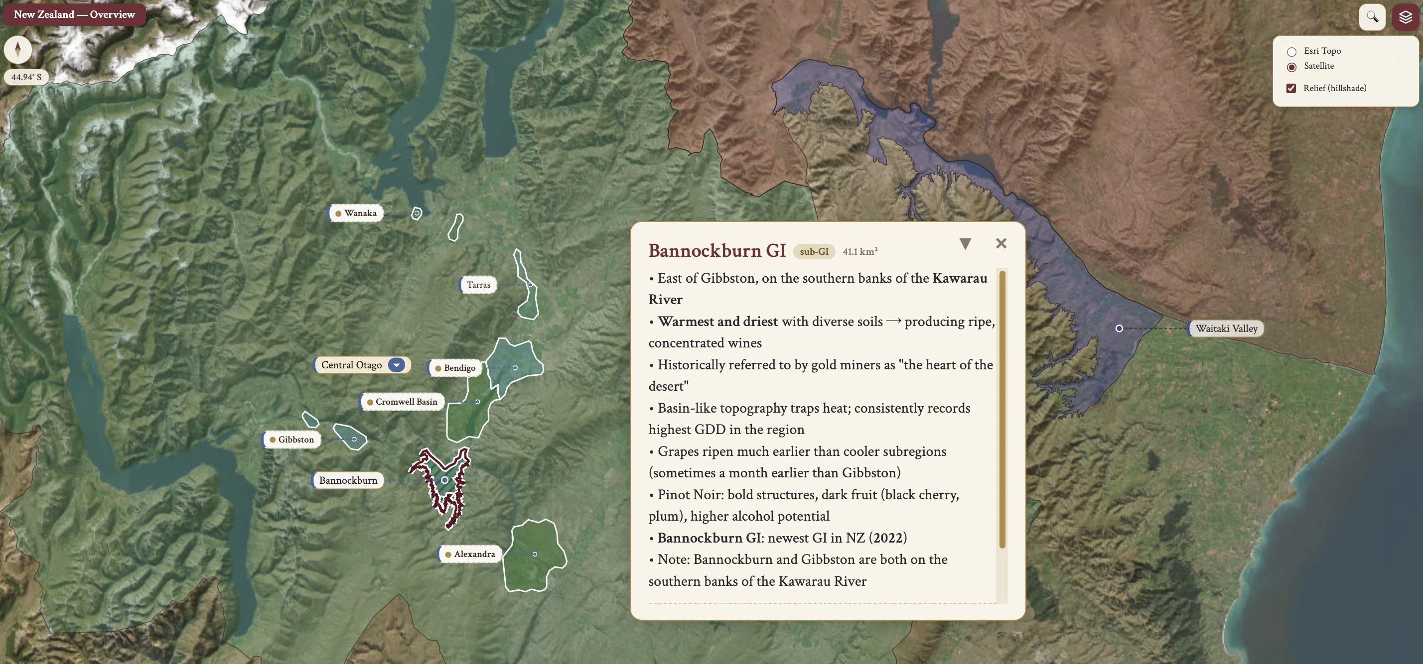
The New Zealand maps from Your Own Wine Encyclopedia — every name tag opens a study card. Below, the chapter's own geography, climate and geology notes.
From the encyclopedia
New Zealand — National Overview
New Zealand's climate is predominantly cool and maritime, and its vineyards span latitudes 36°–46°S with high sunshine hours. The country produces about 3.25 million hL/year on the 2020–2022 average, roughly 1% of world wine by volume. It is ranked 7th in value and 10th in volume globally, and it commands the highest average price per bottle of any country.
The national vineyard area grew from 5,000 ha (1981) to 41,600 ha (2022), and exports rose from 6,000 hL to nearly 2.7 million hL. Sauvignon Blanc has been the signature variety since the late 1980s, in a distinctive unoaked style envied and copied globally. The reds are high-acidity Pinot Noir and full-bodied Bordeaux blends. The 5 top GIs by volume and acreage are Marlborough, Hawke's Bay, Central Otago, Canterbury and Gisborne.
The First Vines, and Māori Wine
NZ's early history begins in 1819, when the first grapevines were planted by Samuel Marsden in Northland. In 1833 James Busby — British Resident and wine enthusiast — arrived in the Bay of Islands, which marks the real start of NZ winemaking; the first recorded NZ winemaking is 1840, from cuttings taken from France and Spain. Industry growth was inhibited by British beer and whisky culture and by a temperance movement.
The Māori, NZ's indigenous Polynesian population, were significantly reduced by European disease and conflict. Several Māori-owned wineries exist today, among them Tohu Winery, the world's first Māori-owned winery. Māori tribes are iwi, subdivided into hapū, and the sacred meeting houses are marae. Of NZ's roughly 700 wine labels, about 80 feature Māori names but only about 6 have Māori ownership or leadership. The TUKU Collective is an association of Māori-owned wine producers promoting Māori contributions to NZ wine.
Prohibition and the Dalmatian Community
In the early-1900s, at the opening of the 20th century, the wines were mostly fortified — "Port" and "Sherry". Also in the early 1900s, Dalmatian immigrants from modern-day Croatia, fleeing Austro-Hungarian rule, established a winegrowing community in west Auckland. Dalmatian family names are still prominent: Babich, Fistonich of Villa Maria, Brajkovich of Kumeu River. In 1902 Romeo Bragato was appointed NZ Government Viticulturist, tasked with studying vineyards and combating phylloxera.
In WWI the "six o'clock swill", an early pub closing hour, was instituted, and it lasted until 1967. At the 1919 national prohibition vote local residents voted in favour, but Kiwi troops in Europe voted 4-to-1 against, and the soldiers tipped the balance, saving the fledgling wine industry. NZ narrowly avoided national prohibition, and many lower-quality hybrid grapes, immune to phylloxera, were planted.
In 1960 Albany Surprise was NZ's most planted variety. The Sale of Liquor Act of 1989 permitted supermarket wine sales, and today about 60% of domestic wine is sold via supermarkets.
The Modern Industry and the Sauvignon Blanc Story
NZ's long-standing dairy industry contributed hygiene and temperature-control infrastructure to the developing wine industry. The Sauvignon Blanc story itself starts with Ross Spence, who obtained SB cuttings from the government research station Te Kauwhata and planted them in his Matua Road vineyard in Auckland in 1968, giving the first NZ commercial Sauvignon Blanc in 1974. Spence supplied cuttings to Wayne Thomas of Montana, which gave the first Marlborough SB vines in 1975, and Montana released the first commercial Marlborough SB in 1979.
In the mid-1980s the first overseas critics tasted Marlborough SB, and vibrant aromas, bold green flavours and bright acidity captured international palates. Cloudy Bay launched in 1985, founded by David Hohnen, who also founded Cape Mentelle in Margaret River.
Montana Wines, renamed Brancott Estate in 2010, is NZ's largest winemaking company; it was purchased by Pernod Ricard NZ in 2005. The Brancott Estate group of wineries takes in Brancott in Marlborough, Church Road in Hawke's Bay, Corbans, Montana Gisborne and Tamaki in Auckland, and the Pernod Ricard NZ portfolio also includes Stoneleigh in Marlborough, Mumm, Perrier Jouët and Jacob's Creek. Kim Crawford was sold to Vincor in 2003 and then to Constellation Brands in 2006, and was the first to commercially release a screwcap wine in NZ.
New Zealand Winegrowers formed in 2002, a joint initiative of the Grape Growers Council and the NZ Wine Institute, and presents a unified face for NZ wine. Sauvignon Blanc reached 64% of all plantings by 2022, the catalyst for the industry's growth.
A Maritime Climate
The climate is predominantly maritime. The exception is Central Otago, a semi-continental climate sheltered from ocean influence by the surrounding mountains — the only region with a truly continental climate in NZ.
The oceanic influence runs through the cool Pacific Ocean, which moderates the climate and prevents it from becoming too warm. Rome and Marlborough sit at the same distance from the equator, 41–42°S. The coast is never farther than 120 km away from any NZ vineyard, and 95% of vineyards are within 50 km of the sea. NZ vineyards span about 1,600 km north-to-south, from sub-tropical Northland at 35°S to alpine Central Otago at 45°S.
Marlborough's average growing season temperature is 15.2°C, closer to Burgundy's 15.1°C, and it records 1,118 GDD against Burgundy's 1,068 — despite a latitude similar to Rome.
High UV, Sunlight Hours and Diurnal Range
Three climate features here are unique. UV radiation is the first: levels can be 40% higher than at similar latitudes in the Northern Hemisphere, the reasons being the hole in the ozone layer and low air pollution levels. High UV enhances the development of colors and tannins.
Long hours of sunlight, especially in the more southerly latitudes, extend the viable ripening period. A large diurnal range is notable in the South Island wine regions and helps preserve acidity. The North Island averages more rain than the South Island, which has a rain shadow from the Southern Alps.
Isolation, Latitude and Where the Vineyards Lie
NZ's geographical isolation is best given in distances. It is located in the South Pacific Ocean, 1,900 km south-east of Australia, 5,000 km north of Antarctica and 9,000 km west of Chile, and its North Island lies on the same latitude as Tasmania.
Latitude and topography go together: the country spans 36°–46°S, which contributes to its climate variation. The South Island is mostly cool climate, while the North Island's lower latitudes lead to moderate climates, as in Auckland and Gisborne. Cook Strait divides the North and South Islands. In north–south city order the sequence is Auckland, Wellington, Christchurch and Dunedin (Central Otago).
Vineyard locations are predominantly on the east of the islands. The Southern Alps run the length of the South Island, protecting vineyards from excessive rains and from the prevailing winds off the Tasman Sea, west of NZ; rainclouds moving eastward from the Tasman Sea deposit all their moisture high in the mountains, which is the rain shadow effect. Marlborough has an average of around 650 mm of rainfall per year.
Soil
Greywacke, or greywacke sandstone, is the most abundant bedrock of New Zealand: a type of sandstone that is hard, dark in color, composed of poorly sorted angular grains of quartz, feldspar and small rock fragments embedded in a compact clay-rich matrix. Due to NZ's geological youth, vineyard soils are generally less than 10,000 years old.
Alluvial soils dominate the valley floors and terraces — gravel, stone, silt, sand. Hillside vineyards were historically rare, since alluvial soils drain well and sunlight is abundant, but they are recently growing, in the Marlborough Southern Valleys and at Waipara Omihi for Pinot Noir.
Soils vary dramatically by region. Alluvial gravels belong to Marlborough and to Hawke's Bay, in the Gimblett Gravels. Clay loams are found in the Southern Valleys of Marlborough and in the Moutere Hills of Nelson. Volcanic soils are Auckland and the Bay of Plenty. Schist is the parent rock of Central Otago, and limestone belongs to the Waitaki Valley and to Waikari in Canterbury. Marlborough's main soil is a sandy alluvial loam over gravel, with excellent drainage, limiting vine vigor. Martinborough has silt loam and loess, a cooling influence, elongating the growing season.
Dominant Varieties and Sauvignon Blanc
The dominant varieties, in the ranking by plantings of 2020, put SB far ahead of the rest, then PN, CH, PG, Merlot, Riesling, Syrah, CS and Gewürztraminer. Sauvignon Blanc represents 62% of vineyard area on 2020 data and 64% of all plantings on 2022 data.
Typical Sauvignon Blanc winemaking is a short list of choices. Low fermentation temperatures in stainless steel retain the primary fruit; cultured yeasts enhance the aromatics; MLC and oak fermentation or maturation are avoided; and it is done without any extended lees contact. Chaptalization is used in particularly cool years, and ascorbic acid and SO₂ serve as antioxidant, used to ensure freshness after bottling. The most widely planted Sauvignon Blanc clone in Marlborough is UCD-1.
Key Aroma Compounds and Thiols
The key aroma compounds in NZ Sauvignon Blanc are three. 3MH (3-mercaptohexanol) is the thiol responsible for passionfruit and gooseberry aromas, and can also read as sweaty or herbaceous. 3MHA (3-mercaptohexyl acetate) is a thiol with tropical, passionfruit character. IBMP (isobutyl methoxypyrazine) is the methoxypyrazine responsible for green, herbaceous notes. NZ examples typically display higher concentrations of 3MH, 3MHA and IBMP than Sauvignon Blanc from France, Austria and South Africa.
A University of Auckland study found thiol levels 5 to 10 times higher in machine-harvested fruit than in hand-harvested fruit, hand-picking handling the fruit more gently. The "Managing Thiols" paper from NZ Winegrowers puts it as follows: "key enzymes, such as the lipoxygenases and their substrates, are better released with greater maceration, leading to more thiol precursors in the grape juice prior to fermentation". This drives the broad use of machine harvesting for Marlborough Sauvignon Blanc.
Barrel-Fermented Sauvignon Blanc
A non-classic, barrel-fermented Sauvignon Blanc style emerged in the early 1990s with Sacred Hill "Sauvage" and Cloudy Bay "Te Koko". The best results come from hand-picking, whole-bunch pressing, and fermentation in older oak and larger formats. If MLC takes place it is only partial: Te Koko was once 100% MLC and today is typically around 10%.
Chardonnay
Chardonnay was NZ's most planted variety from 1996–2002, with Müller-Thurgau before it and SB after. The first bottled examples emerged in the 1960s, in Auckland and Hawke's Bay. New oak was introduced in the late 1970s, and barrel fermentation in French oak was first tried in the early 1980s. Kumeu River's Michael Brajkovich MW introduced MLF in 1985 and was "panned by conservative winemaker judges of the day"; Kumeu River has since been recognized as NZ's most coveted Chardonnay producer.
The North Island style is fuller in body, with tropical fruit and moderate acidity. The South Island style is tighter and fresher, citrus and nectarine. The trend is high-solids fermentation with lees aging, which gives some reductive complexity — too much of it dominates.
Diacetyl is the by-product of MLF responsible for the buttery character. Adding SO₂ too soon after MLF preserves diacetyl; delaying the SO₂ addition allows the lees to consume it, much reducing the buttery character, and the technique is now common in NZ.
Pinot Noir — Clones
NZ's Pinot Noir is planted to a number of clones. The Swiss clone 10/5, "Ten Bar Five", was imported into NZ in the early 1960s by the head of government viticulture. It can taste green unless fully ripe, it comes in two confusing versions, and older plantings still produce serious wines. The Dijon clones are 113, 114, 115, 667 and 777, and UC-Davis UCD 5 is also here. The Abel clone, or Gumboot, is covered in the Wairarapa section — the DRC origin legend, and the customs officer Malcolm Abel. It is common to find multiple clones planted in a single vineyard and blended before bottling.
Syrah — the Modern Revival
This is the story of Syrah's modern revival. Romeo Bragato, in his 1895 report, suggested that Syrah should account for as much as half of NZ's vineyard area. The variety languished most of the 20th century until the scientist and winemaker Dr. Alan Limmer took cuttings from the national viticulture center and planted them in the Gimblett Gravels in 1984. This clone is known as the MS clone, or Limmer clone, and is common in Hawke's Bay. The source of the original cuttings is speculated to be either the James Busby 1832 import or Brother Elie-Regis, a Condrieu-born Marist missionary who planted in 1839 on a slope reminiscent of Côte-Rôtie.
Alternative and Other Varieties
The alternative white varieties are two. Albariño and Grüner Veltliner together account for about 0.2% of NZ vineyard area, under 100 ha combined. Albariño's tolerance of high rainfall makes it appealing in wetter regions, notably Gisborne. Grüner Veltliner is mostly on the South Island and produces a fresh, fruity style.
Beyond these there are Pinot Noir, Chardonnay, Pinot Gris and the rest: more than 50 grape varieties are planted overall, with increasing experimentation with different winemaking techniques and styles. There is no GI-specific winemaking regulation.
Canopy Management and Training Systems
NZ vines are prone to excessive vegetative growth, for four reasons at once: high rainfall in many regions, high UV radiation, sunshine hours exceeding 2,000 hours per year, and relatively fertile soils. Canopy management is essential for high-quality fruit production. It prevents excessive vegetative growth, shading of the fruit, and reduction in yield and quality, and it reduces stalky vegetal flavors in the grapes.
VSP (Vertical Shoot Positioning) with 2 canes is the general training system in NZ. More complex trellising systems, such as 4 canes per vine in Scott-Henry, are used by some large-volume producers; they give high yields, and there can be issues with ripening in cooler years. Vines are trained with a higher fruiting zone for easier hand harvesting, and there is no need for ground-reflected solar energy given the high sunlight hours.
Yield, Irrigation and Sustainable Practices
Yield per vine can be high, given sufficient rainfall and sunshine with fertile soil, despite low planting densities of 2,000–2,500 vines/ha. Overall yield per hectare is typically quite high: 92 hL/ha in 2022. Irrigation may be necessary owing to the free-draining alluvial soils and to strong winds increasing evapotranspiration.
Sustainable Winegrowing New Zealand (SWNZ) is an independently-audited certification program covering environmental, social and economic parameters. Almost all producers, 96%, participate. It is praised for reducing the amount of pesticides used, but criticized for setting too low a bar for sustainable certification. Interest in certified organic viticulture is growing: 10% of wineries held organic certification as of 2018, with a higher percentage in Central Otago at 17% and less than 4% in Marlborough. Some producers adopt biodynamic practices as their sustainability model.
Hazards
Fungal diseases lead the hazards: high rainfall and humidity lead to fungal disease risks, especially in the North Island. Birds are a significant threat, eating grapes and damaging bunches, which leads to infections; growers use netting and bird scarers to protect the fruit, adding to production costs. Strong wind damages vines and increases the evaporation rate which, with free-draining soil, necessitates irrigation, and windbreaks of trees can reduce the winds but may exacerbate the bird problems.
Sunburn is due to the high UV levels and necessitates careful leaf positioning for shade. Unpredictable weather events, including tropical cyclones, can affect flowering, fruit set and harvest, potentially reducing yields and impacting quality. Frost is a hazard especially in the southern regions, Central Otago and Canterbury, where there is some use of helicopters to mix air.
Harvesting
Machine harvesting is common, for three reasons: the flat vineyard land; the difficulty of finding a consistently cheap source of manual labor in a sparsely populated country; and the flavor benefits, since machine picking gives some skin contact with the juice.
Marlborough Sauvignon Blanc — Vineyard and Winery
Marlborough Sauvignon Blanc production begins in the vineyard. Ripe fruit is ensured by high light levels, adequate water with irrigation as required, and careful canopy management. The high diurnal range leads to a long growing season, and with it intense aromas and high acidity. Row orientation and canopy management are set to produce the desired aromas: the sunny side for tropical flavors, the shadier side for green pepper and grassy, herbaceous aromas. For higher levels of herbaceous aroma the picking is slightly early. Mechanical harvest creates some skin contact with the juice.
In the winery, refrigerating the fruit preserves the primary fruit characters and reduces oxygen contact. Selected yeast gives aromatic intensity, low fermentation temperatures in stainless steel retain the primary fruit, and the avoidance of MLC retains the primary fruit as well. Minimal aging on lees follows, 2–3 months in stainless steel vessels. Ascorbic acid and SO₂ are used at bottling to retain freshness, and bottling is under screwcap for freshness.
Experimental Winemaking — White
Experimental white winemaking runs in a few directions. For SB there is increasing use of barrel fermentation, lees stirring, partial or full MLC, and oak maturation. Experimentation with skin contact for white grapes leaves a small percentage of production up to two months to add texture and aroma. For other white grapes, especially small volume or premium ones, the tools are a high level of solids in fermentation, ambient yeast strains, skin contact and oak aging.
Red and Sweet Wine Production
High-volume red wines are made with mid-range fermentation temperatures, cultured yeasts and neutral vessels, giving fresh, fruity styles.
Premium wines are where the technique varies. Whole bunch fermentation is being experimented with in varying proportion for Pinot Noir and Syrah, and adds herbal or floral notes. Cold maceration is commonplace, especially for Pinot Noir, and extracts more color and aromas. Extraction techniques are varied depending on grape variety and desired style. Maturation is in French oak barriques for full-bodied CS and Merlot, while larger oak vessels are increasingly used for Pinot Noir.
Sweet wines are made in a full range of sweetness levels, dry to sweet. Noble rot is used for premium Sémillon and Riesling, and some producers use long hang times in the vineyard. Fermentation may stop naturally or be halted by winemakers, with SO₂ and filtration.
Screwcaps and Bulk Shipping
Screwcap usage covers 90% of production. Screwcaps were initially adopted owing to high TCA levels in cork, the incidence of premature oxidation, and bottle variation. The New Zealand Screwcap Wine Seal Initiative was founded in 2001, and Kim Crawford was first to commercially release a screwcap wine. Consumer acceptance of screwcaps, even for premium wines, is well established in NZ and in key export markets like the UK.
Approximately 40% by volume of all exports is shipped in bulk. That bulk shipping is due to the rapid increase in production, a 500% increase between 2000 and 2019.
On the map
- North Island — Overview
- South Island — Overview
- Northland
- Auckland
- Matakana
- Kumeu
- Waiheke Island
- Gisborne
- Hawke’s Bay
- Central Hawke’s Bay
- Wairarapa
- Martinborough
- Gladstone
- Nelson
- Marlborough
- Canterbury
- North Canterbury
- Waipara Valley
- Waitaki Valley (North Otago)
- Central Otago
- Bannockburn