South Africa — Wine Region Guide
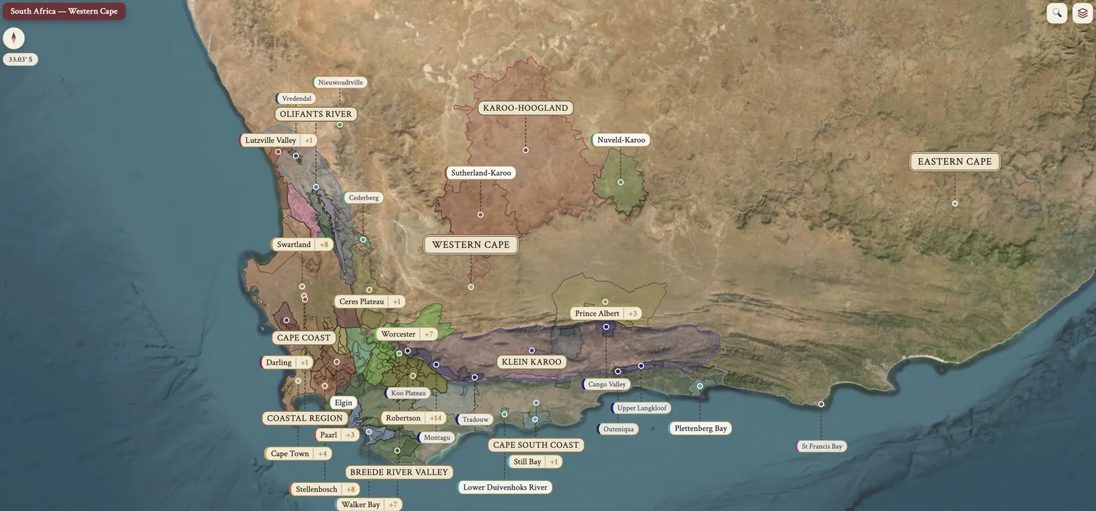
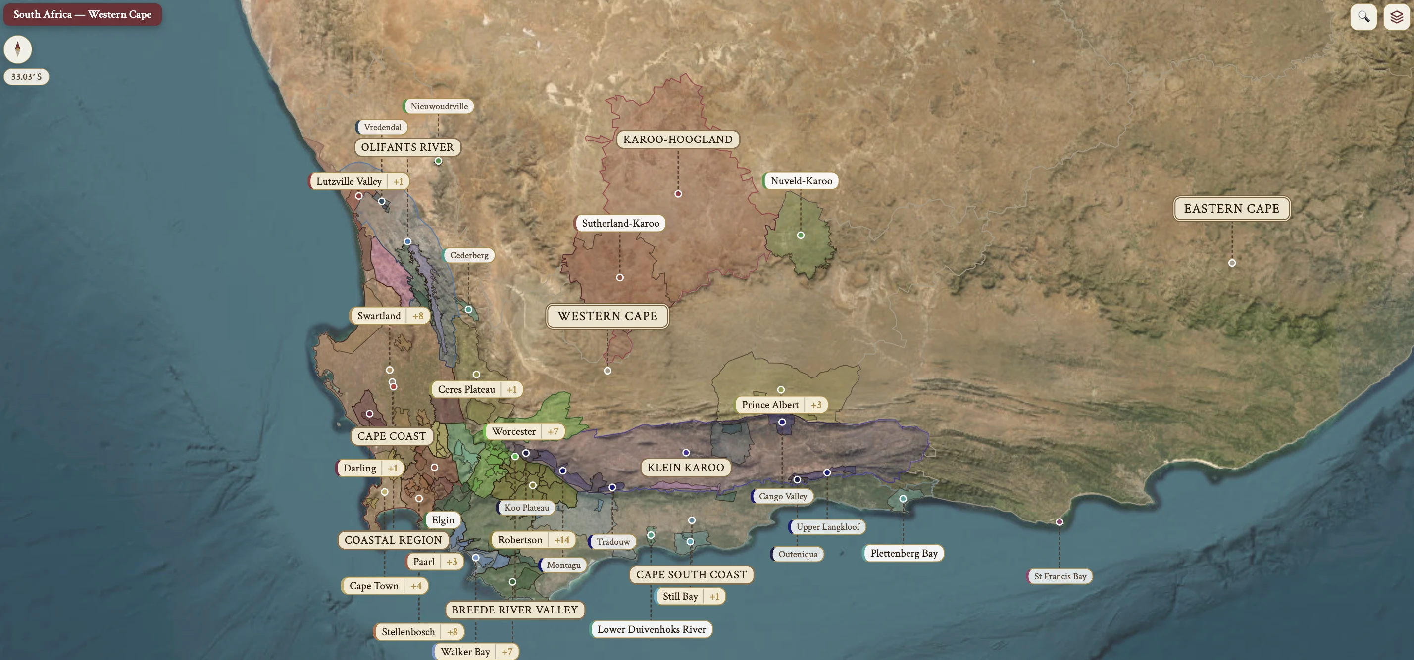
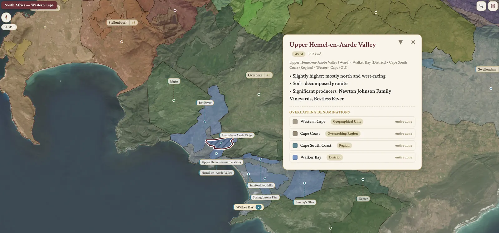
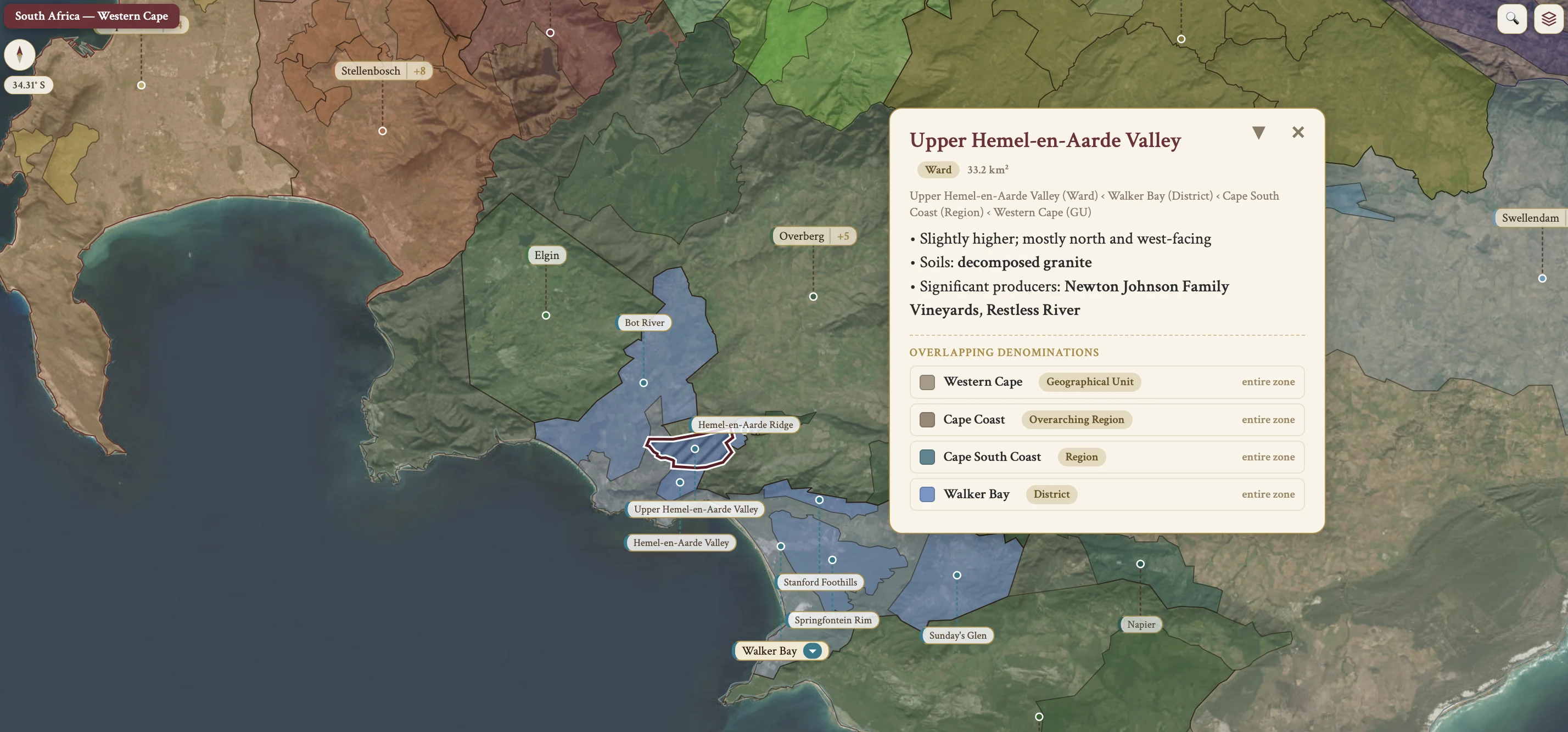
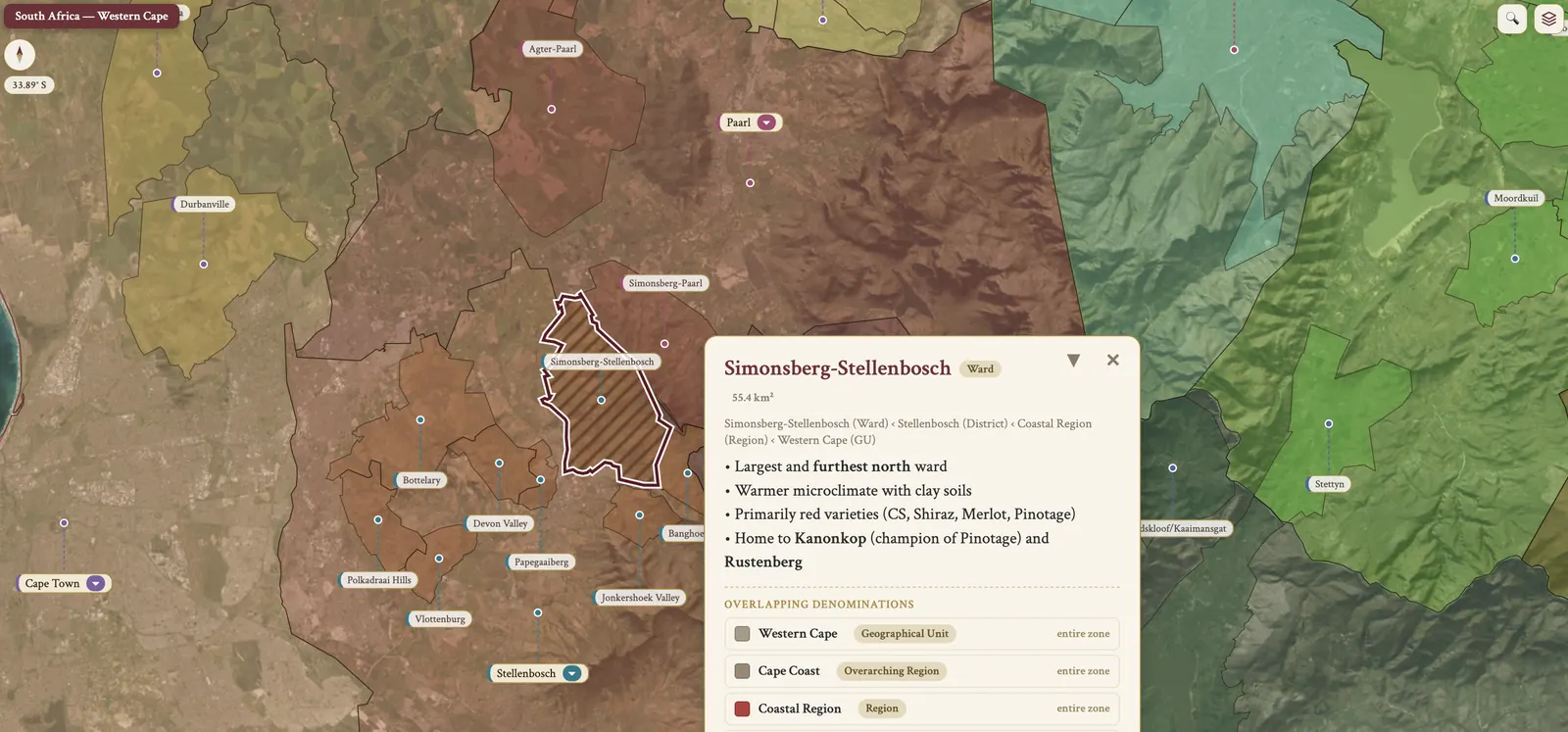
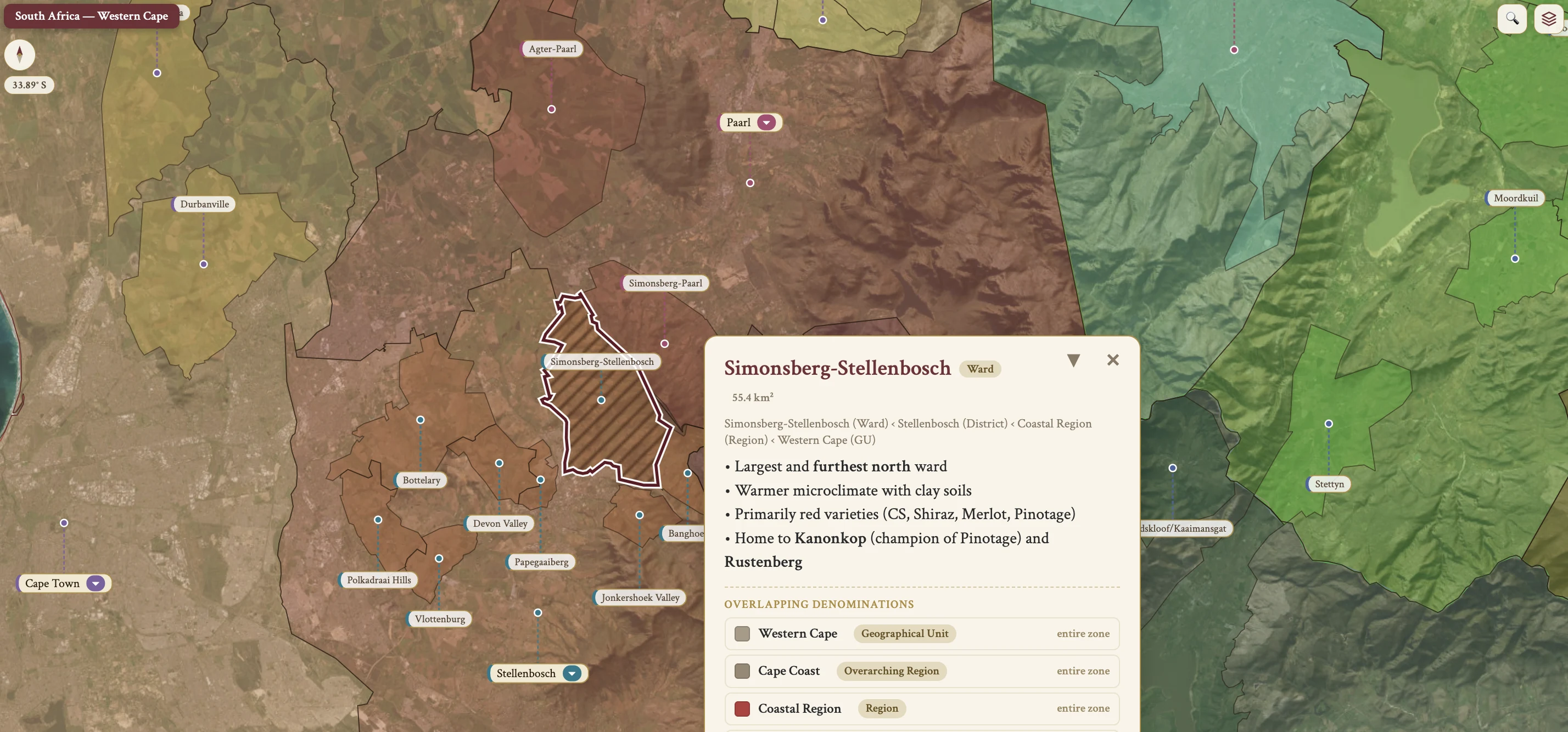
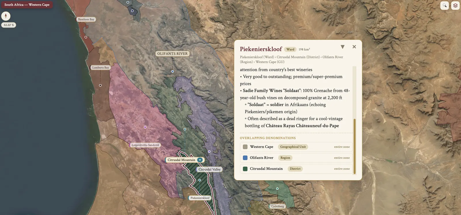
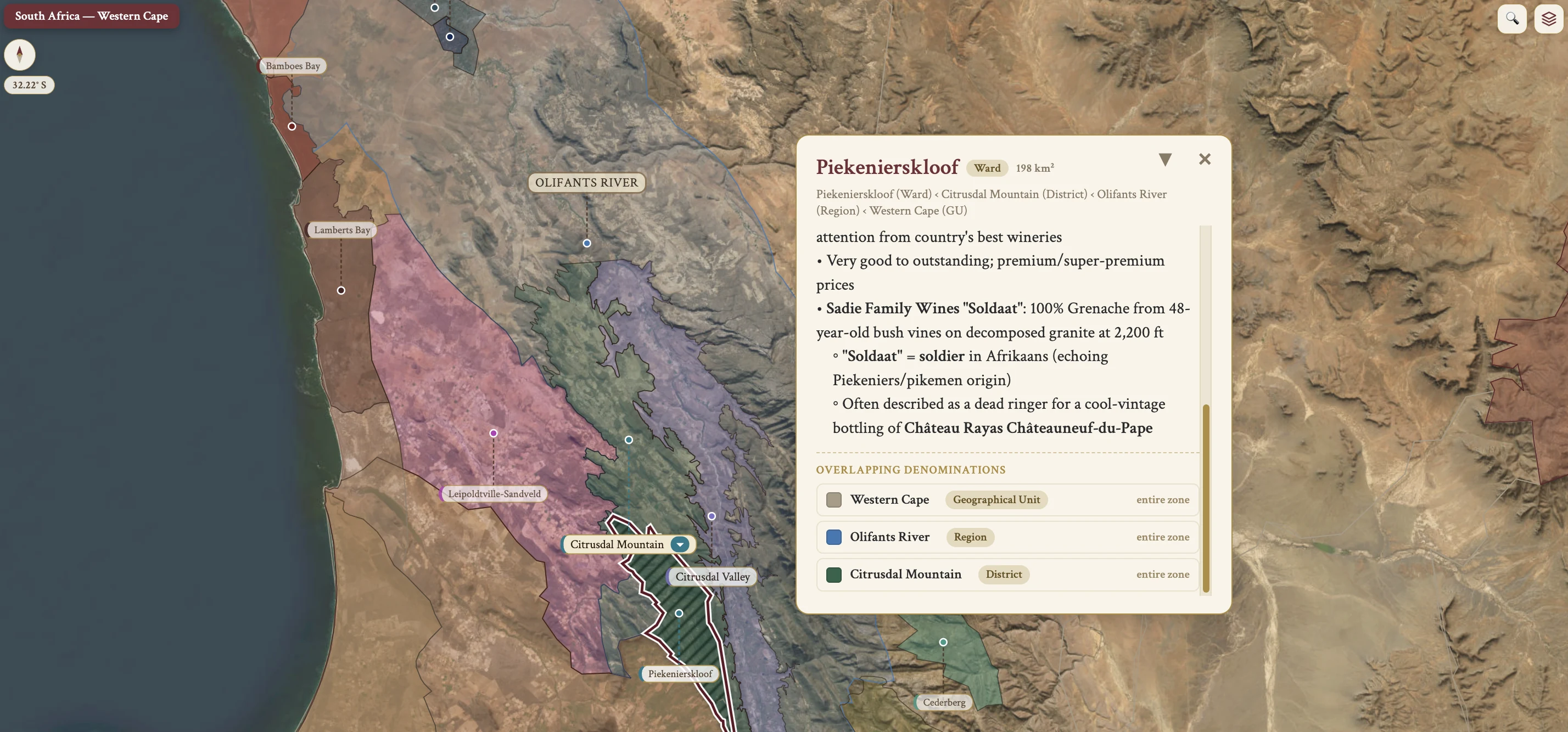
The South Africa maps from Your Own Wine Encyclopedia — every name tag opens a study card. Below, the chapter's own geography, climate and geology notes.
From the encyclopedia
National Overview
South Africa's wine country lies in a warm Mediterranean climate in the Western Cape, with vineyards between latitudes 32°-35°S. The country stands 9th in global wine production, at about 825 million L in 2018, and 15th in vineyard area at roughly 93,000 ha. Wine production is concentrated in the Western Cape GU, one of a total of 7 Geographical Units alongside the Northern Cape, Eastern Cape, Limpopo, North West, Free State and KwaZulu-Natal.
The industry carries a dual identity: high-volume bulk wines still dominate the national reputation, while a premium tier grows beside them. The "Big Six" varieties frame most of what is planted — the whites are Chenin Blanc, Sauvignon Blanc and Chardonnay, the reds Cabernet Sauvignon, Shiraz and Pinotage. Pinotage is the unique SA crossing, Pinot Noir × Cinsaut, bred in 1925 by Prof. Abraham Perold at Stellenbosch, and it celebrated its 100th anniversary in 2025. The quality wave dates from the end of apartheid in 1994, when international markets reopened, foreign investment arrived and a new generation of winemakers came through.
History — the Cape, Constantia and Phylloxera
Europeans settled the Cape in 1652 under Jan van Riebeeck of the Dutch East India Company, and the first vineyards were planted at the Cape in 1655 under Jan van Riebeeck and the Dutch East India Company. The first grape crush followed in 1659. In 1685 Governor Simon van der Stel founded the Constantia estate, and in the late 1680s and early 1690s the Huguenots arrived in South Africa. Upon van der Stel's death in 1712 Constantia was divided into 3 parts — Groot Constantia, Klein Constantia and Bergvliet — a division formalized in 1778.
The years that followed swung twice. In 1813 the British lowered export taxes on South African wines, inspiring a boost in production, and in 1834 South Africa abolished slavery. In 1861 the British abolished preferential tariffs and SA wine collapsed competitively against the French, compounded by heavy SO₂ and poor brandy fortification plus costly ocean transit. From the 1870s the railway system extended inland, allowing interior wine regions to be developed. In 1885 the state purchased Groot Constantia and phylloxera appeared on the property, ravaging its famous vineyards; Phylloxera was discovered in South Africa in 1886.
History — KWV, Apartheid and the Quality Wave
The conclusion of the Boer War in 1902 resulted in the unification of South Africa. In 1918 the KWV was established — the Ko-operatieve Wijnbouwers Vereniging van Zuid-Afrika — and the Wine and Spirits Control Act of 1924 formalized its regulatory powers: it fixed minimum prices, determined production areas and established production limits. In 1948 the National Party came to power and instituted apartheid, and from the 1960s other countries began boycotting South African goods in protest of apartheid.
The Wine of Origin (WO) scheme was established in 1973. The late 1970s mark the beginning of the quality wave: the first Cape Bordeaux blend was released and the coastal regions were developed. Platter's South African Wine Guide debuted in 1980 and the Cape Winemakers Guild was established in 1982. The KWV eliminated the quota system in 1992, apartheid ended in 1994, and the KWV became a private company in 1997.
In the late 1990s international export ramped up. SAWIT, the South African Wine Industry Trust, was established in 1999 to speed transformation and empower black workers. In the 2000s coastal development expanded and rapid improvements were made in viticulture and vinification, and in 2002 Rose Kruger started the old vine registry.
Climate — the Mediterranean Cape
In general terms the vineyards are situated between 32°-35°S, similar to California and Israel in the Northern Hemisphere. The classification is a warm Mediterranean climate in the Western Cape, though that generalization is dangerous. Summers are long and dry, with rain generally confined to the winter months. Winters are warm, and the lack of a consistent winter freeze can lead to failure of winter dormancy.
Water is the constraint. The 2017-2018 water crisis brought a severe shortage that led Cape Town to plan for "Day Zero", with dams falling below 13.5% capacity; it was narrowly avoided through restrictions and the 2018 summer rains.
Oceanic Cooling and the Cape Doctor
Oceanic cooling sets the frame. Most grape-growing areas are cooled by the ocean, which allows cultivation of both cool-climate and heat-loving varieties — Pinot Noir at one end, Shiraz and Tinta Barocca at the other. The Benguela Current is a cold north-flowing current along the western coast, and it mingles with the warmer Agulhas Current from the Indian Ocean. That mingling lowers water temperatures between Cape Town and Cape Agulhas. The large temperature difference between ocean and land causes regular beneficial coastal fog and cooling breezes.
The Cape Doctor is a south-easterly wind that blows during spring and summer. Its positive effects are to extend the cooling impact of the Benguela Current, to inhibit disease and to bring occasional rain to the South Coast. Its negative effects are damage to leaves, which affects photosynthesis and ripeness, and severe interference with flowering and berry set, reducing yields.
Rainfall and Irrigation
Rain falls mainly between May and August. In normal years the rainfall is adequate — >700 mm/year in Stellenbosch, for example. Rainfall is reduced in the northern Western Cape due to decreased Benguela Current impact and mountain protection.
Irrigation is essential in the drier areas, and recent prolonged droughts have made water availability a leading priority. Many vineyards have drip irrigation installed. Access to water remains an issue, particularly in dry-farmed areas such as Swartland.
Topography & Geography
The major winegrowing areas bracket the conjunction point of the Atlantic and Indian Oceans. A braid of mountains traces the coastline, forming an L-shape that carves the country into climatic zones, and vineyard elevations range from 50 to 600 m.
The Western Cape's many mountain ranges, slopes and aspects create a range of climates. The Drakenstein Mountain Range includes the Groot Drakenstein and Klein Drakenstein Mountains and is part of the Cape Fold Belt in the Western Cape; it creates the rain shadow that runs from Paarl to Franschhoek.
Three coastal bays mark the shore, west to east: Table Bay, False Bay and Walker Bay.
Soil — Bedrock and Main Soil Types
The geological background is a quiet one. SA's soils are relatively simple and very old, geologically stable for millennia, with no glacial or volcanic activity and very few earthquakes. Most mountains are granite capped by sandstone, and those bedrocks decomposed to form the basis of the soils. Quartz is scattered throughout nearly all the major winegrowing regions, with pockets of slate and shale.
The main soil types are derived from that bedrock. Table Mountain Sandstone–derived soils are sandy, with low nutrient and low water-retention, and require careful irrigation and fertilization. Granite-derived soils are found on foothill slopes and hilly areas and have good water-retention, which gives the potential for dry farming. Shale-derived soils have good nutrient levels and good water-retention, and are suitable for dry farming.
Soil — Cape Acidity and Koffieklip
Most Cape soils are excessively acidic. That acidity requires heavy lime adjustments to achieve a suitable pH for vine growing, and proper pH is crucial for nutrient availability and for maintaining yields.
Koffieklip — coffee stone, or dorbank — is an iron-rich ferricrete soil, a hardened ironstone gravel with clay and sandy elements. It is reddish-brown in color, drains well and retains heat, which extends ripening. It is found primarily in Cape Agulhas (Elim), and also in Stellenbosch and Swartland. Mullineux sources its "Iron" Syrah from the iron-rich koffieklip soils west of Malmesbury, in Swartland.
Soil — Regional Notes
Stellenbosch has alluvial loam over shale on the valley floors, with granite and sandstone on the hillsides. Franschhoek Valley is sandstone and shale, and Paarl is sandstone, granite and weathered shale. Darling is weathered granite with higher water-holding capacity. Swartland is diverse but mainly low fertility granite and shale, especially around Paardeberg. Constantia has low vigour granite — decomposed granite, with tectonic movement — above a sandstone layer, and Durbanville has shale soils with high water-holding capacity.
Robertson is notable for its limestone soils, unusual in South Africa. The Hemel-en-Aarde Valley has shale-based clay soils, up to 55% clay, similar to Burgundy; the Upper Hemel-en-Aarde Valley has decomposed granite soils; and the Hemel-en-Aarde Ridge has shale-based clay soils at 400m elevation.
Grape Varieties — Plantings and Historical Context
By plantings in 2021 the top varieties run CB, Colombard, CS, SB, Shiraz, Pinotage, CH and Merlot. These 8 varieties account for more than 80% of all plantings. The "Big Six" splits three and three: the white trio is Chenin Blanc, Sauvignon Blanc and Chardonnay, the red trio Cabernet Sauvignon, Shiraz and Pinotage. Colombard is typically used for blends or for brandy and distillation, and so is not part of the "Big Six".
The historical context begins elsewhere. Semillon took the early lead and held a near monopoly in the 1800s; the 1909 census still showed 40% of plantings. The phylloxera replant after 1886 opened an opportunity to diversify, and Palomino, Chenin Blanc and Muscat filled the void. Cinsaut, historically called Hermitage, was the dominant red of SA's past: introduced in the 1880s, it was by 1909 the third most widely planted variety. Chenin Blanc later supplanted Semillon as the most planted variety, and Chenin Blanc and Steen were officially recognized as the same variety only in 1963.
The first varietal Sauvignon Blanc was bottled in 1977, the first Cape Bordeaux blend debuted in 1979 from Hofmeyr, and the first Sauvignon Blanc/Semillon blend came in 2001. In 1993 SA was still planted to 81% whites. By 2018 white grapes were 55.3% of vine land, but nearly twice as many white grapes were crushed owing to higher yields — 792,837 t white against 403,239 t red.
White Varieties — Chenin Blanc, Colombard and Sauvignon Blanc
Chenin Blanc, also known as Steen, is the most widely planted white, at 17,242 ha in 2018 (18.5%), over 16,000 ha overall. Plantings are double that of the Loire Valley, and the growing environment and vinification are comparable to the Loire region — Savennières, Vouvray. In 2018 there were 242 ha of new plantings, a counter-trend favoring CB. The semi-sweet Chenin-based wine Lieberstein debuted in 1959 and became enormously popular domestically, the style enabled by refrigerated tanks. Old vine CB is head-trained and dry-farmed, mostly in the hotter interior regions, and premium examples are often aged or fermented in oak, partly new, with lees aging, bâtonnage and MLF for texture.
Colombard stands at 10,821 ha in 2018 (11.6%). It is neutral, with medium to medium(+) acidity, and with CB it was historically the basis of SA brandy. Unlike CB, nobody is bothering to replant Colombard, and old vine Colombard is rarely championed.
Sauvignon Blanc covers 9,533 ha in 2018 (10.3%) and is the most rapidly expanding variety. About a third is located in Stellenbosch, positioned as the white foil to high-end CS, à la Napa Valley, and it is the most widely planted variety in cool Constantia, where it is often blended with Semillon. The national style favors the green/grassy side and is rarely tropical.
White Varieties — Chardonnay, Semillon, Muscat and Riesling
Chardonnay covers 6,661 ha in 2018 (7.2%). It was especially virus-laden in the 1970s and '80s, which motivated smuggling. In the smuggling story, Peter Finlayson and Danie de Wet in the late 1970s had dormant branches sent Switzerland to Swaziland and on into SA in a logging truck bed; a few Auxerrois cuttings were included accidentally, a KWV inquiry followed in 1986, and quarantine policies were relaxed. Today Chardonnay is the MCC backbone, and it gives terroir-driven still wines from Hemel-en-Aarde, Elim and Elgin, and from Robertson limestone at De Wetshof.
Semillon is down to 1,064 ha in 2018 (1.1%). It was historically known as Greengrape, spelled without an accent in SA. Most remaining Semillon is now confined to the coast, with small patches of old vines in Franschhoek and Stellenbosch. Semillon Gris is an unusual red mutation of Semillon; the French had it once but culled it, and SA producers now receive requests for cuttings, per Eben Sadie.
The Muscat family was among the Cape's original vinifera plantings and one of the grapes used in the original Constantia. Hanepoot is Muscat of Alexandria, 1,665 ha in 2018 (1.8%); when it is fortified prior to fermentation it becomes the vin de liqueur Jerepigo. Muscadel is Muscat Blanc à Petits Grains, 825 ha (0.9%), and it is unrelated to the Bordelais Muscadelle.
Riesling carries a labelling distinction. Weisser Riesling, that is Rhine Riesling, is the true Riesling grape, while Cape Riesling is Crouchen Blanc and is not true Riesling. The distinction has been enforced since the 2010 wine labeling update: only wines from true Riesling may be labeled "Riesling" or "Weisser/Rhine Riesling", and wines made from Crouchen Blanc must be labeled "Cape Riesling" or "Crouchen". Other whites account for 3,594 ha (3.8%) and include Cape Riesling, which is Crouchen Blanc, along with Gewürztraminer and Viognier.
Red Varieties — Cabernet Sauvignon and Shiraz
Among the reds, Cabernet Sauvignon covers 10,233 ha in 2018 (11%). It was first documented in 1894 and played a minor role until the independent producer movement of the 1960s-'70s. The best-known wines come from Paarl, Franschhoek and Stellenbosch, with Stellenbosch especially Napa-like. The style is restrained by contemporary standards, and the Wine Commission tasting panel treats "over-oaked" as a flaw. A weak Rand drives up barrel prices.
Shiraz covers 9,497 ha in 2018 (10.2%). It was first planted in Groot Constantia in the 1890s. Popularity spiked in the Aussie-crazed 1990s, and most producers label the wine as Shiraz; the more restrained, Rhône-leaning producers often label it as Syrah.
Pinotage — Origin and Adoption
Pinotage covers 6,791 ha in 2018 (7.3%). Its origin lies in a single act of breeding: it was bred in 1925 by Dr. Abraham Izak Perold at the University of Stellenbosch, a crossing of Pinot Noir × Cinsaut — Cinsaut being historically known as Hermitage in SA. Perold swabbed pollen from Pinot Noir onto a Cinsaut flower, the idea being to marry the refined Pinot Noir with the workhorse Cinsaut. The plants were nearly forgotten when Perold changed jobs and were rediscovered later. The first experimental batches came in 1941, and the variety celebrated its 100th anniversary in 2025.
Commercial adoption came through Stellenbosch. The earliest commercial adopters were Kanonkop and Bellevue in Stellenbosch, and in the 1960s the domestic press encouraged a planting rush. The British media were hostile early on, likening the wine to "rusty nails" or "paint thinner".
Pinotage — Vine Character, Off-Aromas and Modern Style
The vine buds early and is moderately susceptible to fungal diseases. Small berries with high sugar levels give potentially high alcohol with deep color.
Two off-aromas dog the variety. Isoamyl acetate — paint-thinner, nail polish, acetone — develops when the grape is heat stressed during ripening, water stressed, or fermented at higher temperatures, and it is sometimes exacerbated by high ethyl acetate, that is volatile acidity. A burnt rubber smell is thought to be related to viral disease in the vineyards, though the research is ongoing and the causes unclear.
Aggressive extraction and high pH historically yielded toothsome tannins and a risk of microbial spoilage. Modern champions plant in cooler microclimates with lower yields and handle the fruit gently, which coaxes out the Pinot Noir side, and the problem is mitigated by cooler fermentation, canopy management for shade and careful yeast selection. Whole-cluster Pinotage examples now exist, made for light chilling. The coffee style owes its aroma to the compound furfurylthiol, formed from furfural released by toasted staves during fermentation. Cape Blends, a well-established term that is NOT legally regulated, take Pinotage as the major blending variety.
Red Varieties — Cinsaut, Pinot Noir and Other Reds
Cinsaut, also spelled Cinsault, stands at 1,713 ha in 2018 (1.8%). In SA it is not uncommon to see Cinsaut bottled as jelly or consumed as table grapes. New plantings are rare, so the vines are mostly of ancient form — gnarly, dry-farmed, head-trained — and the variety is enjoying a surge in popularity with new-wave producers.
Pinot Noir covers 1,176 ha in 2018 (1.3%). Historically only a single clone was available, the Swiss sparkling clone BK5, and most of it was planted historically in service of MCC production. The rise of high-quality still PN comes from Hemel-en-Aarde and Elgin, inspired by Peter Finlayson at Hamilton Russell in the 1980s-'90s.
Other reds account for 12,207 ha (13.2%) and include Merlot, Cabernet Franc, Tinta Barocca, which has an avid following, and Pontac, a teinturier whose red flesh and juice come from anthocyanin pigments and which is historically linked to the old red wines of Constantia. Eben Sadie experiments with Mediterranean varieties, with selections from Greece, Italy, Portugal, S. France and Spain. The SA crossings are Ruby Cabernet, which is Carignan × Cabernet Sauvignon, and Roobernet, which is Cabernet Sauvignon × Pontac.
Viticulture
Planting density is typically low, with larger vines carrying more fruit, though some high-quality growers use closer spacing to enhance grape quality.
The diseases divide into viral and fungal. The viral pair is leafroll and fanleaf; leafroll is the most present viral disease in South Africa, and the vector for the leafroll virus is the mealybug. They reduce yield and increase replanting costs for badly affected vineyards, and are tackled by planting virus-tested vines, which adds cost. The fungal problem is powdery mildew, common and controlled by systemic fungicides or organic methods.
Training and pruning follow a few patterns. Cordon with VSP — Vertical Shoot Positioning — is common, with the fruiting wire at 0.75 m for ease of pruning. Short spur pruning is common and often mechanized to save costs. In Swartland the traditional treatment for old vines in dry conditions is spur pruning and goblet, that is bush vines.
Yields are influenced by irrigation, vine spacing and the age of the vines: average yields for Chenin Blanc are significantly higher in Olifants River than in Swartland due to irrigation.
Hazards & Harvesting
The hazards run to a short list. Spring frost is an occasional problem, particularly in the Breedekloof ward. Drought is the major ongoing concern, with recent prolonged droughts. The viral diseases are leafroll and fanleaf, whose vector is the mealybug, and the fungal disease is powdery mildew. The Cape Doctor wind damages leaves and reduces flowering and berry set.
Harvesting is mainly hand harvest, thanks to good labor availability, though some choose mechanical harvest.
Old Vine Project (OVP) — Origins and the Heritage Seal
The origins are recent. In 2002 the viticulturist Rosa Kruger began compiling a list of old vine vineyards, and in 2014 SAWIS gave her its vineyard registry dating back to 1900, at which point the OVP was formally established. Members associated with the project include Rosa Kruger and Eben Sadie. The mission is to preserve old vineyards, promote sustainable farming and showcase wines from old vines; the goal is to raise awareness and raise prices, to incentivize growers to keep these vines.
The Certified Heritage Vineyard seal was released in 2018 by OVP members. The minimum vine age for the seal is 35 years, the seal includes the planted year of the vine, and records are maintained by SAWIS.
Certified Heritage Vineyards — Hectares, Varieties and Oldest Vines
The hectares by WO district run as follows. The largest Certified Heritage Vineyards are Stellenbosch at 857.17 ha, Swartland at 708.95 ha and Paarl at 457.79 ha, for a total of about 3,693 ha. The largest holdings of old vines per OVP records are Stellenbosch 1,111 ha, Swartland 928 ha and Paarl 587 ha, while the smallest are Swellendam 10 ha, Elgin 11 ha and Citrusdal Valley 14 ha.
Over half of SA's vines older than 35 years are Chenin Blanc. By variety the old vine plantings run Chenin Blanc 2,475 ha, of which 2,074.49 ha are CHV; Colombard 530 ha; Sauvignon Blanc 459 ha; Muscat d'Alexandrie 217.51 ha CHV; Pinotage 147.26 ha CHV; and Cinsault 132.46 ha CHV.
Vineyard turnover in 2018 shows the pressure. 3,858 ha were pulled out, mostly CB 806 ha and Colombard 790 ha, while only about 1,500 ha were planted — SB 337, CB 242, Colombard 177, CS 151 and CH 143.
The oldest documented vines are Chenin Blanc planted in 1942 in Stellenbosch — the Sadie Family's "Mev. Kirsten" is sourced from SA's oldest documented vineyard, planted between 1905-1920 in Jonkershoek Valley — and Pinotage planted in 1950 in Stellenbosch.
Winemaking — Chenin Blanc
High volume inexpensive Chenin Blanc is grown at high yields, sprayed regularly to avoid all botrytis, and given minimal sorting. It may be blended with up to 15% of a less valuable variety such as Colombard, and acidification is normal practice. There is no MLC, which preserves natural acidity; cultured yeast is used, and fermentation is cool, in stainless steel or concrete. The wine is rested in stainless steel or old oak for a few months, and oak flavor may be added via chips or staves. Residual sugar is adjusted using concentrated grape must to 5+ g/L. The wine is stabilized, fined and filtered for early release, and is often transported in bulk and bottled in the final market.
Small volume premium Chenin Blanc is grown at low yields, often on old, dryland vines; a small amount of botrytis may be allowed, and sorting is careful. The wine is 100% Chenin Blanc and acidification is typically avoided. Ambient or cultured yeast is used, with cool fermentation in inert vessels — larger format, older barrels — and there is increasing use of 'eggs' and amphora. Lees aging runs 3-9 months in stainless steel or concrete, or 10-12 months in old oak, eggs or amphora. For the oaked style, French oak barrels are used for 10-12 months with variable new oak, and bâtonnage is applied if a richer style is desired. The wine is bottled without sugar adjustment (1.5-6 g/L), lightly fined and filtered, and bottled in South Africa.
In general character Chenin Blanc is medium to pronounced in intensity, with ripe yellow apple or peach and tropical fruit notes, and may include vanilla and toast from oak. Acidity is high, alcohol medium, body medium. DeMorgenzon and Ken Forrester, "Mr. Chenin Blanc", are significant producers.
Winemaking — Pinotage and Premium Red Wines
High volume Pinotage is made at high yields with minimal sorting. Premium Pinotage is made at low yields with careful sorting and optional cold soaking for color extraction. Both see pumping over and punching down at the start of fermentation.
The traditional fuller-bodied style is deep ruby, with red plum and blackberry, high tannins, full body and high alcohol, and is macerated on skins 3-5 days post-fermentation. The lighter, more elegant style comes from cooler sites and fruit picked at lower ripeness, giving medium ruby, red fruit and medium tannins, and is typically not macerated post-fermentation.
Inexpensive Pinotage is aged in stainless steel or used barrels, or with oak alternatives, and released 6-12 months after the vintage. Premium Pinotage is aged 12-15 months in French oak barriques, often >50% new, and released two years after the vintage, with an increasing trend to reduce new oak.
Premium red wine production more broadly uses cold maceration and varied extraction with French oak maturation, and whole bunch fermentation for some premium Syrah.
Wine Styles & Blends — Varietal Wines, Main Blends and MCC
Varietal wines and blends sit side by side: both single variety wines and blends are made from the "Big Six" across all regions.
The main blends run as follows. White Cape Blends are typically Chenin Blanc-dominant and may include white Rhône varieties, Chardonnay, Sémillon or Sauvignon Blanc. Red Cape Blends are a broad category for blends with a significant proportion of Pinotage and/or black Rhône varieties. Red Bordeaux Blends are predominantly CS and Merlot, and there are some white Bordeaux blends.
Méthode Cap Classique is traditional method sparkling wine, rebranded as Cap Classique. It is made principally from Chardonnay, Pinot Noir, Chenin Blanc and Pinotage. Simonsig Wine Estate, in Stellenbosch, made the first traditional method sparkler in 1968, released in 1971, and the CCPA, the Cap Classique Producers Association, was founded in 1992. For full coverage — categories, growing environment, winemaking, dosage scale, law and business — see the dedicated MCC & Other Sparkling Wine chapter.
The Cape Blend has a rule of its own. The historical rule is that it contains 30%-70% Pinotage to qualify; from the 2019 vintage Pinotage must also be the major component, the single largest variety of the blend. The term is also used occasionally for Chenin Blanc-driven white blends.
Botrytis Sweet Wines and Fortified Wines
Botrytis-affected sweet wines are notable in Elgin and other cooler high-rainfall districts. Nederburg pioneered SA's first botrytised dessert wine, "Edelkeur", showcased at the inaugural Nederburg Auction in 1975. For "Edelkeur" terminology, see the SA Wine Glossary.
The fortified wines are Cape Port and Cape Sherry, the local Port- and Sherry-style fortifieds. Manufacture of Port-style fortified wines is traced to the early 19th century, the first SA vineyards having been planted in 1659. Production is centred in the Calitzdorp district of the Klein Karoo; see the Klein Karoo chapter for regional detail. Mainly Portuguese red varieties are used, Tinta Barocca and Touriga Nacional, with Shiraz and Pinotage sometimes used. Cape Sherry is SA's Sherry-style fortified counterpart. CAPPA, the Cape Port Producers' Association, established in the early 1990s, sets the label classifications. For the full CAPPA categories — Cape White, Pink, Ruby, Tawny, LBV, Vintage and Vintage Reserve — and the production methods, see Marsala & Other Fortified Wines — South Africa.
Vin de Constance and Jerepigo
Vin de Constance is the most famous sweet wine in SA. It is made from Muscat Blanc à Petits Grains, that is Muscat de Frontignan, or Muscadel. Klein Constantia revived the virtually extinct style with new Muscat de Frontignan plantings in the 1980s. Groot Constantia makes Grand Constance from Muscat Blanc à Petits Grains AND Muscat Rouge à Petits Grains, both varieties being used. Note that Klein Constantia is not a Grenache-based fortified producer.
Jerepigo is the South African vin de liqueur. It may be made from any grape variety. Brandy is added to the must prior to fermentation, giving a full-bodied, sweet wine with RS ≥160 g/L, fresh unfermented grape flavors and high alcohol.
On the map
- All WO areas (incl. Northern Cape, KZN, Free State)
- Coastal Region
- Breede River Valley
- Cape South Coast
- Klein Karoo
- Olifants River
- Cape Coast (overarching region)
- Cape West Coast (subregion)