Wachau — Wine Region Guide
The Wachau maps from Your Own Wine Encyclopedia — every name tag opens a study card. Below, the chapter's own geography, climate and geology notes.
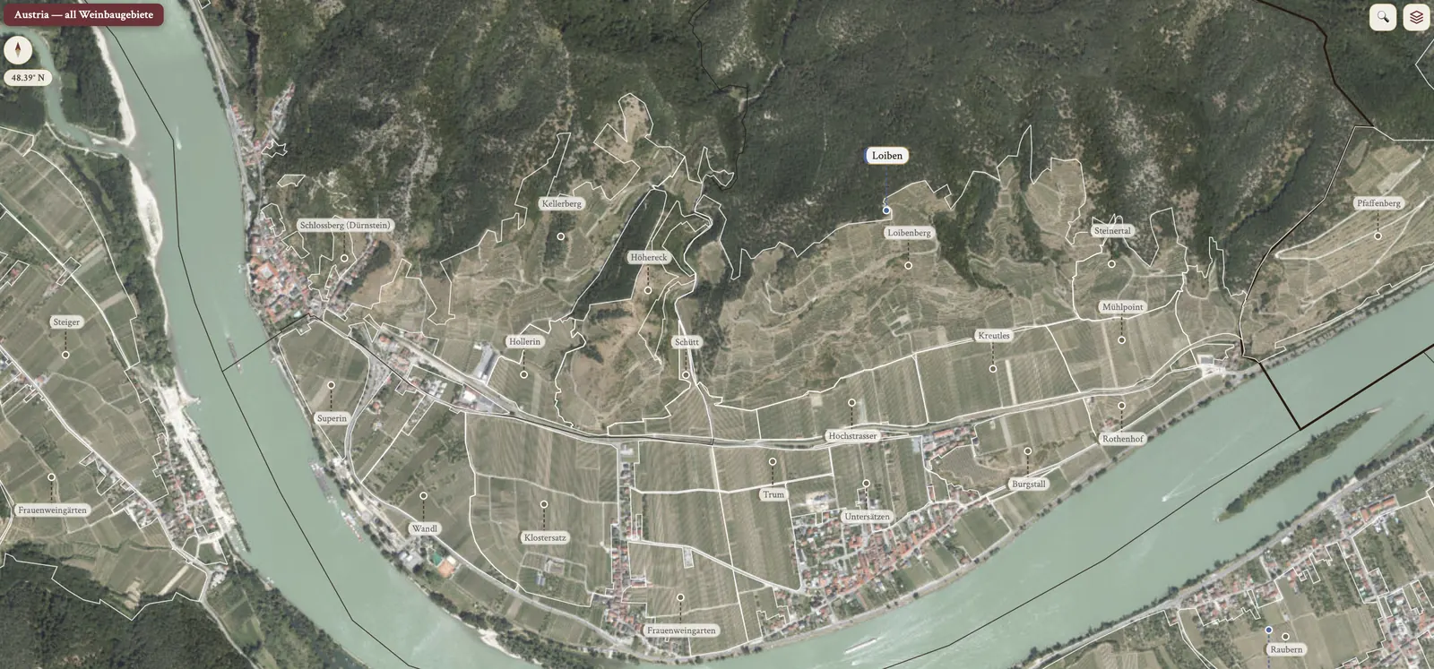
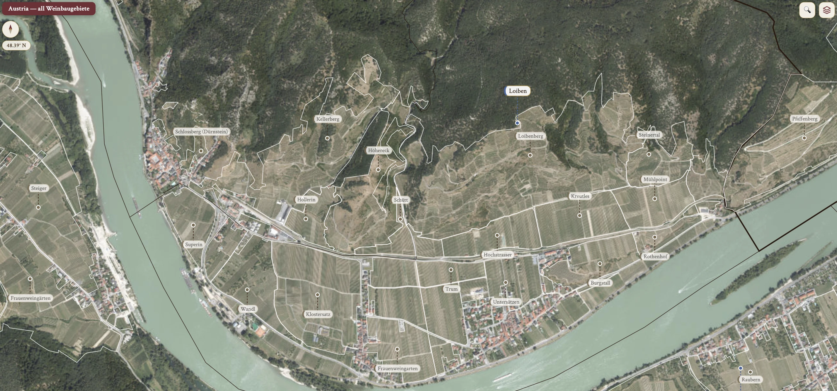
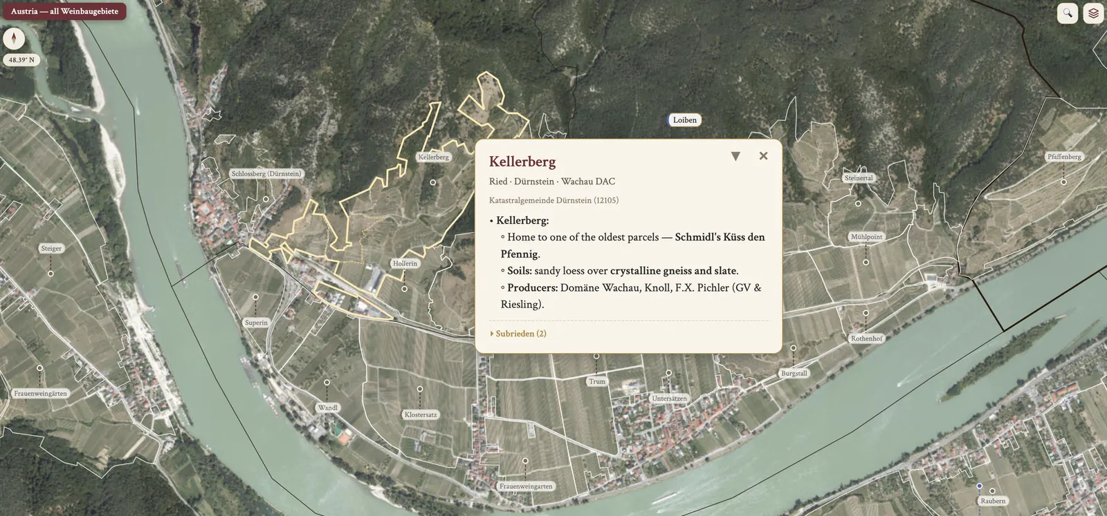
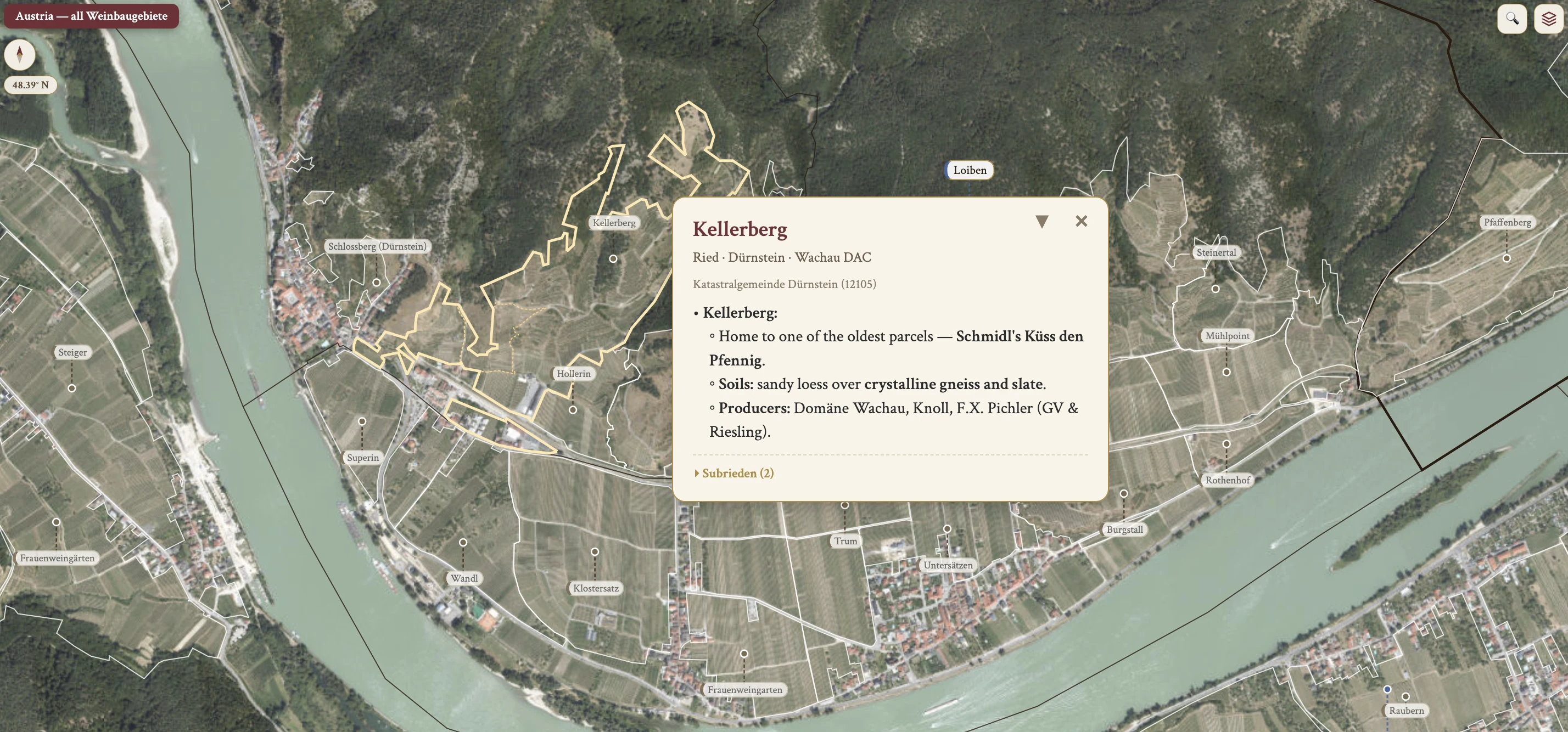
From the encyclopedia
Niederösterreich — Overview
Niederösterreich is the largest federal state and the largest wine region in Austria, in the northeast of the country. It is home to >28,000 ha of vines and responsible for >50% of Austria's total wine production. Within it sit 8 distinct regions, all DACs: Wachau, Kremstal, Kamptal, Wagram, Weinviertel, Thermenregion, Traisental and Carnuntum.
The white : black ratio is ~2/3 white (65%), 1/3 black. Grüner Veltliner accounts for ~50% of all Niederösterreich plantings and is the most important variety overall.
Climate
Three distinct climatic areas sit within Niederösterreich. In the north, the Weinviertel is a vast region — about 100 km across — with its own internal microclimates. Cool northerly winds run through it, and its Grüner Veltliner is peppery.
The Danube corridor west of Vienna takes in Wachau, Kremstal, Kamptal, Traisental and Wagram. It is greatly influenced by the Danube river, by cool winds from the northern forests, and by warm Pannonian Plain air to the east.
Southeast of Vienna, Carnuntum and Thermenregion are more directly impacted by heat from the Pannonian Plain.
Topography & Geography
Lower Austria sits in the upper northeast quarter of the country, between the Bohemian Massif to the north and the Alps tapering off into the Pannonian Plain. The Danube River — second longest in Europe, ~3,000 km — runs through the region. It moderates an otherwise severely continental climate, and historically it was a key European trade route.
The river's effect divides the valley. In the eastern Wachau it warms the slopes, giving lush, concentrated wines. In the western Wachau, at Spitz, the wines are acidic, laser-focused and chiselled — a contrast attributed directly to the river's effect.
Soil
The region has two dominant soil families, with a third metamorphic family in the higher sites. Loess — calcareous-dolomitic and wind-blown — forms deep, chalky masses and makes up over half of the vineyards in Lower Austria. It is blown in from the Alps, and its ample water retention is crucial for Grüner Veltliner.
Granite, or Urgestein, is found in the higher vineyards along the Danube. These are Neogene-period deposits, 23 to 2.6 million years ago, sourced from the Molasse Basin: thin soils over primary rock derived from the Bohemian Massif. It is a prime area for the region's best Riesling.
Weathered metamorphic rocks — slate, schistic paragneiss and amphibolite — occur in select sites.
Grape Varieties (Niederösterreich-wide hectarage)
The Niederösterreich-wide hectarage puts Grüner Veltliner at nearly half of plantings. Zweigelt follows at 12.5%, Riesling at 6.1%, Welschriesling at 4.7% and Müller-Thurgau at 4.4%.
The local varieties are Blauburger, Blauer Portugieser, Scheurebe and Rotgipfler; the French varieties are Chardonnay, Sauvignon Blanc, Weissburgunder and Pinot Noir.
Wachau — Overview
The Wachau is the westernmost wine region of Lower Austria. For many, the Wachau and its iconic producers represent Austrian wine at its peak, and the unparalleled quality of its Grüner Veltliner and Riesling sets the regional benchmark.
It is located between the Benedictine monasteries of Melk and Göttweig (Krems), ~32 km long, with ~20 km of viticultural area running from Spitz in the west to Mautern in the east. It covers ~1,350 ha — only 3% of Austria's vineyard land — and it is a UNESCO World Heritage Site.
More than 600 producers grow grapes in the villages of the north bank — Spitz, Joching, Weissenkirchen, Dürnstein and Loiben — and of the south bank, at Mautern. Grüner Veltliner is just over half of plantings, ~800 ha, and Riesling ~200 ha. Most other Austrian grapes can be found here, but in tiny amounts, often less than 1 ha.
Wachau — Climate
The Wachau is one of the driest of the Danubian regions, often under 500 mm of rain annually. It is more affected than other Lower Austrian regions by pre-Alpine Atlantic winds from the west, while warmth from the Pannonian Plain stretches as far as the eastern Wachau — particularly notable in Loiben.
Cool northern winds at night are essential to give the wines tension despite a long ripening season, high sugar accumulation and elevated potential alcohol. A microclimate effect works alongside them: the Danube reflects heat and sunlight, and the stone terraces retain warmth by day and radiate by night.
Wachau — Topography, Elevation & Terracing
The Wachau is considerably hillier than the neighbouring Danubian regions, with many mesoclimates despite the relatively small growing area. Vineyards lie predominantly on the north bank of the Danube, with south-facing exposure, and take in over 150 rieden plus >900 unofficial subzones.
Slopes rise as high as 600 m, with the best sites around 400 m on an average 30-degree gradient. Spitz vineyards can be as steep as 70°. Every ~150 m of elevation gain drops the temperature by ~1°C.
Hand-built granite stone walls — nearly 3,000,000 m² of them on the northern bank — preserve humus, hold heat and moisture, and contribute to individual microclimates. Those steep slopes make the Wachau poorly suited to Lenz Moser's Hochkultur system, and mechanised farming is nearly impossible.
Wachau — Soil & Geology
Volcanic soils inform much of the Wachau's geology. They drain quickly and hold heat, and combined with dry summers they historically stunted vine growth in warm vintages. Since 1983 irrigation has been permitted, which dramatically improved quality.
The primary soil types are gneiss and loess. Gneiss — Gföhl gneiss, or Gföhler Gneis — is a metamorphic rock of quartz, feldspar and mica, found in the higher vineyards at ~450 m+ and ideal for Riesling. Loess is wind-deposited from the Alps and favours Grüner Veltliner.
The soil-to-grape pairing follows from that: gneiss to Riesling, loess to Grüner Veltliner, and terrace stone to general ripeness enhancement.
Wachau — Grape Varieties
Grüner Veltliner takes ~63% of plantings under the current Wachau hectarage emphasis and is the dominant variety. Riesling takes ~18% and is the prestige variety, with world-class examples from gneiss-based sites.
The other authorised grapes are present in tiny amounts. The whites are Weissburgunder, Grauburgunder, Chardonnay, Neuburger, Muskateller, Sauvignon Blanc, Traminer, Frühroter Veltliner, Müller-Thurgau, Muskat Ottonel and Roter Veltliner; the reds are Blauer Burgunder, Sankt Laurent and Zweigelt. The Chardonnay synonym in Wachau is Feinburgunder, distinct from Steiermark's Morillon.
Wachau — Viticulture
All grapes must be hand-harvested. That applies regardless of DAC tier — Gebietswein, Ortswein, Riedenwein — and it is also required under Vinea Wachau at all levels, for Steinfeder, Federspiel and Smaragd alike.
The Codex Vinea Wachau principles are hand-harvest only, only natural sugars for fermentation, no artificial concentration techniques, no additions and no fractionation methods.
The Wachau is poorly suited to Lenz Moser's Hochkultur. The Einzelpfahl, or single-pole, training style is common.
Wachau — Winemaking
At pressing and fermentation, most winemakers destem the fruit and use a pneumatic press upon reception, and temperature-controlled fermentations in stainless steel are common. Some prefer ambient yeasts, no temperature control and neutral barrels — Weingut Emmerich Knoll among them. Most actively avoid malolactic fermentation.
Various vessels are used for fermentation and aging. Stockinger barrels, locally crafted from nearby forest wood, are a Wachau favourite; others opt for extended lees aging. New oak is rarely used and is not allowed for Ortswein, Riedenwein or Vinea Wachau-status wines.
Some producers employ a little skin contact. Botrytis is infrequent and seldom welcome, with severe sorting when present.
Vinea Wachau Nobilis Districtus
Vinea Wachau Nobilis Districtus is an association of estates sworn to uphold natural winemaking, as spelled out in the Codex Vinea Wachau. It was founded in 1983. Membership runs to ~200 members and controls roughly 90% of Wachau production, and the chairman is Emmerich H. Knoll.
The Codex Vinea Wachau rules are no additives, including chaptalisation; no concentration by reverse osmosis, cryo-extraction and the like; no aromatisation, including new barrique; no fractionation, meaning de-alcoholisation; and no manipulation of nature, with all harvests by hand.
Steinfeder, Federspiel & Smaragd
Three categories were created and trademarked in 1984 to replace the German system, classifying wines by must weight and natural alcohol achieved.
Steinfeder is named for the long wispy grasses near vineyards. In style it is typically stainless steel, fruity and youthful. Its specs are a max 11.5% abv and a min must weight 15° KMW.
Federspiel is named for the bait used to lure falcons to the falconer's glove, and it replaced Kabinett wines. It shows more pronounced varietal character, still youthful and fruit-driven, again typically stainless. Its specs are alcohol 11.5–12.5% and a min must weight 17° KMW.
Smaragd is named for the sun-bathing lizards on Wachau stones. It was introduced 1986, replacing dry Spätlese-ripeness wines, and comes from the warmest, arguably best sites — long-lived, powerful, concentrated. Its grapes are harvested last and may show signs of botrytis with honeyed and mushroom-like aromas and a deeper golden hue. Its specs are a min 12.5% abv, with a min must weight of 18.2° KMW, and many achieve >14% alcohol in warm years.
Smaragd develops more botrytis than Steinfeder or Federspiel because it is the latest-harvested and highest-must-weight category: the berries remain on the vine longest, giving the greatest window for Botrytis cinerea. Vinea Wachau generally prefers dry fruit over noble rot — botrytis is incidental rather than targeted.